Sea of Galilee — Northern Shore
Click the title to view map
Introduction
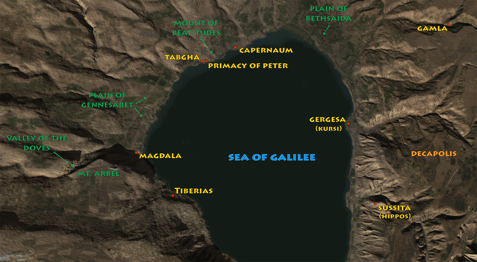
In the first century, the northern shore of the Sea of Galilee was a densely settled landscape of fishing villages, fertile fields, busy roads, and local markets. Jewish communities such as Magdala, Capernaum, and Bethsaida participated in the lake’s fishing economy while remaining connected to the wider world of Roman Galilee. Boats carried people and goods across the water, and regional roads linked the shoreline with the villages of the Galilean hills and territories beyond the Jordan.
This was also the principal setting of Jesus’s Galilean ministry. Here he called fishermen to become disciples, taught in village synagogues and along the shore, healed the sick, fed crowds, and traveled repeatedly across the lake. The geography of the northern shore—its water, fields, hills, and close-knit communities—therefore forms more than a backdrop to the Gospels: it helps explain how Jesus’s message spread and why this small stretch of shoreline became one of the most significant landscapes in Christian memory.