Photo Library Overview

- Landscapes of the Holy Land

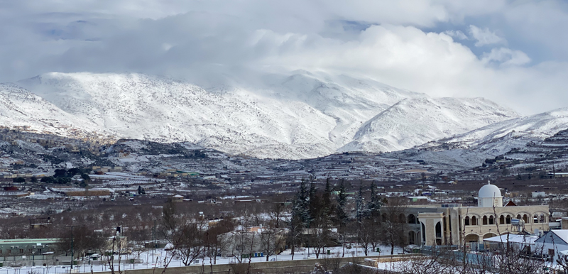
- Mount Hermon
Mount Hermon - March 2022
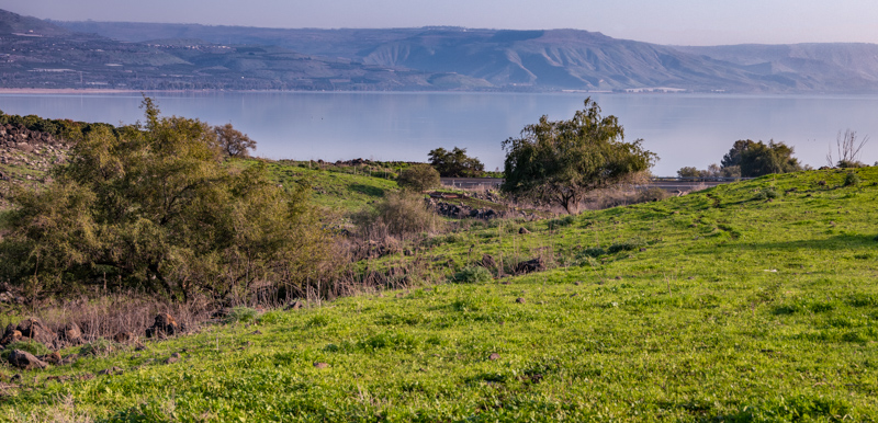
- Sea of Galilee
Northwestern shore of the Sea of Galilee
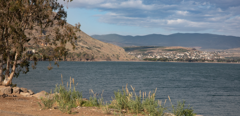
- Sea of Galilee
The northern and eastern shores of the Sea of Galilee from the hills west of the Jordan River Delta
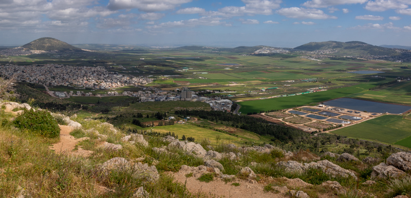
- Jezreel Valley
Jezreel Valley looking east toward Mount Tabor (left) and Mount Moreh (right)
- Caesarea - Mediterranean Sea
The Mediterranean Sea - Caesarea and the city’s hippodrome (right)
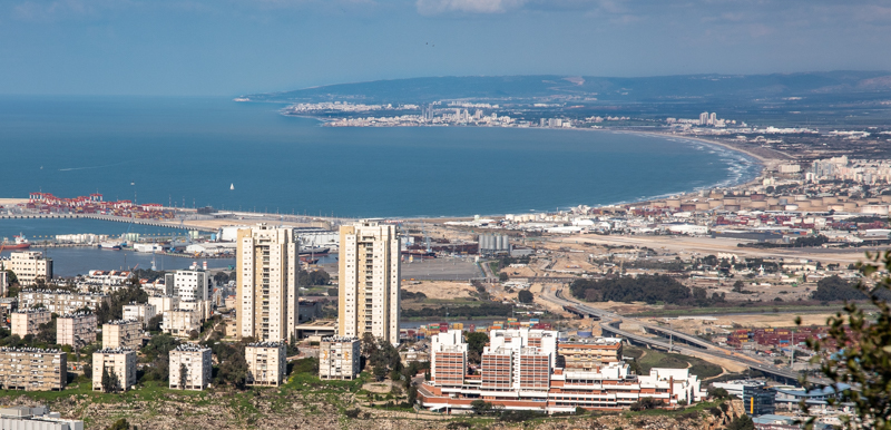
- Haifa Bay
Haifa Bay from Mount Carmel with Acco/Ptolemais (top center)
- 04.10.22__O4A2856-HDR-Edit
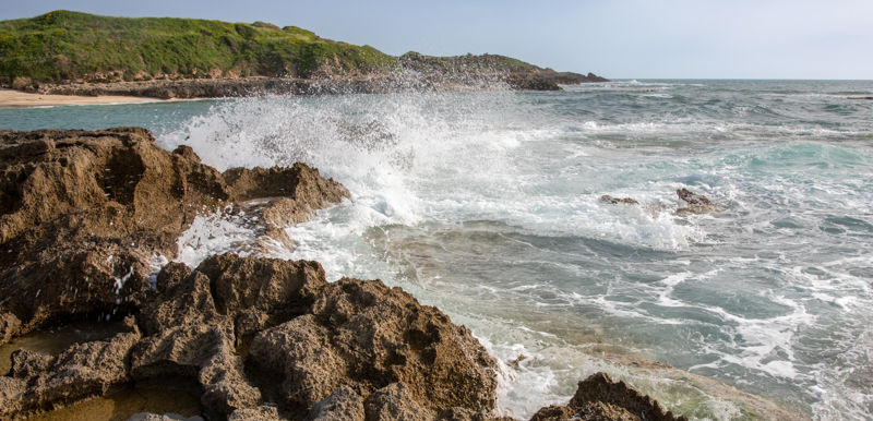
Tel Dor (upper left) - Mediterranean Sea south of Mount Carmel
- Beit Netofa Valley
Beit Netofa Valley - Aerial view east with mountains of Lower Galilee
- Tel Megiddo
Tel Megiddo - Aerial view south with mountains of Samaria in the background
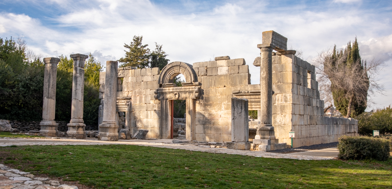
- Kafar Baram
Kefar Baram Synagogue - Upper Galilee
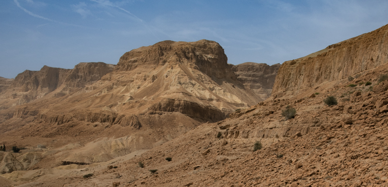
- Nahal Arugot
Nahal Arugot near the western shore of the Dead Sea - South of En Gedi
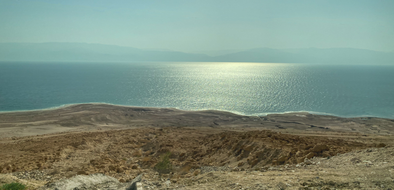
- Dead Sea
Dead Sea between Nahal Arugot and Masada - The mountain coast of Jordan is also visible (top)
- Nahal Zin - Ben Gurion
Nahal Zin from Ben Gurion’s gravesite - Western Negev
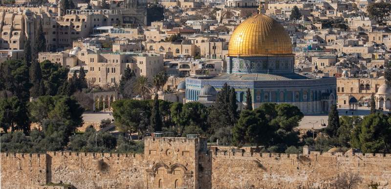
- Dome of the Rock - Jerusalem
Dome of the Rock - Jerusalem
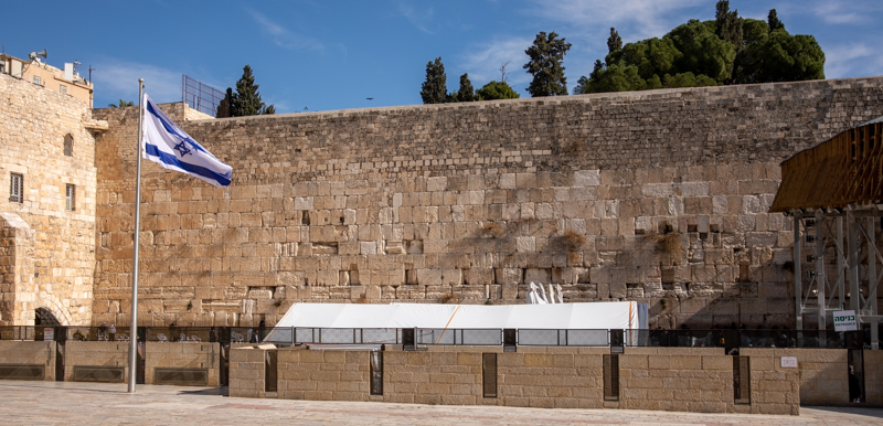
- Western Wall - Wailing Wall
Western Wall - Jerusalem
- Shepherd's Field - Bethlehem
Traditional Shepherd’s Field - Bethlehem
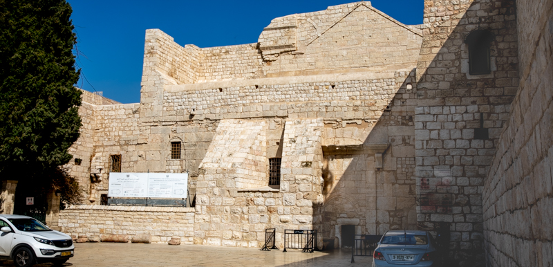
- Church of the Nativity - Bethlehem
Church of the Nativity - Bethlehem
The Bible Land Images Photo Library contains hundreds of photographs from Israel, Jordan, and surrounding regions that illuminate the Bible’s geographical, historical, and cultural setting.
While the books featured on this website use selected photographs to tell specific stories and explore particular themes, the Photo Library serves a different purpose. It functions as a growing visual archive of the lands of the Bible, providing access to a much broader collection of sites, landscapes, regions, and historical locations than can be included in any single volume.
Whether you are a teacher, student, pastor, scripture scholar, or interested traveler, these images are intended to help bring the world of the Bible into clearer focus.
The collection is organized into four major categories:
Historical Sites
Archaeological locations, ancient cities, and places associated with biblical and non-biblical events.
Geographic Locations
Mountains, valleys, rivers, deserts, and other physical features that shaped life in the ancient world and provide essential context for biblical events.
Holy Land Regions
The major territorial divisions of scripture and history include Galilee, Samaria, Judea, and neighboring regions.
Parks & Nature Reserves
National parks, wilderness areas, and scenic landscapes that showcase the natural beauty of the land.

Each photograph includes a brief caption, with additional information available when the image is opened. Together, the books and photo library provide a visual companion for studying the lands where biblical history unfolded.
Photo Galleries
The Photo Library is a long-term project that combines photography, historical research, and biblical context. While I have photographed hundreds of locations and collected thousands of images throughout the Holy Land, building complete gallery pages for each site takes considerable time. As new galleries are completed, they will be added to the site. Locations with finished galleries appear as clickable links on the menu pages. Additional sites and photographs will continue to be added as the project expands. I appreciate your patience and hope you enjoy exploring the galleries as they become available. New galleries are typically added each week. Check the Site Updated page to see what's new since your last visit.
Photo Usage: All photographs may be downloaded free for personal, educational, and non-commercial use. See the Photo Usage Policy for complete details.
Cana of Galilee
Jesus performed His first public miracle, turning water into wine, in Cana of Galilee (John 2:1–11). The ancient town was built atop the sunlit hill in the photo below (upper center) and is preserved today in the archaeological remains of Khirbet Qana. The valley below Cana formed a natural corridor connecting the village with the nearby town of Jotapata, only 2 miles away.

The photograph below shows the trail winding toward Jotapata, visible on the distant hill above the shadows (upper right). Jotapata was a Jewish stronghold during the First Jewish Revolt against Rome. The Jewish general Josephus and his troops were charged with its defense before the Roman General Vespasian finally conquered it in AD 67.

Trails such as this one connected the villages of Galilee and formed the paths of everyday life during Jesus’s ministry. Along these routes He traveled from town to town, teaching, preaching, and “healing all manner of sickness and all manner of disease among the people” (Matt. 4:23).
Learn more in Walking the Way of Christ: Blessed Pilgrimage, Vol.1.
The Jezreel Valley
Most people have heard of Armageddon, the great battle between good and evil that will precede Christ’s millennial reign on earth (Zech. 12–14; Rev. 16:14–21; 19:11–18). The name comes from the Hebrew Har Megiddo, meaning “mountain of Megiddo.” The ancient city occupied one of the most strategic locations in the Holy Land, controlling the routes between the Mediterranean coast, the Jezreel Valley, and the Jordan Rift Valley. The ruins of the ancient city (below) overlook the Jezreel Valley.
To learn more about Megiddo and the Jezreel Valley, see Embracing the Covenant: Blessed Pilgrimage, Vol. 2, where you can explore the history, geography, and prophetic significance of this remarkable site and valley.

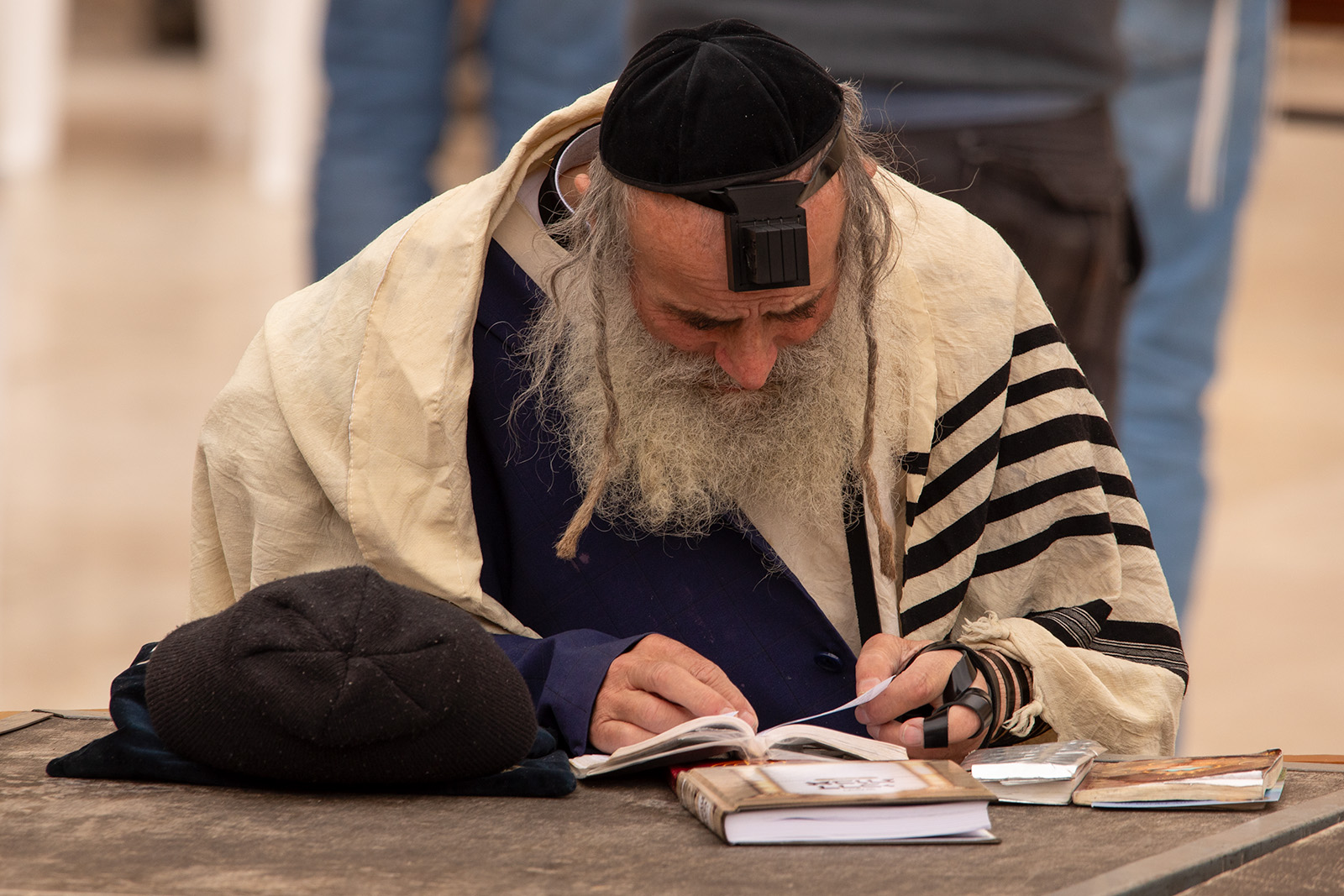
Jerusalem
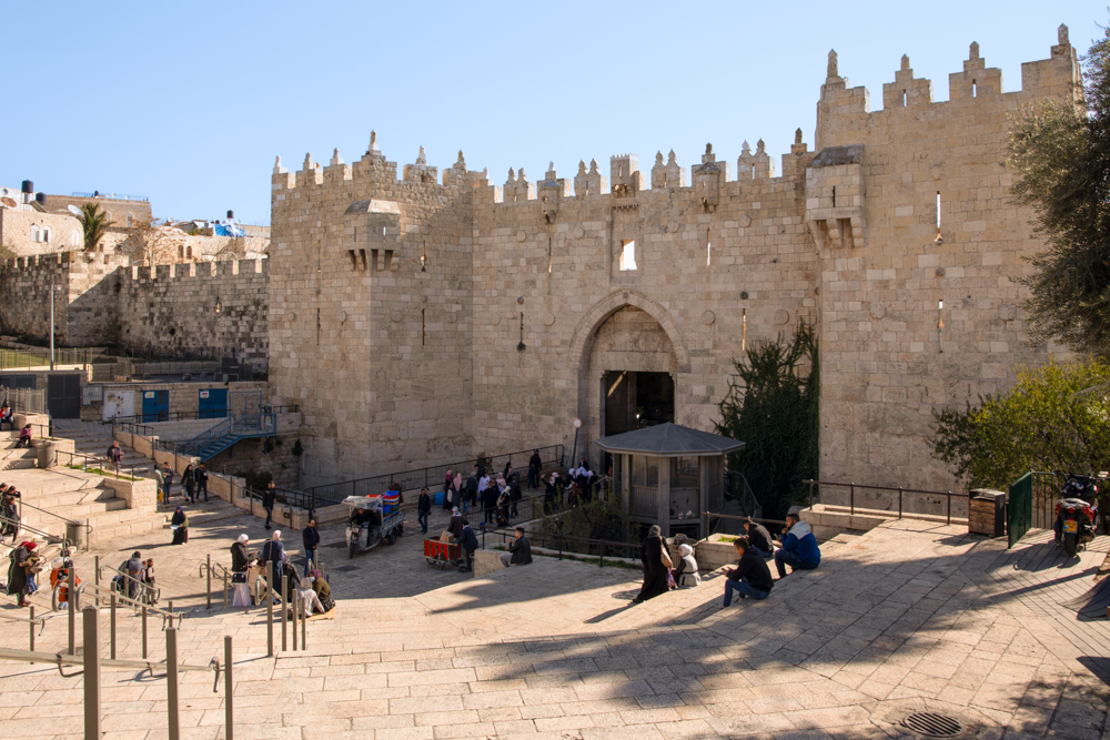
Jesus came to Jerusalem as a young boy and visited the city often during His public ministry. Here He cleared the temple grounds twice and taught Nicodemus about baptism. Here He was falsely accused by the city’s Jewish rulers, unjustly condemned by Pilate, and finally crucified outside its northern wall not far from the Old City’s Damascus Gate (below).
Jerusalem is the city of cities. Isaiah prophesied that Jerusalem will be one of two great centers from which Christ will rule during the Millennium (see Isa. 2:2–3). The Holy City is the subject of Jerusalem—The City of the Great King: Blessed Pilgrimage, Vol. 3.
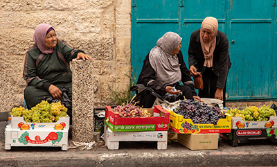
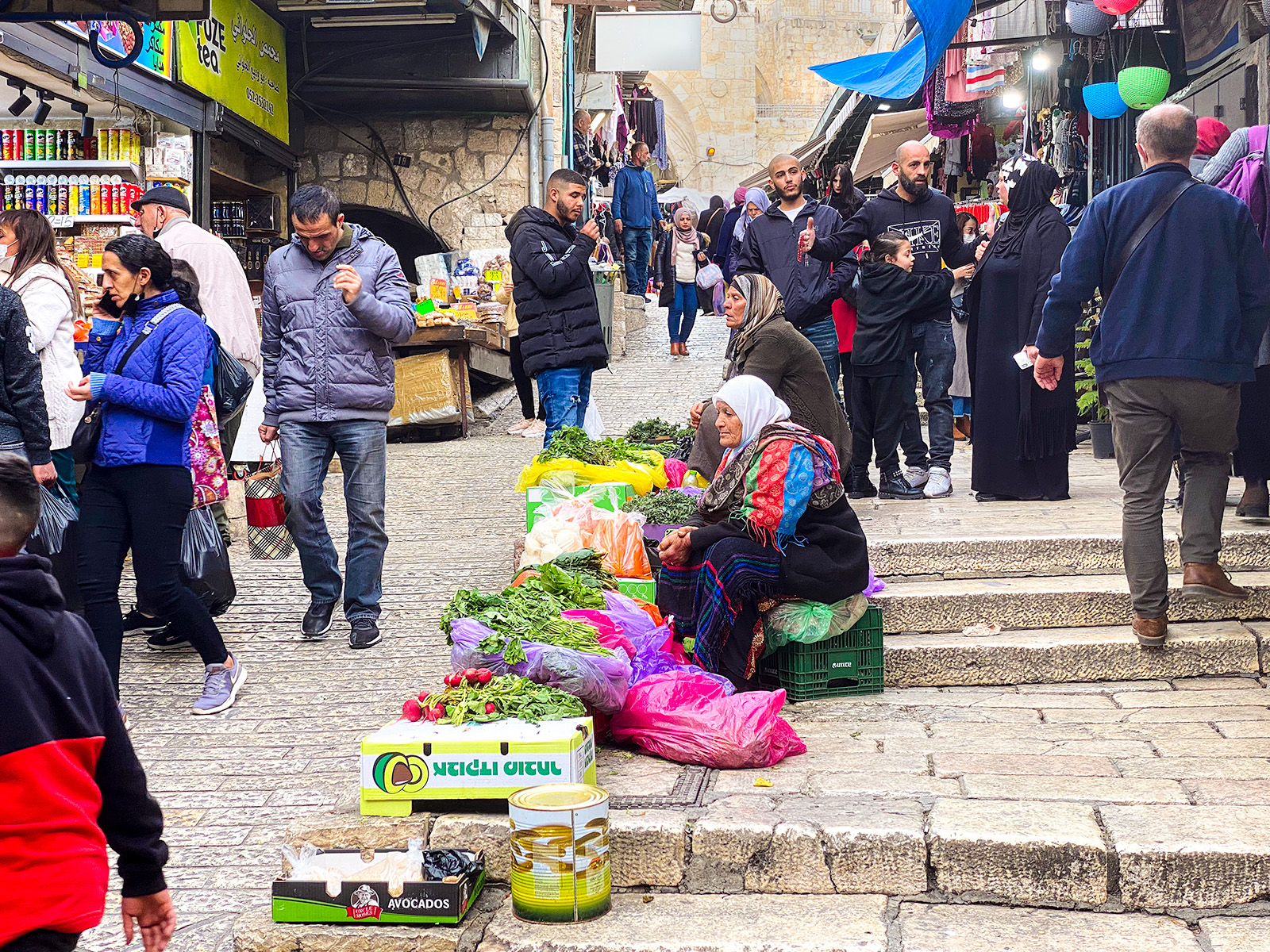
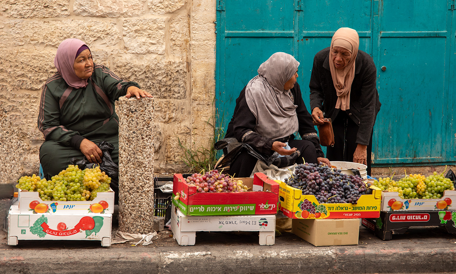
Just inside Damascus Gate is one of the Old City’s bustling market districts, where residents and visitors shop for fresh produce, bread, meat, fish, spices, and countless other goods. The sights, sounds, and aromas provide a glimpse into the daily life of the city.
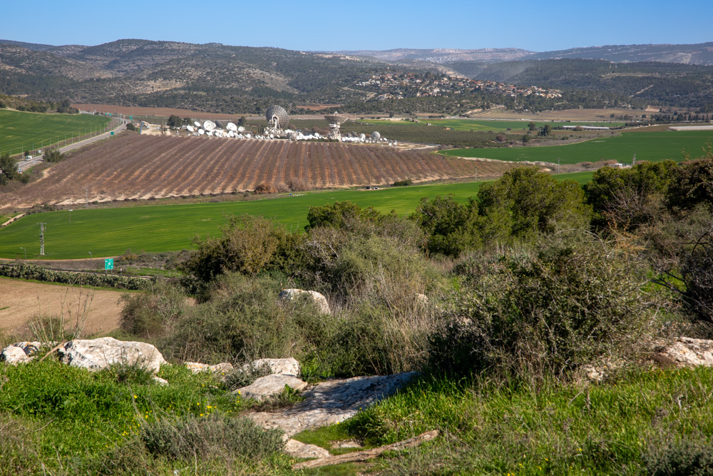
The Valley of Elah
The photograph below was taken from biblical Sochoh, where the “Philistines gathered together their armies to battle” against “Saul and the men of Israel” (see 1 Sam. 17). The broad valley (center right) is traditionally identified as the place where David slew Goliath with a stone he picked up in the stream that flowed through the valley. The ramifications of the battle for the kingdom of Judah are discussed in Navigating the Wilderness: Blessed Pilgrimage, Vol. 4.
The photograph below illustrates one of the routes leading from the Valley of Elah into the hill country of Judah. It contains a portion of the two-thousand-year-old Roman road that led from the Valley of Elah to Bethlehem (David’s home). Notice the modern road that follows the same mountain ridge as the ancient one into the hill country of Judah. The significance of mountain ridges and ancient byways is a topic discussed Navigating the Wilderness: Blessed Pilgrimage, Vol. 4.
