Download Photos and Maps • Photo Usage Policy • Back to Overview
Open chapter PDF to read or share (new tab)
Open chapter PDF (new tab, book format)
View northeast: The Roman amphitheater of Sepphoris looks out across the western end of the Beit Netofa Valley toward the mountains of Lower Galilee.
You may download photos free of charge for non-commercial, educational purposes: home, church, synagogue, or school. You must, however, give proper attribution on or below each image to BibleLandImages.com.
If you’re using photos as part of a PowerPoint or other electronic presentation, it’s enough to mention the source of the photos at the beginning of your lecture.
The photos may not be used on other internet sites without permission.
You may download favorite chapters and sections or copy their URL links to share via email or in a messenger app. You may also post links on social media or a personal website.
By downloading a photo, chapter, or section you agree to this policy. If you have questions about it or need a commercial photo license, please contact me via email: Daniel@BibleLandImages.com.
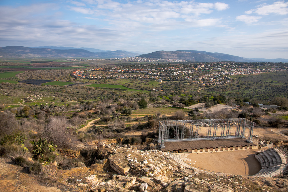
View northeast: The Roman amphitheater of Sepphoris looks out across the western end of the Beit Netofa Valley toward the mountains of Lower Galilee.
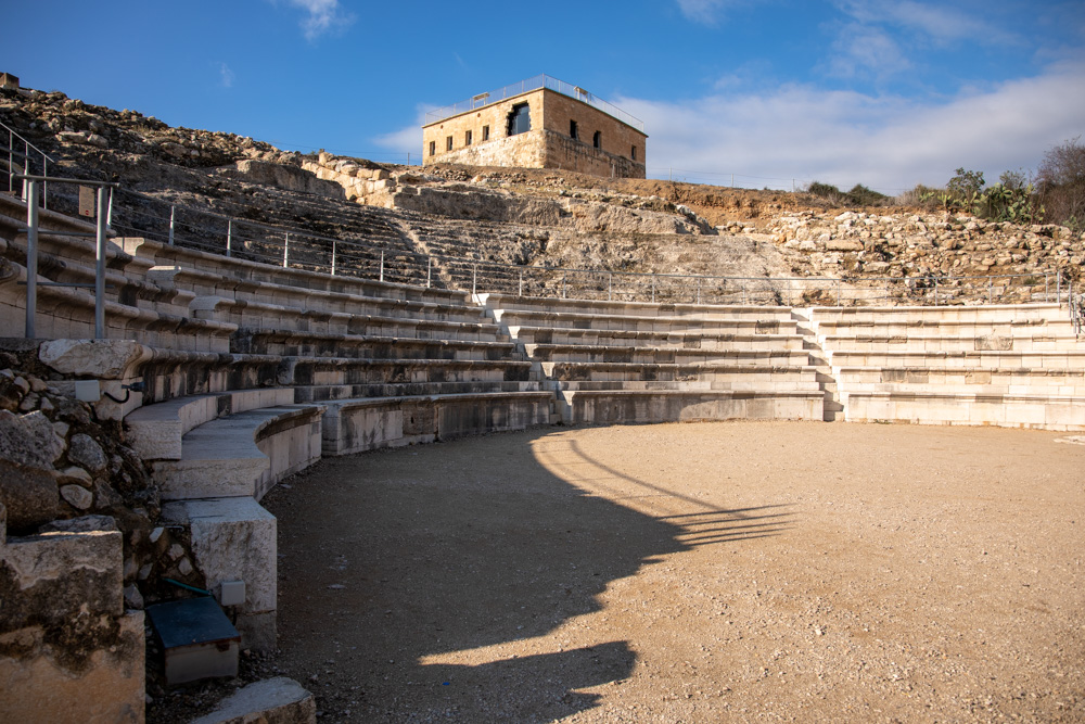
View northwest: The Roman amphitheater of Sepphoris with the Crusader tower above it (top center). The view from the tower of Lower Galilee is spectacular (see photo above).
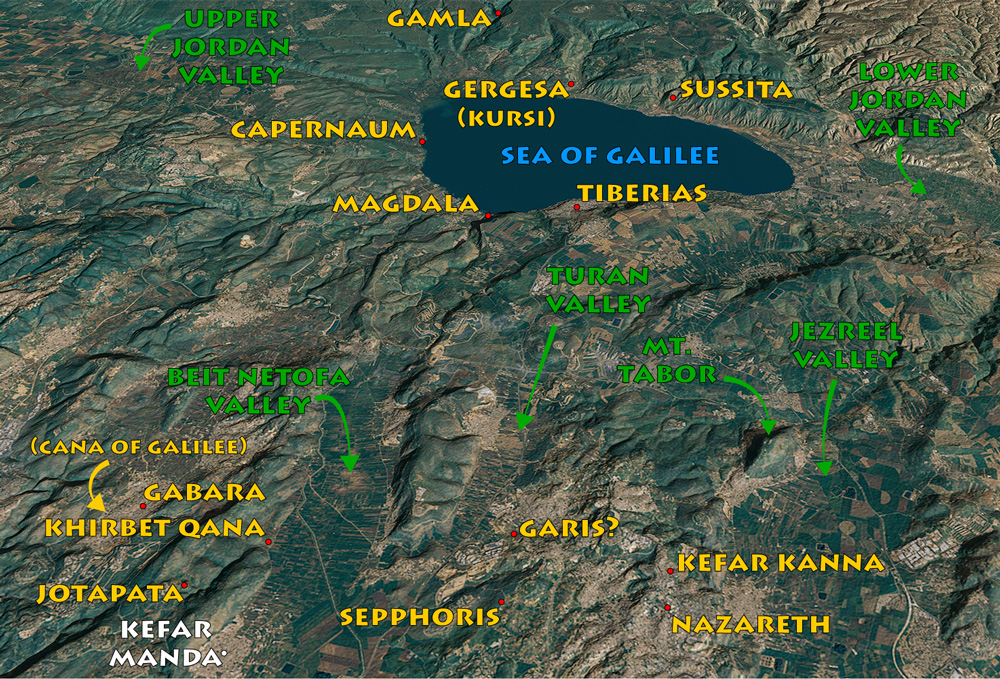
View east: This map also goes with Jotapata (page 99) and Nazareth (page 127). The cities around Jotapata and Sepphoris figure into the campaigns of Vespasian in Lower Galilee.
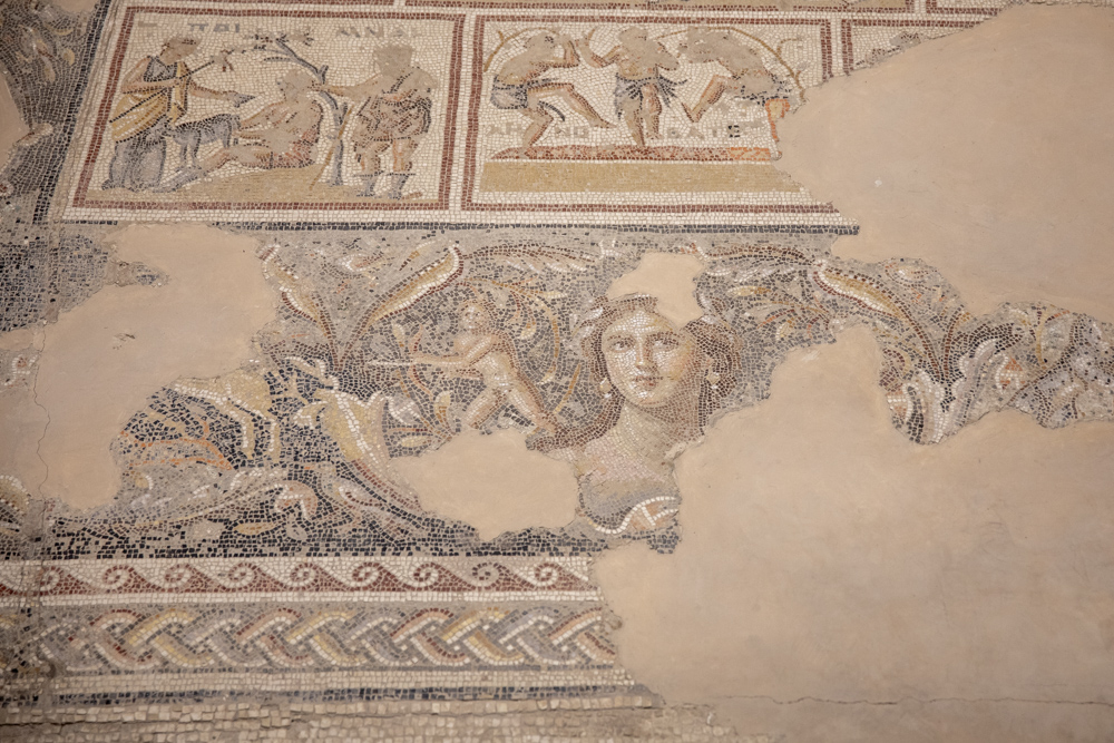
South of the theater is a third-century AD mansion known as the Dionysus House. the dining room floor features this beautiful portrait of an unknown woman called “The Mona Lisa of Galilee.”
View northeast: This colonnaded street dates to the early second century ad. The Builders paved the porticoes along the sides of the street with mosaics. Wagon wheel ruts (center) attest to its use.
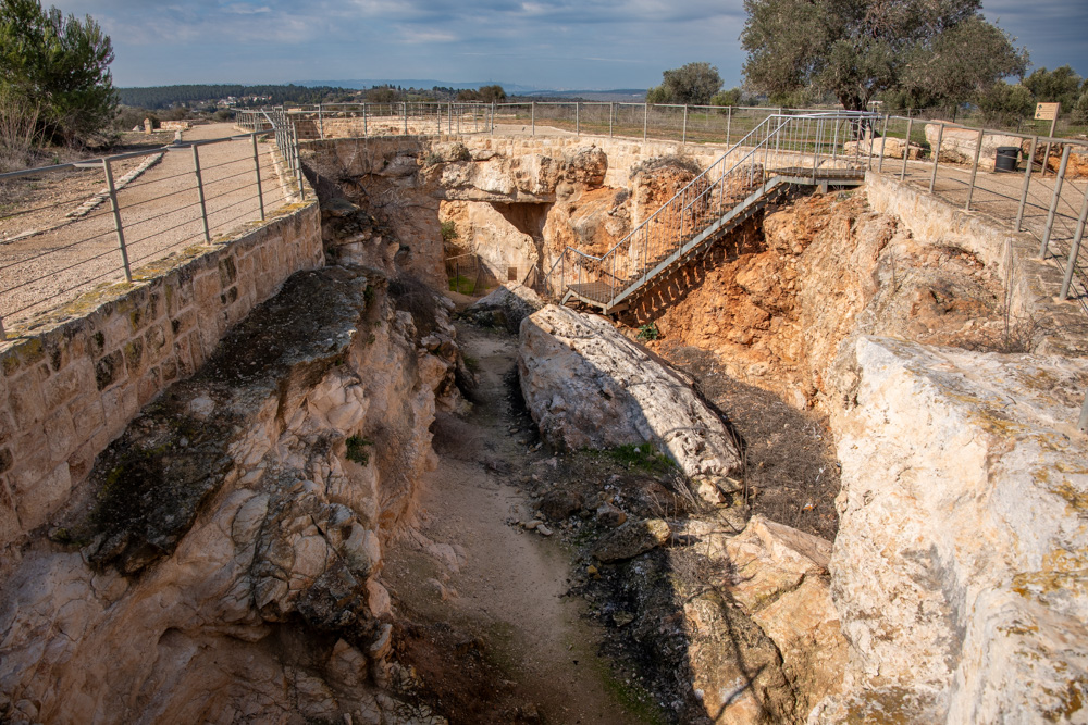
View west: Roman-built aqueducts filled Sepphoris’s impressive underground reservoir that stored water and regulated its flow into the city. The reservoir was reached through six vertical shafts.
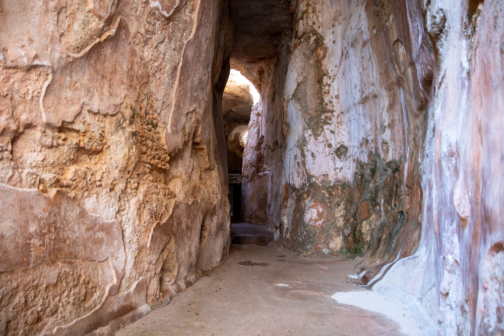
Detail of the underground reservoir that carried water to the city.

View south: The first of six vertical shafts that led to the reservoir below the city. Nazareth is also visible (top).
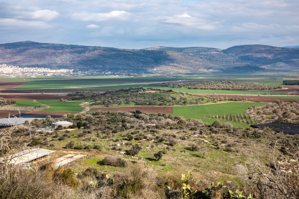
View north: This photo was taken standing near the theater (see photos on page 118), looking toward Kefar Manda (center left) and Cana of Galilee (center right; sunlit mound on the right edge of the photo).
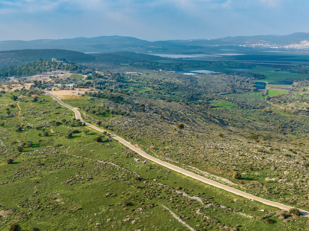
View northwest: The crusader fortress of Sepphoris (top left) is visible from all over Lower Galilee, including Nazareth. The Hebrew name for the city is Zippori (“bird”) because it sits on a hilltop like a bird.
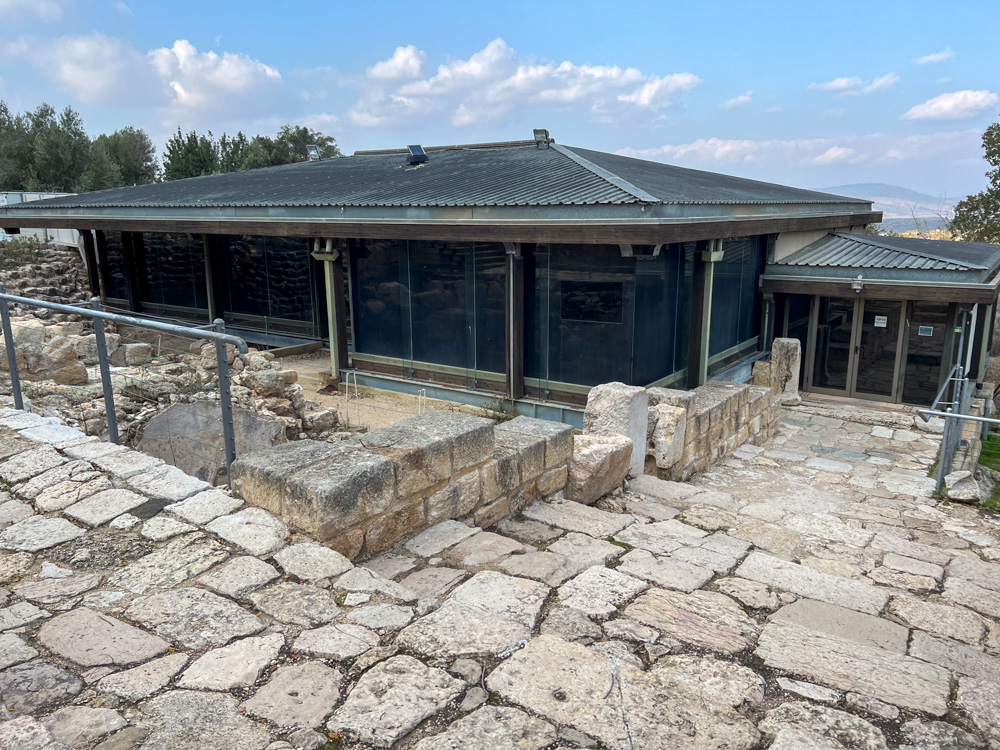
View northwest: The fifth-century AD synagogue of Sepphoris, covered for protection, was built near Roman residential buildings. Ancient sources indicate that Sepphoris had more than one synagogue.
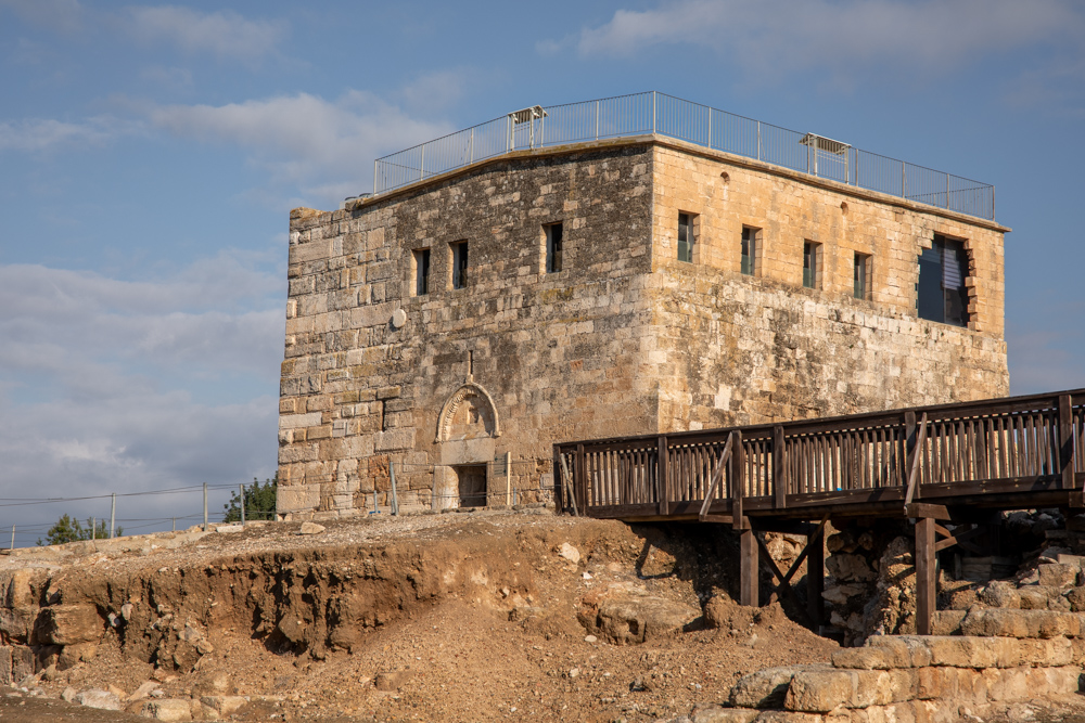
View northwest: The Crusader fortress was refurbished at the end of the nineteenth century and served as a school until 1948. Today it houses a museum of Sepphoris archaeological finds.
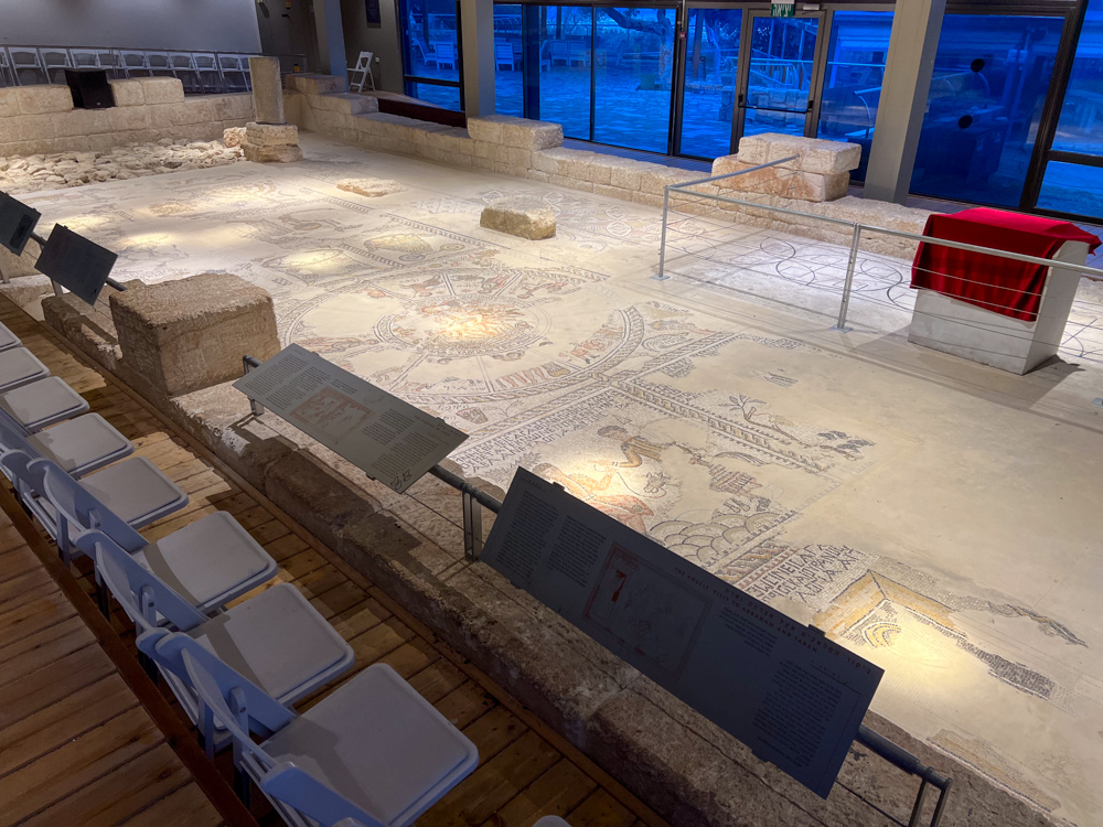
The mosaic floor of the Sepphoris synagogue. Signs describe the various scenes, which include Jewish motifs and Bible stories arranged in horizontal panels.
You may download photos free of charge for non-commercial, educational purposes: home, church, synagogue, or school. You must, however, give proper attribution on or below each image to BibleLandImages.com.
If you’re using photos as part of a PowerPoint or other electronic presentation, it’s enough to mention the source of the photos at the beginning of your lecture.
The photos may not be used on other internet sites without permission.
You may download favorite chapters and sections or copy their URL links to share via email or in a messenger app. You may also post links on social media or a personal website.
By downloading a photo, chapter, or section you agree to this policy. If you have questions about it or need a commercial photo license, please contact me via email: Daniel@BibleLandImages.com.