(Golan Heights)
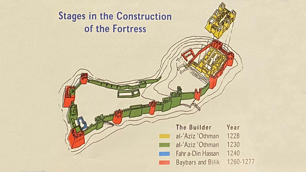
“The fortress is the largest and most impressive surviving medieval Muslim fortress in Israel. It controlled the main road from Tyre in Lebanon through the northern Hula Valley to Damascus in Syria. The eastern part of the fortress was built in 1228 by the Ayyubid governor of Banias, Al-Aziz Uthman, to prevent the Crusaders from invading Damascus. In 1230, the governor expanded the fortress to its present size.
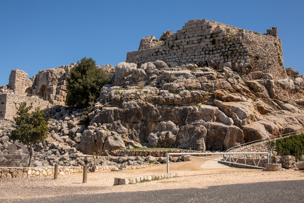
“The fortress was built following the topography. At its high point is a keep and at its lower part are structures surrounded by a wall and towers.
“The fortress was first called Qal'at al-Subeiba, which means ‘castle of the large cliff,’ or ‘castle that leaps on prey.’ The name Qal'at Nimrod means ‘Nimrod’s fortress,’ named after the biblical hunter who legend says built his palace here.” (Text is from the site plaque.)
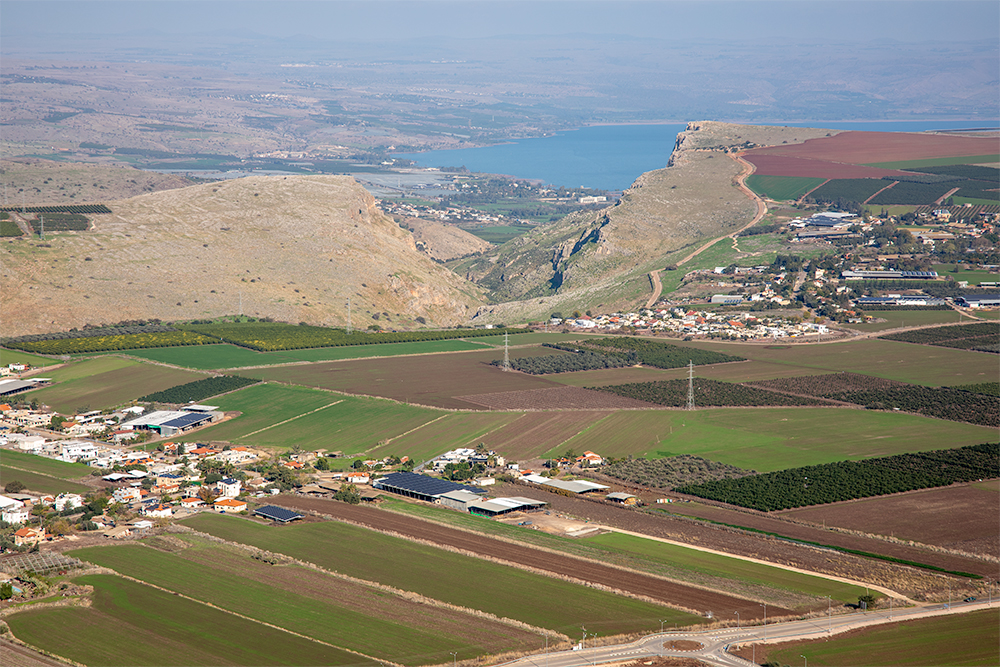
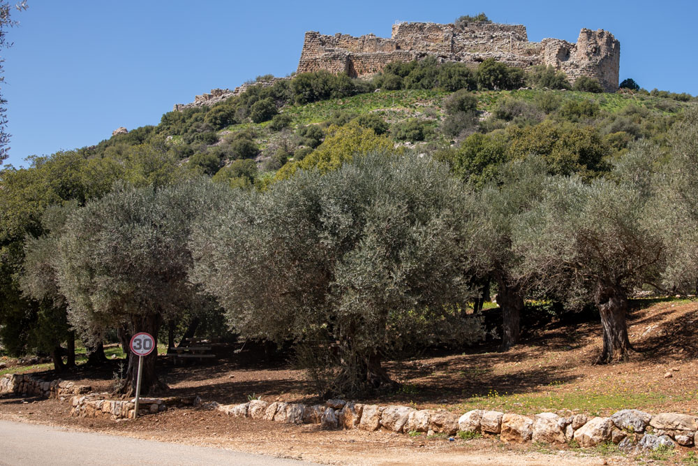
Nimrod’s Fortress lies at the northern end of the Golan Heights overlooking the Hula Valley. The modern border between Israel and Lebanon runs along the top of the photo.
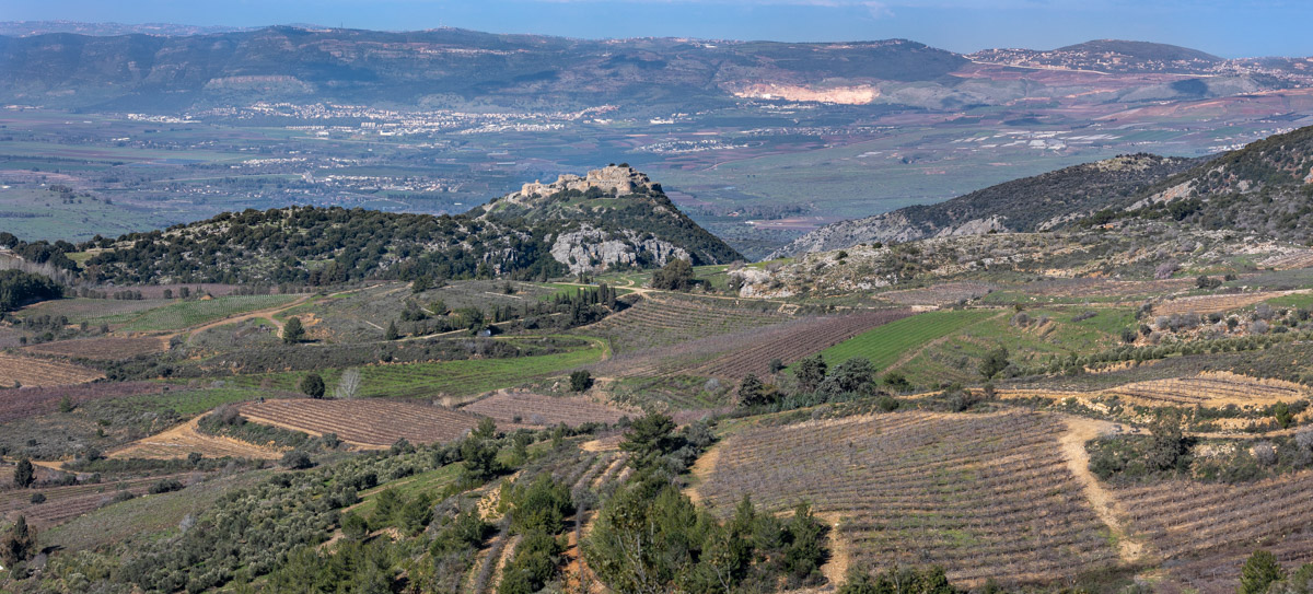
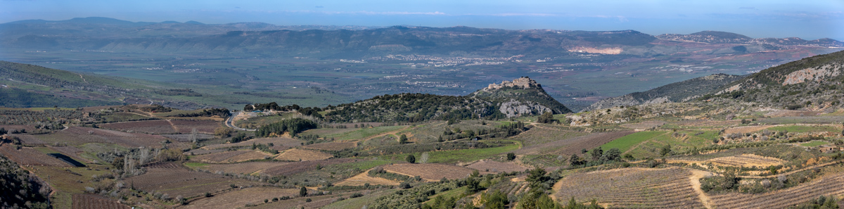
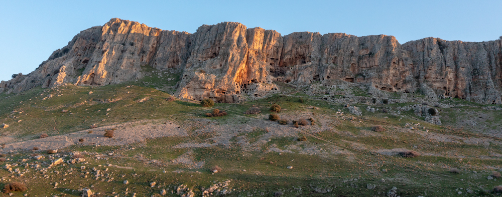
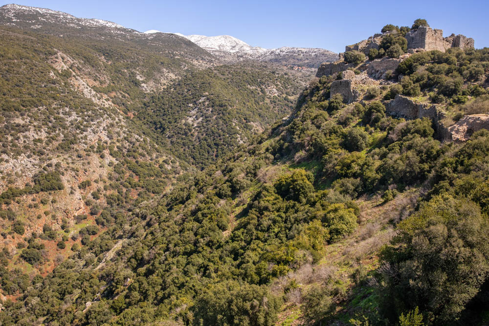
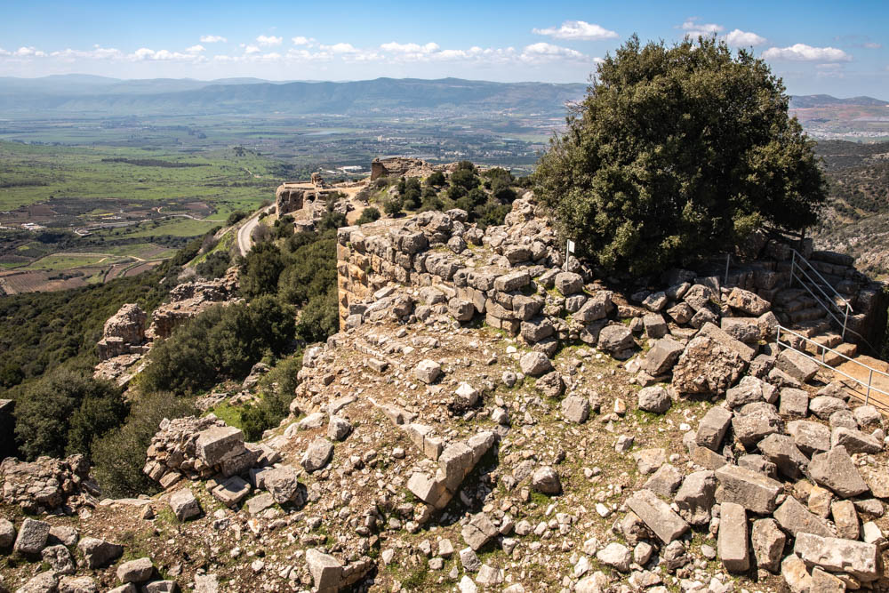
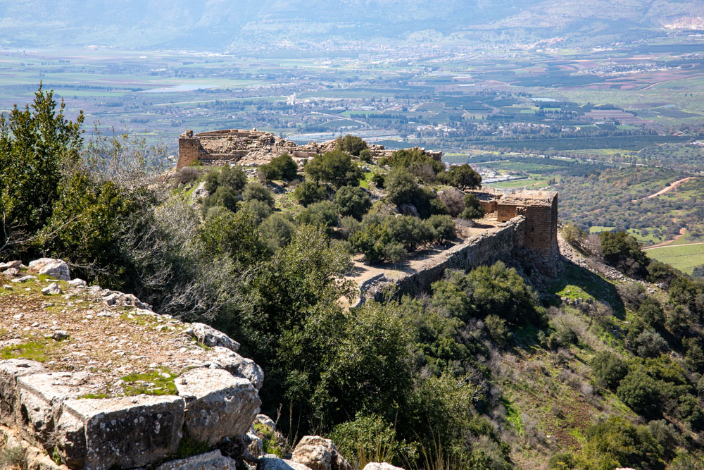
View east: This photo (detail and panorama) was taken from the mountain east of the fortress (center), and shows its commanding view of the Hula Valley.
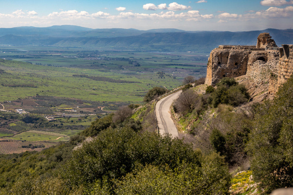
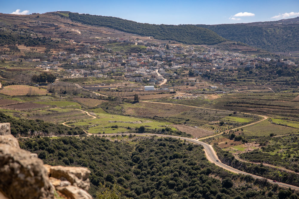
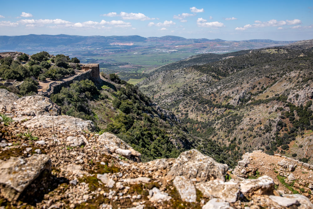
View southwest, looking towards the Hula Valley with the mountains of Lower and Upper Galilee in the background. The southwest corner of the fortress is also visible (middle right).
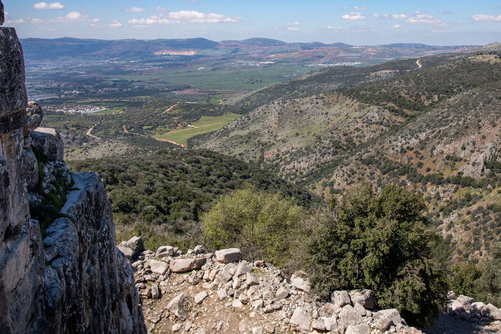
View northwest, looking towards Metulla (Israel’s northern most city near the border with Lebanon) and Upper Galilee. The photo was taken from the northeast corner of the fortress.
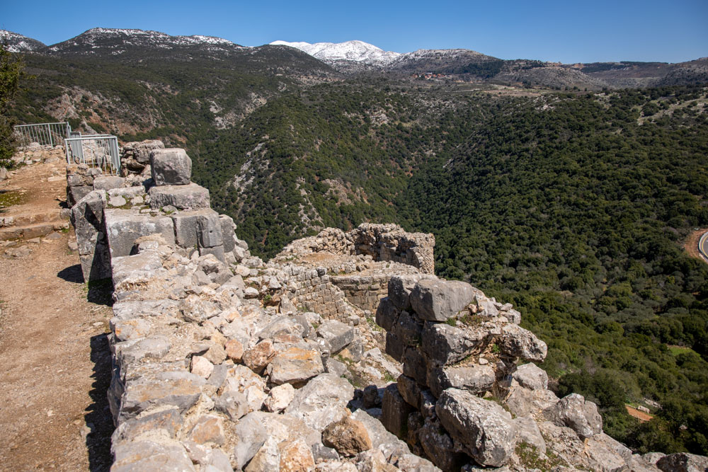
View east, looking toward Mount Hermon in snow. The photo was taken from the northwest corner of the fortress looking toward the keep (top right).
View southeast, looking toward the Golan Heights. The photo was taken from the south side of the fortress looking toward the Druze village of Ein Qiniyye.
View east: The Hula Valley panning from southeast to northeast. The video was taken from the fortress’s southwest tower (see photo below).
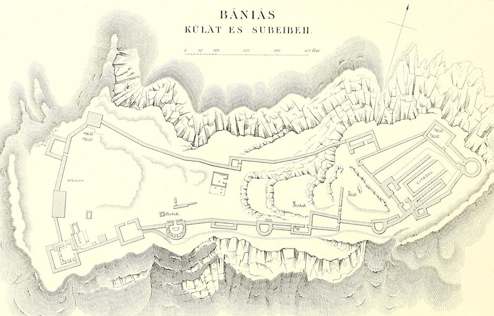
This drawing of Nimrod’s Fortress is from the 1871-77 Palestine Exploration Fund Survey of Palestine.
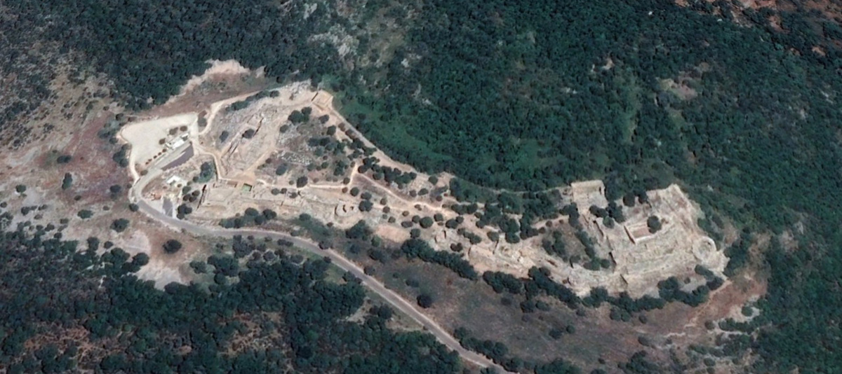
View north: Detail satellite view of the fortress towers.
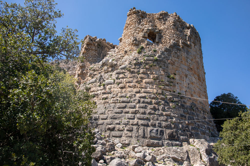
View east: The north tower.
View northeast: The southwest tower.
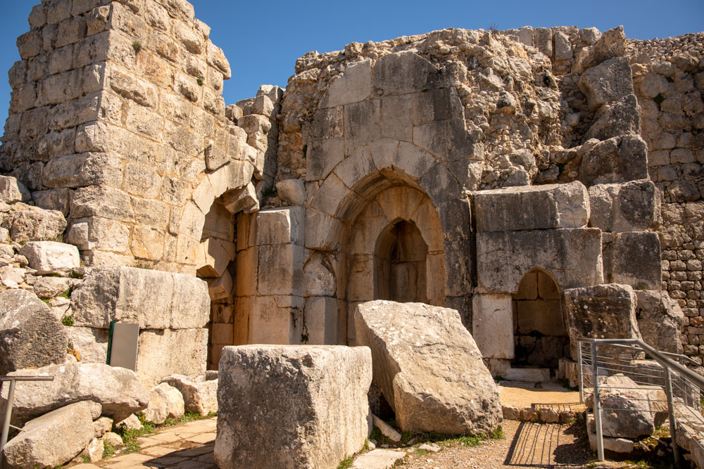
View northeast: The northwest tower and the original gate of the fortress. After two stories were added in 1275, the gate ceased being an entrance gate to the fortress.
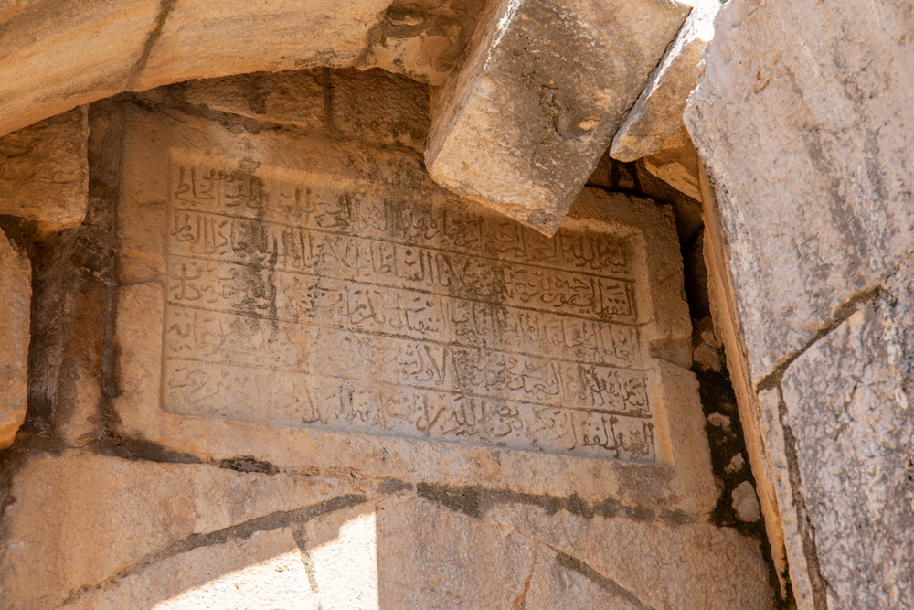
Site plaque: “An inscription above the doorway next to the gate, dated to 1230, glorifies the builder of the fortress, Al-Aziz Uthman, governor of Banias.”
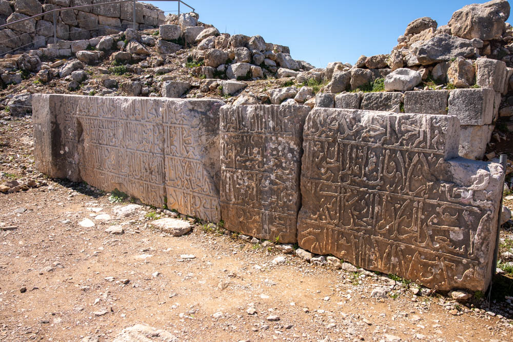
Baybars Inscription (from the site pamphlet): “The inscription contains words of praise and eulogy for Sultan Baybars, who tasked his subordinate Bilik, commander of the fortress, with the building and reconstruction work.” The inscription is just east of the northwest tower.
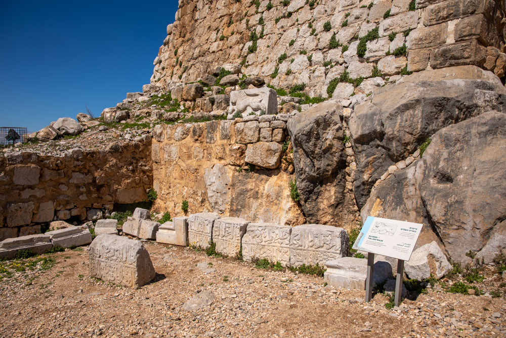
Baybars–The Lion Ruler (site plaque): “The sculpted lion was the symbol of the Mamluk Sultan Baybars, who conquered the fortress from the Mongols in 1260.”
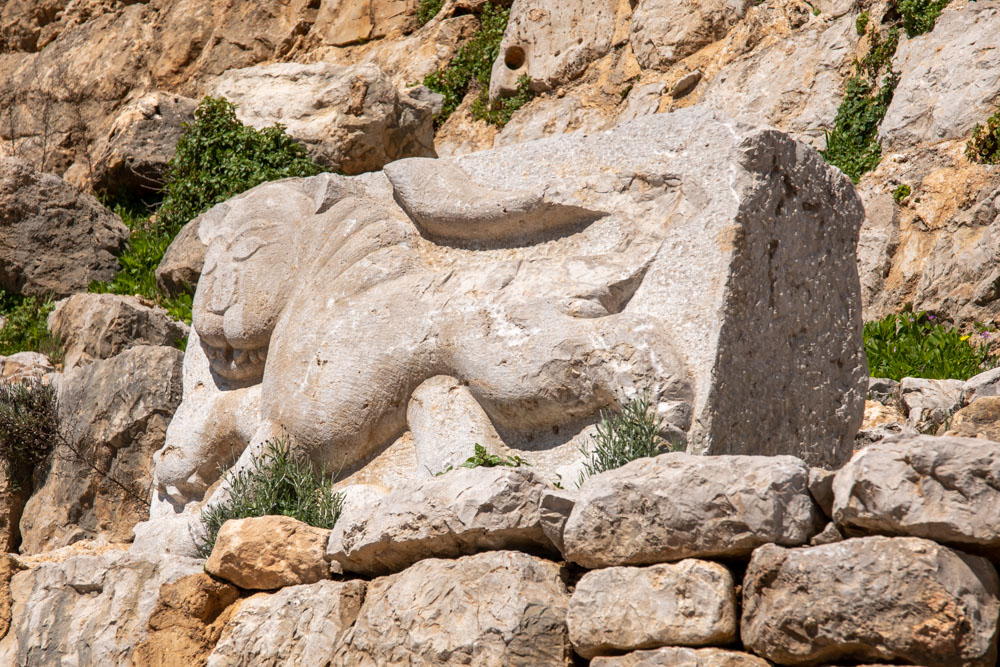
Detail of the sculpted lion (site brochure): “The royal emblem of Sultan Baybars (1275 CE) was discovered in the archaeological excavations.”
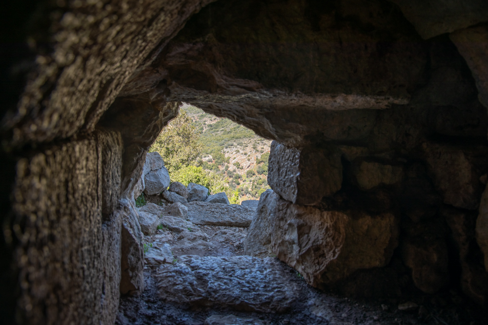
East side firing slits.
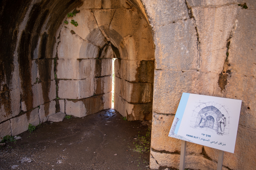
West side firing slits.
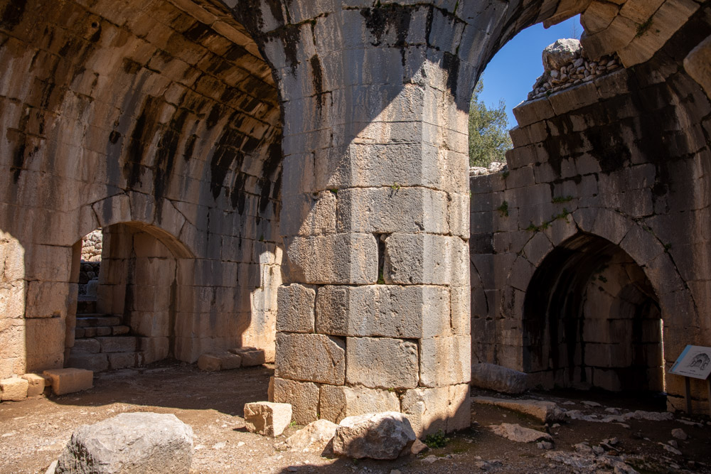
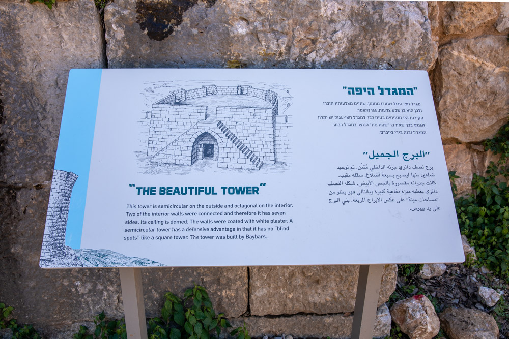
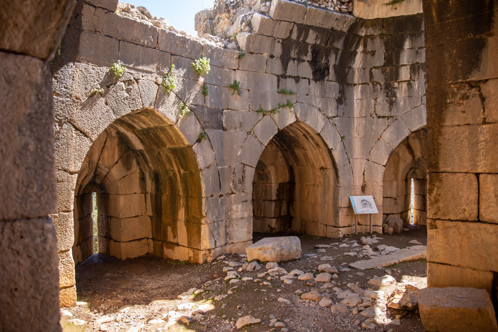
Arches inside the Beautiful tower.
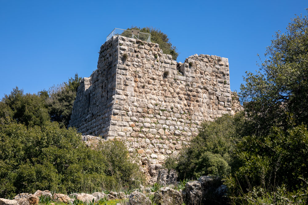
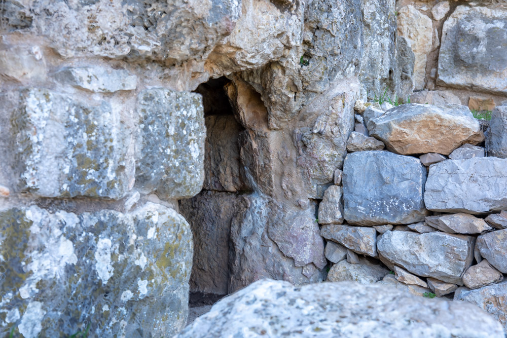
Keep is an English term corresponding to the French donjon. It was the strongest part of a fortress and the place of last resort if the fortress was overrun. Here’s the description of the keep of Nimrod’s Fortress from the site pamphlet: “A fortified, free-standing structure above the fortress. If the lower fortifications were overrun, the defenders were able to continue to defend the fortress from this massive and powerful structure. Its gate is in the northwest corner. At the four corners of the structure square towers were erected. In the area between them remnants were found of the arches of a ceremonial hall, additional halls and water cisterns.”
View west: This photo was taken from the park entrance below the eastern side of the keep (top).
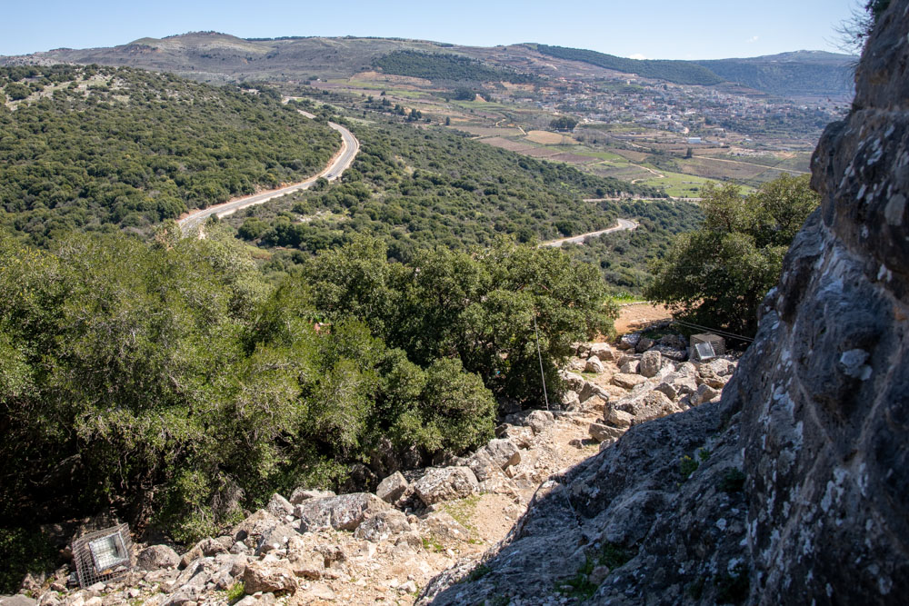
View east: The trail descending toward the park entrance from the keep’s northeast tower.
View west: The keep’s northeast tower. The photo was taken from the trail (see previous photo).
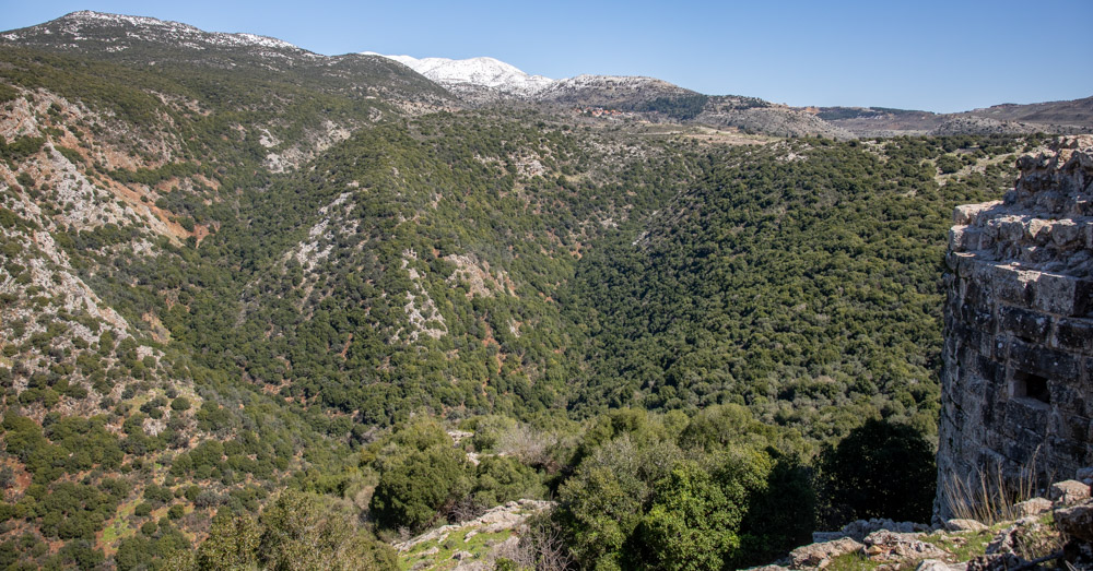
View east, looking across the protective terrain east of the keep toward Mount Hermon in snow.
View southwest, looking down from the keep toward the southern Hula Valley.
View west, looking down from the keep at the north tower (center left) toward the northern Hula Valley.
View east: The eastern side of the keep with tower (center) and Mount Hermon (top).
View west, looking down from the keep at the north tower (center right) and southwest tower (center left).
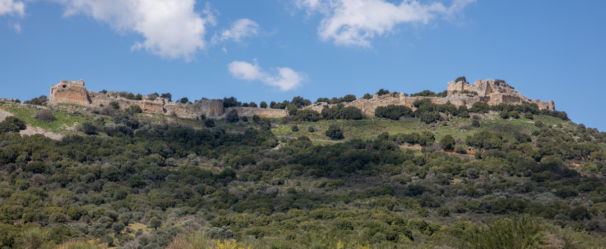
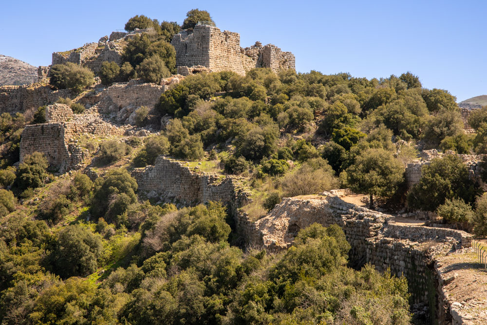
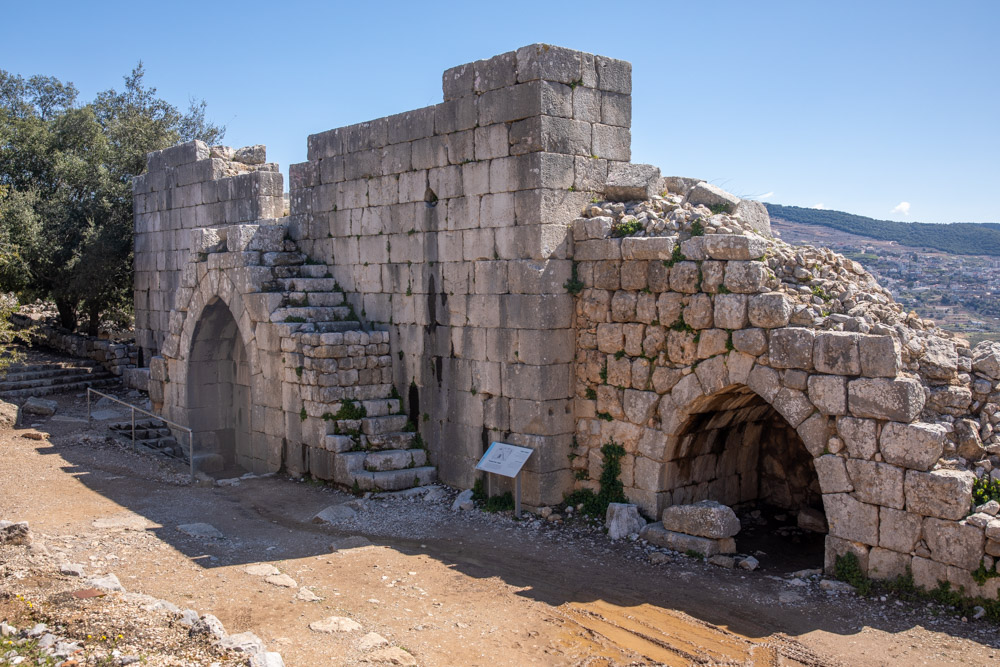
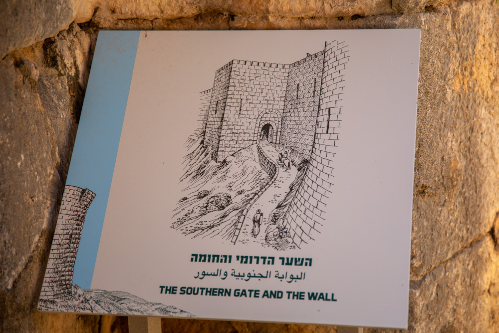
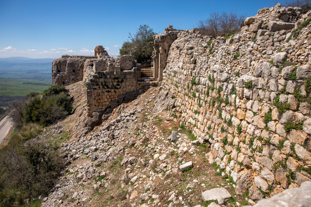
View north: South side of the fortress with the southwest tower (left), the southern gate and wall (between the southwest tower and Beautiful tower), the Beautiful tower (center left), and the keep (right).