(Sea of Galilee Region)
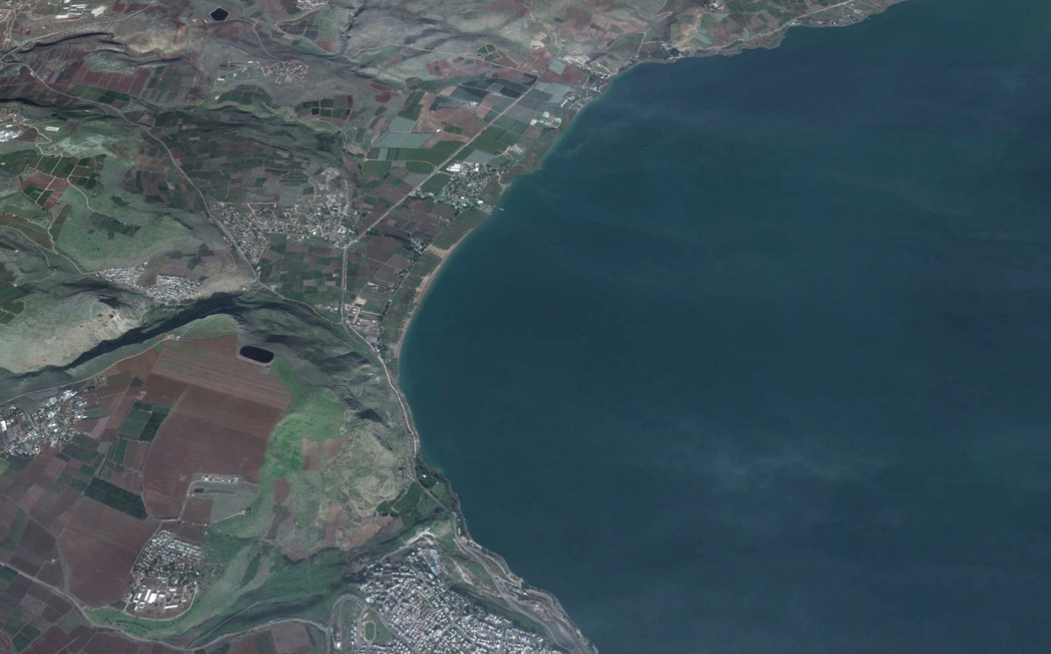
Magdala was a fishing village on the north-western shore of the Sea of Galilee. The gospels identify Mary Magdalene (i.e., Mary of Magdala) as a follower of Jesus. From this, we assume that Magdala was her home. Mary Magdalene was a witness to the crucifixion and resurrection of Jesus and is mentioned more times than any other woman in the gospels. She’s also mentioned more than most apostles. After Jesus fed the 4000 on the borders of the Decapolis, He and His disciples “took ship, and came into the coasts of Magdala” (see Matthew 15:29-39 » KJV, NASB, NIV, ESV).
Visit Bible Land Stories for Capernaum in the Bible and the video “I am the Bread of Life.”
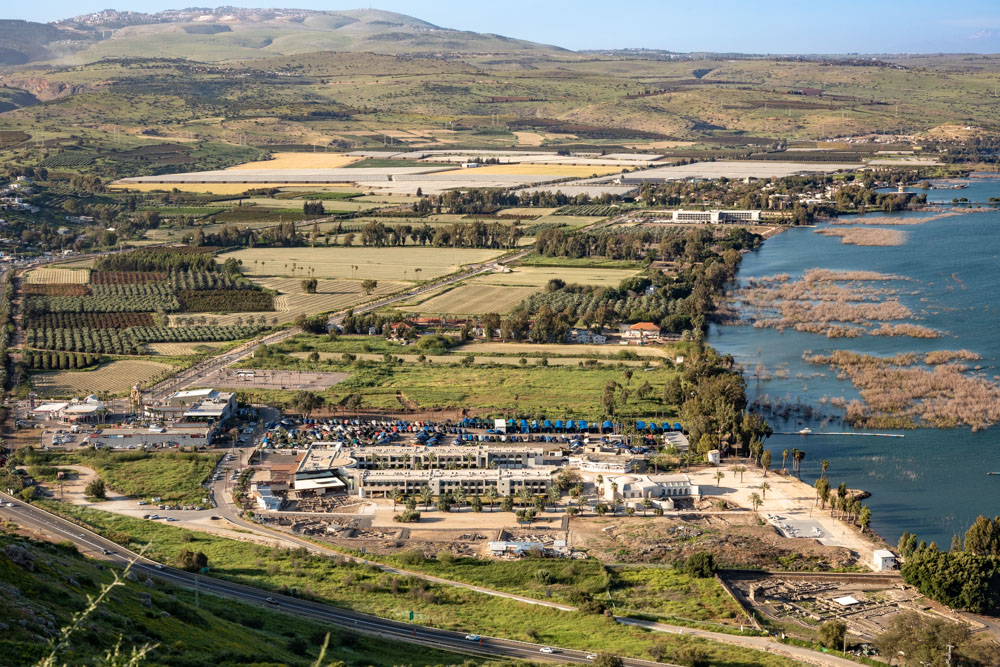
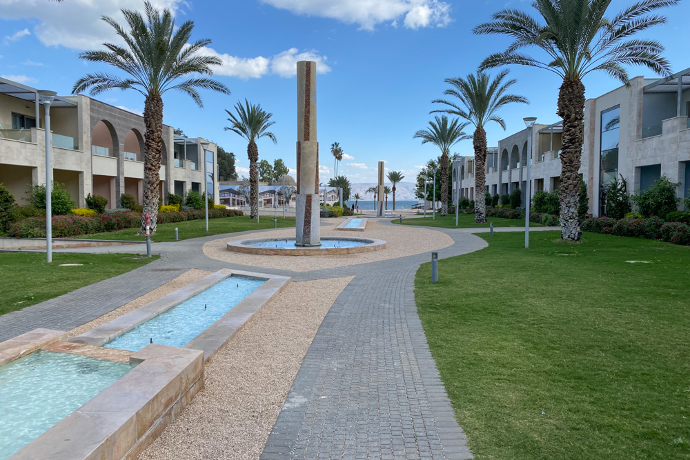
Magdala Complex: Hotel, chapels, and archaeological park. Photo taken from southern slope of Mount Arbel.
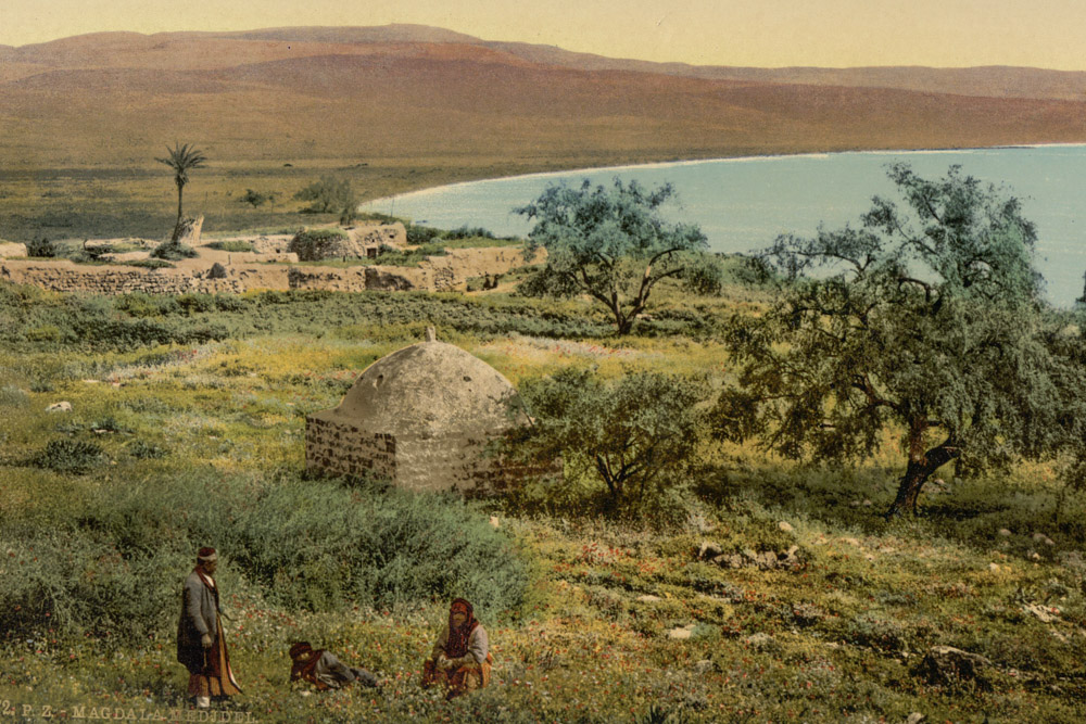
View North (Wiki caption): “Photograph taken c. 1900, showing the shrine of Muhammad al-’Ajami, belonging to the Arab Palestinian village of Al-Majdal, and ruins of Magdala.”
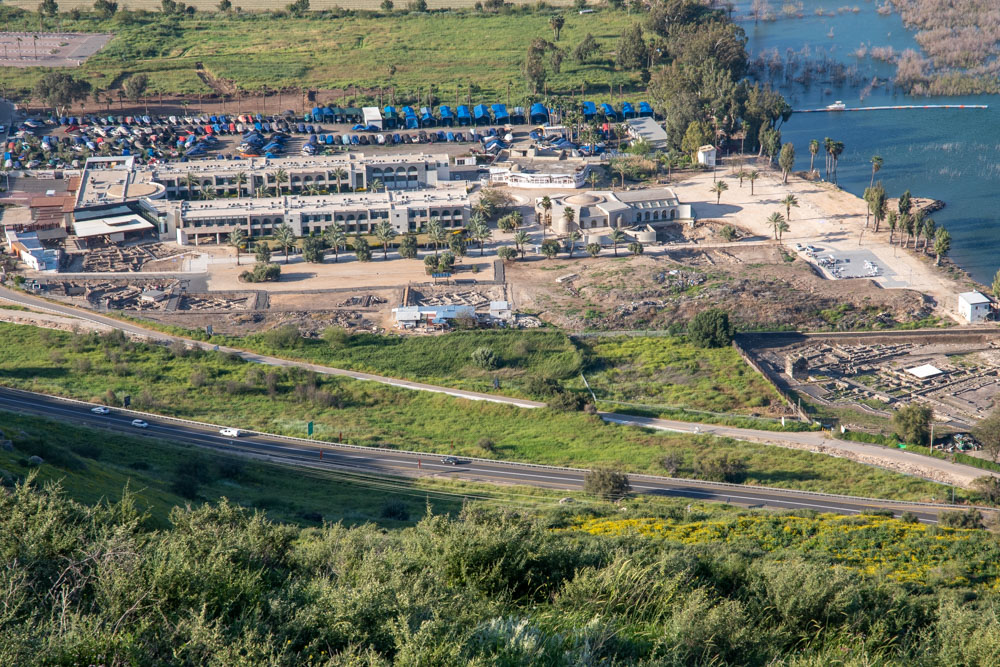
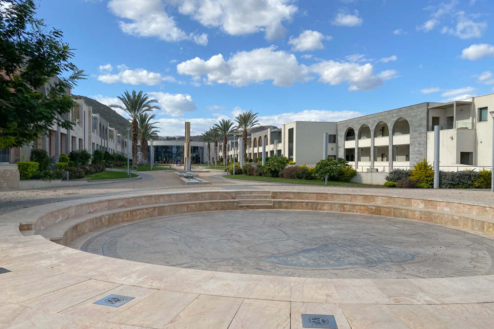
Magdala Complex: Detail view. Photo taken descending southern slope of Mount Arbel.
Jerusalem Post Article: “The Magdala Hotel was designed by Sofia Aspe, the Latin-American interior designer and local architect Rannin Nakhleh-Koury. As a result of the unusual archaeological finds, the construction plans were modified, so the site now incorporates an archaeological park and a magnificent church center adjacent to it.” Click here for more information about the hotel.
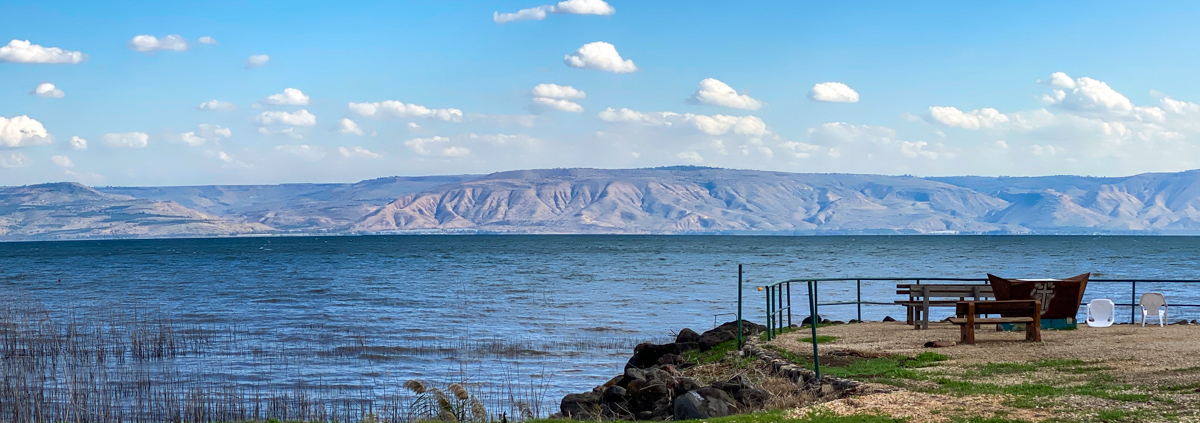
View East: Eastern shore of the Sea of Galilee with the Decapolis city of Sussita in view (right side). Photo taken from the shore of Magdala.
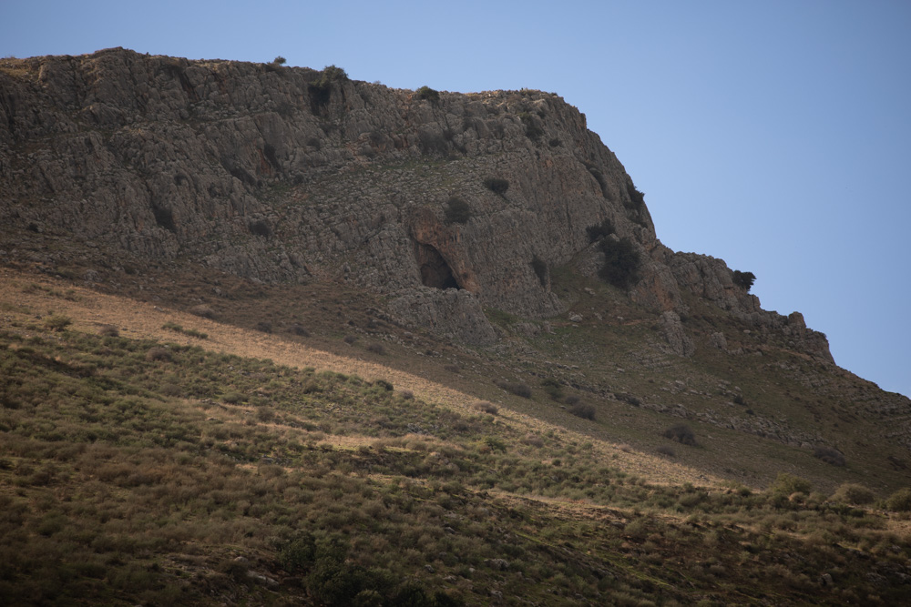
View West: Mount Arbel overlooking Magdala. The slope in the next photo is part of Mount Arbel’s southern ridge.
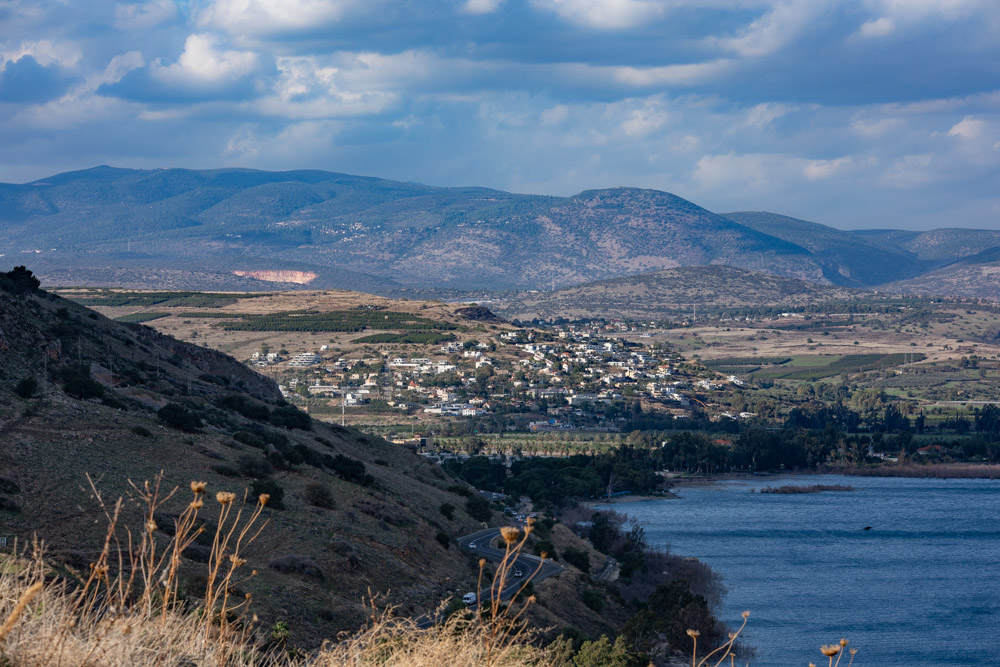
View North: Photo taken from Tel Rakat. Magdala is just behind the mountain ridge.
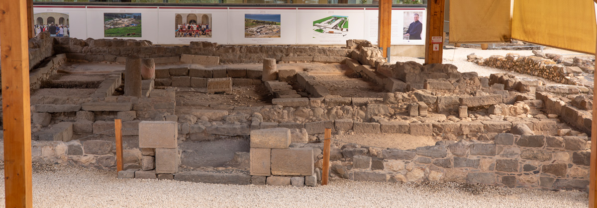
Entrance Hall (from onsite plaque): “A rectangular room that apparently served as a study hall (Beit Midrash). A low bench ran along the walls of the chamber. In its center was a square-shaped stone of chalk that seems to have served as a table.”
Archaeologists date the synagogue to the 1st century AD, before the destruction of the Second Temple (Herod the Great’s Temple). It is one of only seven synagogues discovered in the Holy Land from this period.
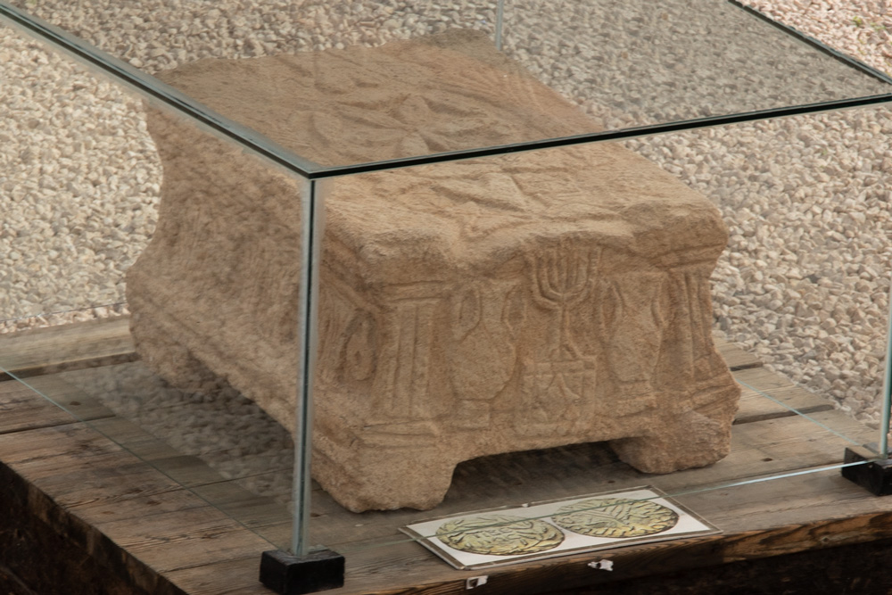
This stone furnishing was located in the center of the synagogue’s entrance hall. From onsite plaque: “All of its five faces are decorated in relief with a variety of patterns that form a model of the Temple and the special utensils that were used in it. This stone is the only known example of its kind; none resemble it. It apparently served in the synagogue as a table, upon which the Torah Scroll was placed when read.”
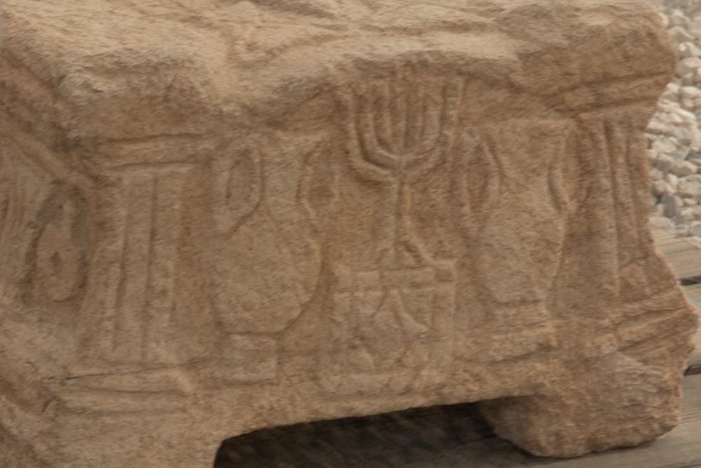
From onsite plaque: “Outstanding among the ornaments decorating the table is a seven-branched Menorah standing on a three-legged base with a description of the sacrificial altar on its facade. This relief joins the small number of Menorah decorations known to scholars, the first to have been discovered in Galilee from this period. This is the earliest example of a Menorah discovered in a Jewish religious building in Galilee.”
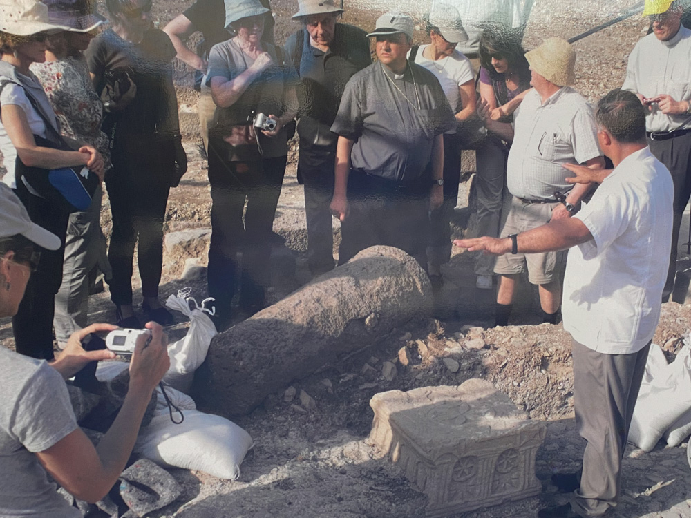
Uncovering the Magdala stone: The Magdala settlement began between the 2nd and 1st centuries BC and ended in the 3rd century AD.
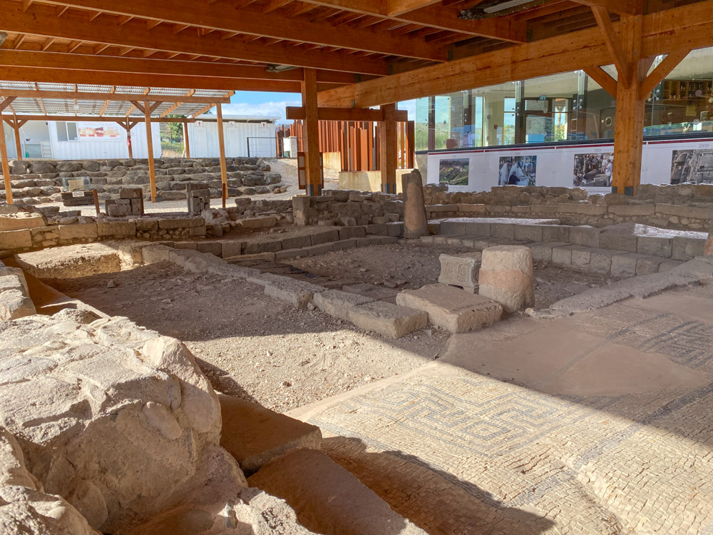
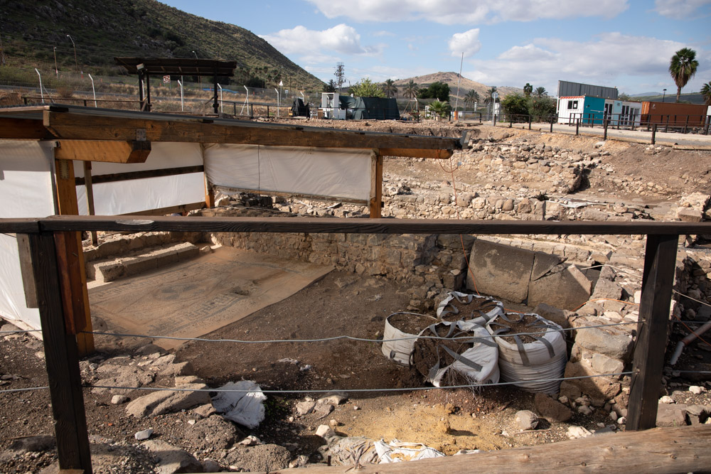
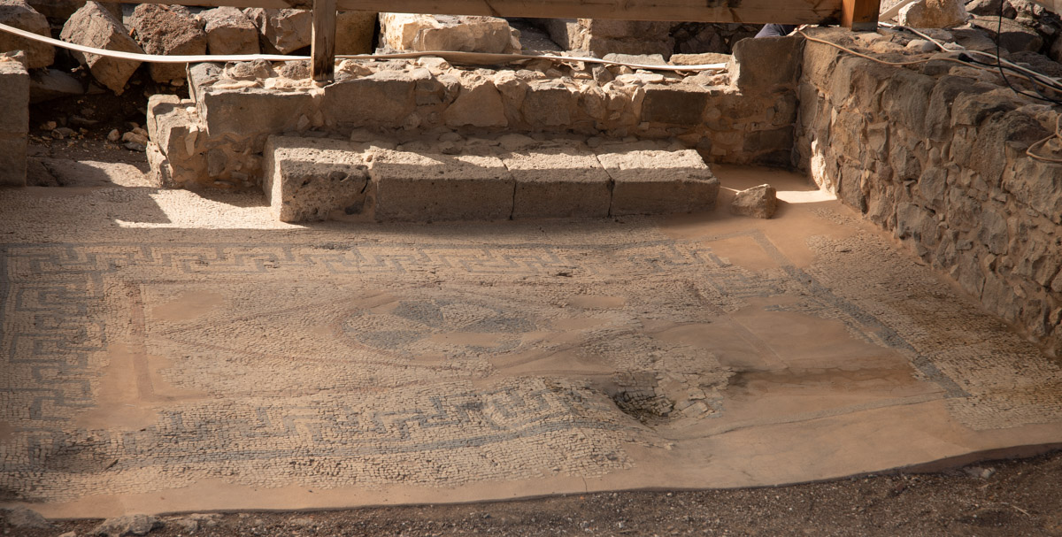
Torah-scroll store chamber (from onsite plaque): “The study hall led to a chamber with a mosaic-paved floor and walls covered with colorful frescos.
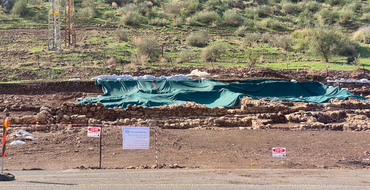
View West: A second synagogue was discovered across the road from Magdala in December 2021. It was the first time archaeologists uncovered two synagogues from the 1st century AD on the same site. You can read about the discovery in this Jerusalem Post article: “2nd-Temple-period synagogue found where Gospel’s Mary Magdalene was born.” From the article: “The building is the second synagogue from the time uncovered in Migdal, a prominent Jewish settlement that was also the main base of Flavius Josephus, historian and anti-Roman rebel commander.”
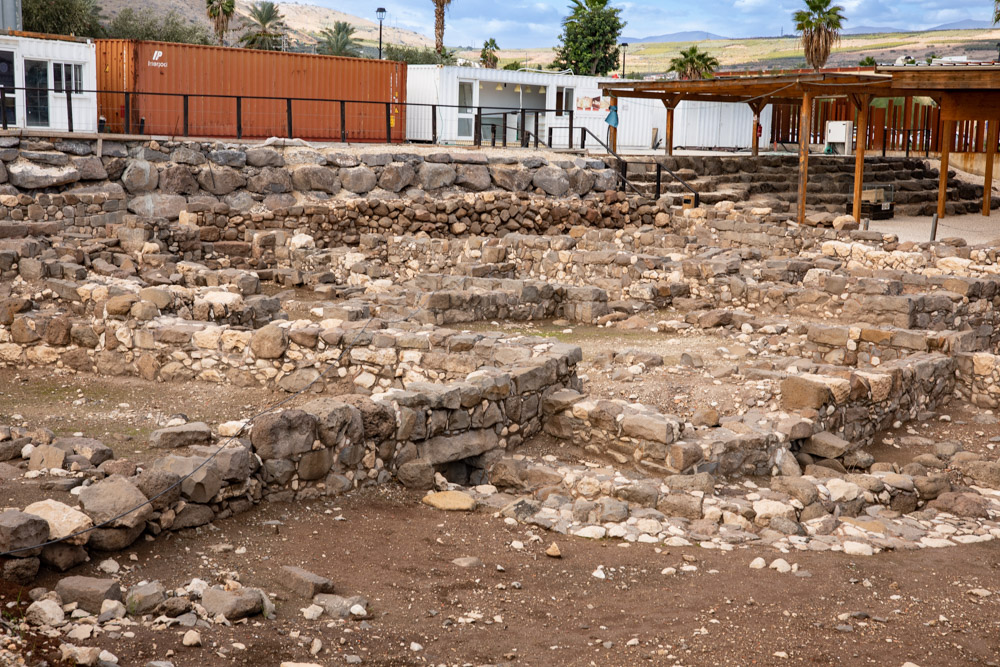
Market Area (from onsite plaque): “The architectural features of this area denote a public buildings identified with commercial activities. A North-South street leads to the synagogue and provides the only access to spaces with an additional eastern access to other structures.”
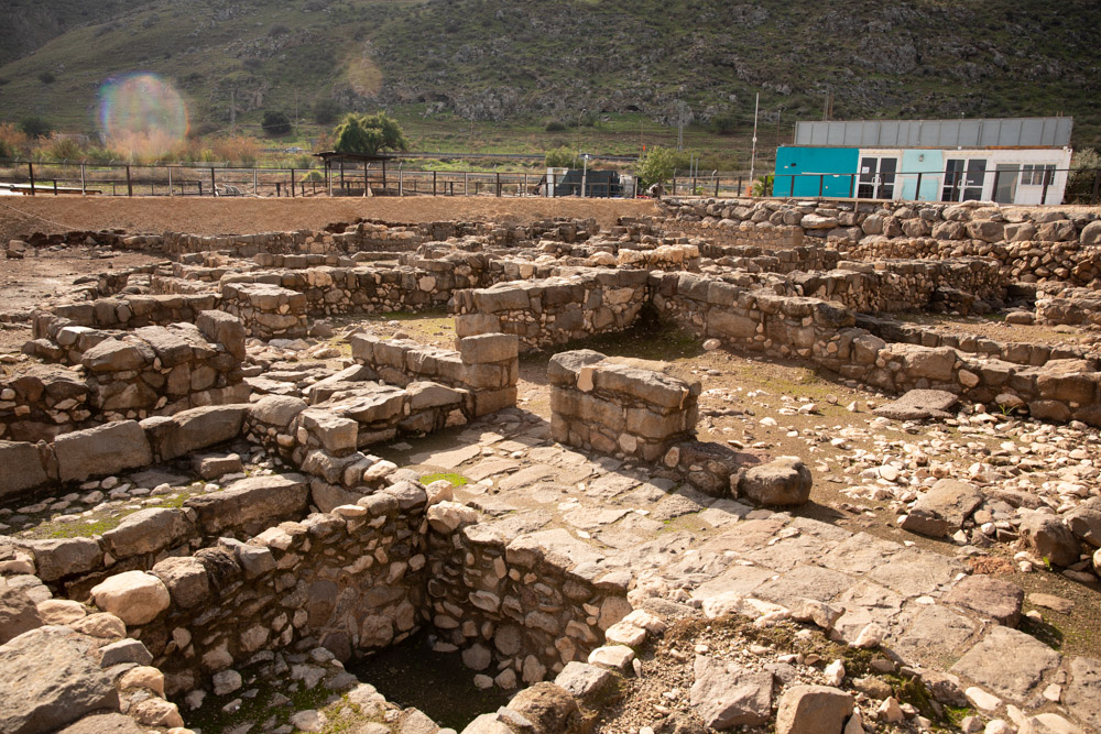
Market Area (from onsite plaque): “Inside the rooms a large number of amphorae, glass vessels, and animal bones were found. The occupation of this space primarily corresponds to the 1st century AD, although there is evidence of occupation in the 2nd century AD.
Domestic Housing Area (from onsite plaque): “The architecture of this area allows us to distinguish two streets that separate three structures following the same symmetric layout as the rooms located west. They are constructed from local materials: the walls are made of roughly hewn basalt stones and some limestone. The floors are very simple, made of compact ground soil and lime. This area was used for residential purposes and storage of products related to the fish industry.”
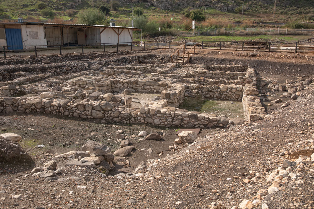
Production and Housing Area (from onsite plaque): “Spaces are arranged around a courtyard that allows communication, lighting, and ventilation into the rooms. It has two clear entrances: one that leads to the courtyard without interfering with domestic activities, and a second access that leads to the cooking area of this building.”
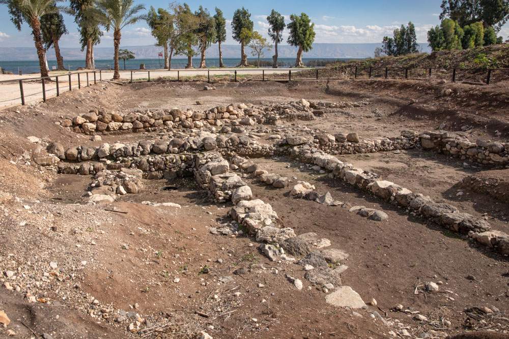
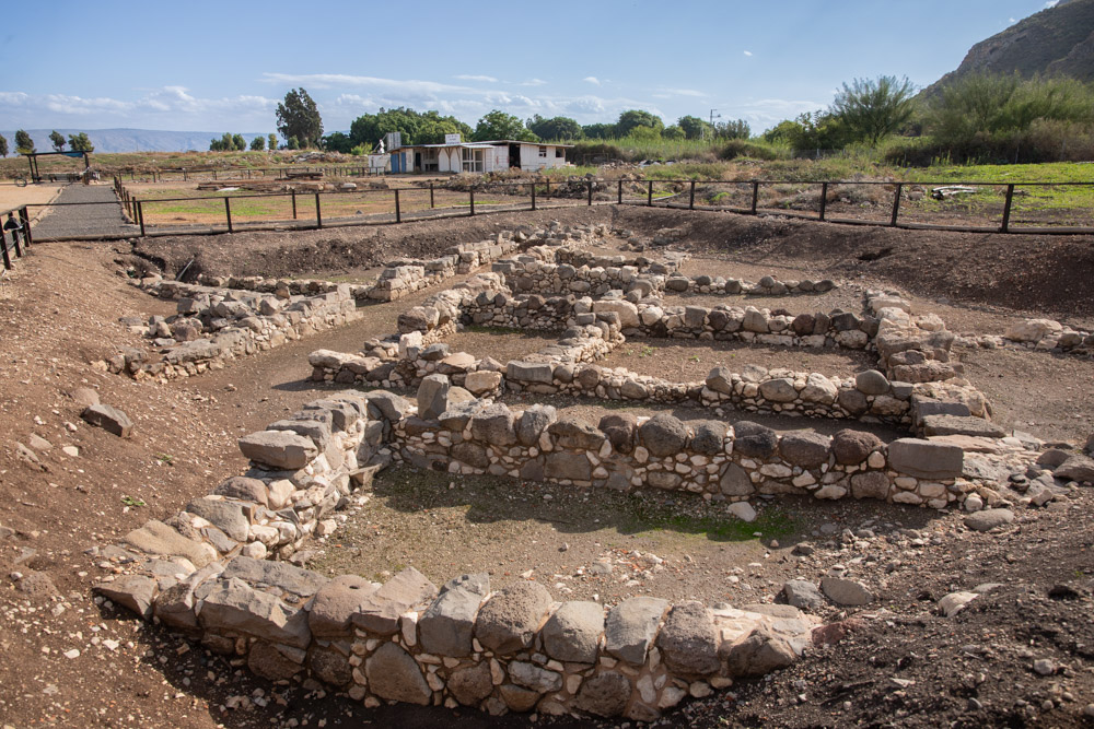
Magdala Port (from onsite plaque): “According to the tradition and history, the most important economic activity in Magdala in the first century was fishing. Flavius Josephus mentions that there was a large fleet of boats in the harbor. The lake bed can be distinguished by the pebbles, shells, and loamy soil.”