Scroll To Top
Scroll To Top

Jerusalem — City of David Photo Gallery

Click the title to view map


Jerusalem Overview

Introduction

Hezekiah's Tunnel - Jerusalem
Hezekiah’s Tunnel

Unlike many archaeological sites, the City of David is surprisingly difficult to visualize. Modern homes cover much of the ancient ridge, while the surviving remains lie buried beneath centuries of construction. Visitors see excavated walls, terraces, tunnels, and foundations, but imagining how they once formed the capital of ancient Israel requires a great deal of interpretation.

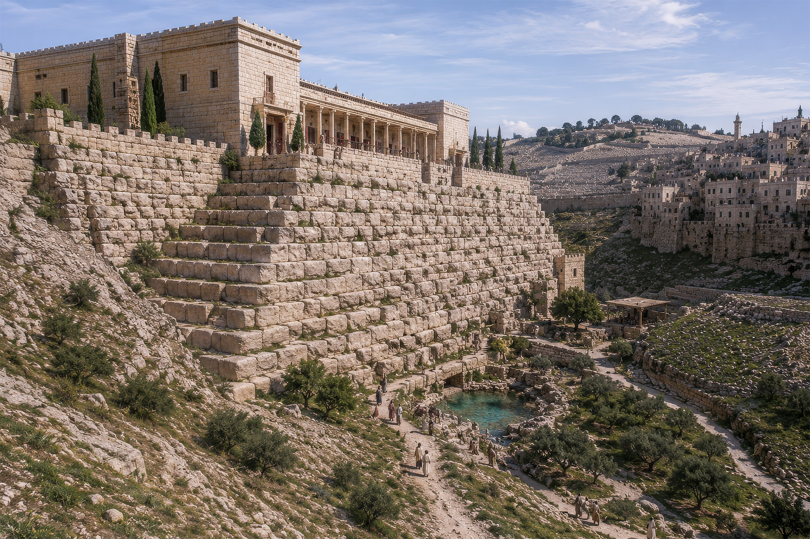
To bridge that gap, this gallery uses a different approach. Each section pairs one of my photographs with an AI-assisted historical reconstruction created from the same viewpoint. Rather than replacing the real landscape, these reconstructions add the walls, buildings, gates, and daily activity that archaeologists believe once occupied the site. Seeing the modern photograph beside an ancient visualization makes it much easier to understand how the surviving ruins fit together.

The reconstructions are not intended as exact archaeological blueprints. Instead, The AI reconstructions in this gallery are interpretive visualizations based on archaeological research and the visible landscape. They are intended to help visitors understand the ancient setting rather than depict every structure with absolute certainty. Together, the photographs and reconstructions invite you to look beyond today’s excavations and imagine the City of David as it appeared during the time of the biblical kings.

Major Events

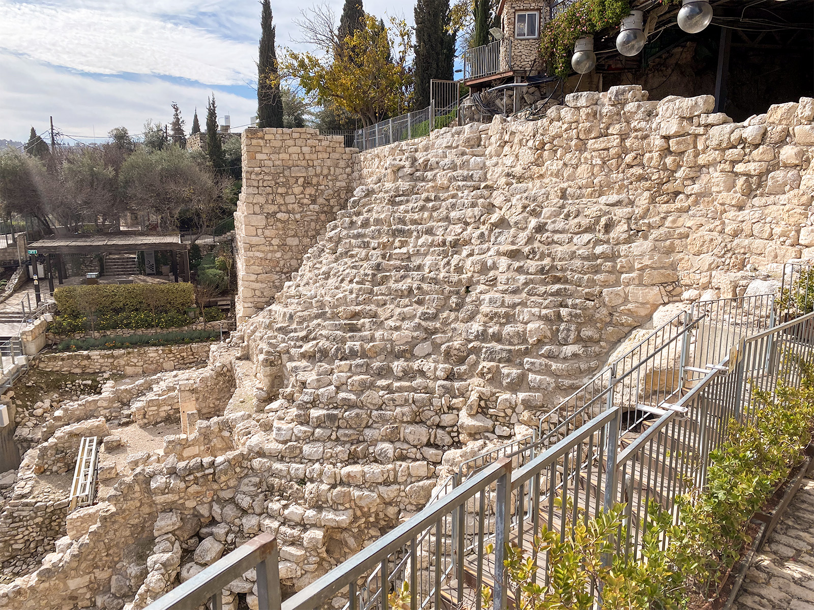
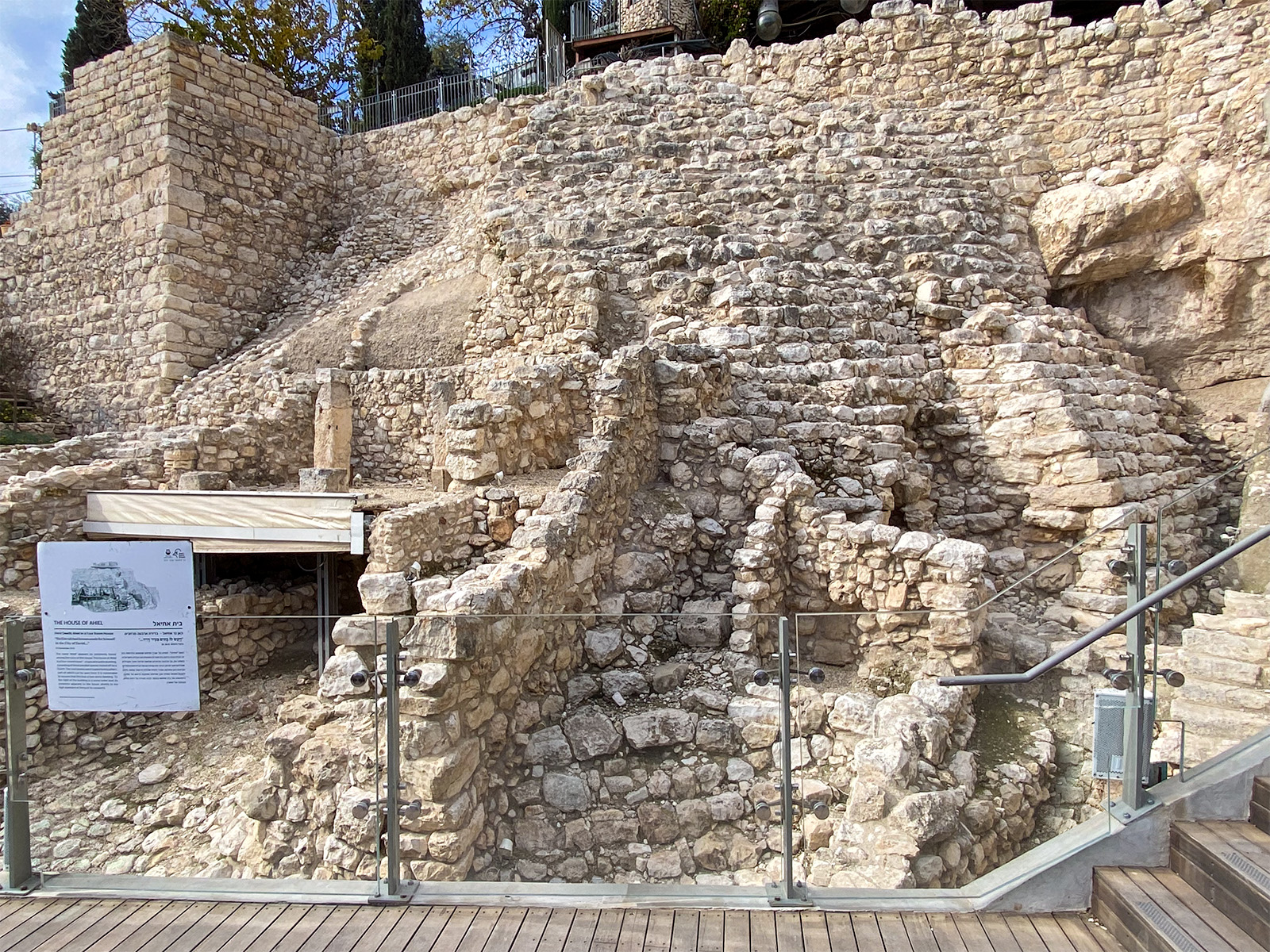
View west: This photo shows the stepped wall and House of Ahiel. Above it is the park entrance and welcome center.

City of David - Reconstruction

City of David Reconstruction Detail

Mount of Olives - Gihon Spring

View north: The Mount of Olives from the City of David, looking across a reconstruction of the Gihon Spring.

Kidron Valley - Mount of Olives

View north: The Kidron Valley with the Mount of Olives in the background.

Gihon Spring Detail

House of Ahiel - Reconstructed

Reconstructed House of Ahiel

City of David - Stepped Stone Structure

The main entrance to the City of David archaeological park overlooks the Stepped Stone Structure, one of ancient Jerusalem's most impressive engineering achievements. Visitors purchase admission here, receive maps and orientation information, and begin exploring the excavations that reveal the city's earliest history. From this point, trails descend into the remains of biblical Jerusalem, including the royal quarter, the Gihon Spring, Hezekiah's Tunnel, and the Pool of Siloam.

City of David - Stepped Stone Structure

The Stepped Stone Structure consists of massive layers of stone built against the eastern slope of the City of David. Archaeologists generally agree that it served as an enormous retaining or support wall for important buildings above, but they continue to debate exactly when it was constructed and what it supported. Some believe it formed part of the original Jebusite fortress conquered by David, while others associate it with the royal palace complex built after Jerusalem became Israel’s capital.

City of David - House of Ahiel (Four-Room House)

The House of Ahiel is one of the best-preserved Israelite homes excavated in the City of David. Dating to the First Temple period, it was likely destroyed during the Babylonian conquest of Jerusalem in 586 BC. The four-room floor plan is characteristic of Israelite domestic architecture, providing a rare glimpse into everyday life in biblical Jerusalem. The house is named after “Ahiel,” whose name appears on an inscribed pottery fragment discovered among the ruins of the house.

Stepped Stone Structure - Reconstructed

Stepped Stone Structure Reconstruction Detail

Hezekiah's Tunnel Inscription - Reconstruction

Hezekiah’s Tunnel Inscription — Reconstruction Detail

Hezekiah's Tunnel - Jerusalem

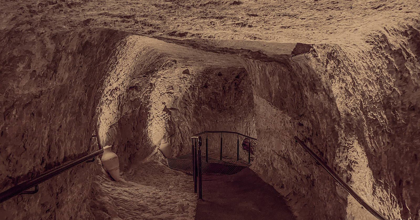
Hezekiah’s Tunnel was constructed around 701 BC. as King Hezekiah prepared Jerusalem for the invasion of the Assyrian king Sennacherib. By diverting the waters of the Gihon Spring through this 1,750-foot (533 m) tunnel to the Pool of Siloam inside the city’s defenses, Hezekiah secured Jerusalem’s water supply while denying it to the besieging army. The project is described in 2 Kgs. 20:20, 2 Chron. 32:2–4, 30, and Isa. 22:9–11, making the tunnel one of the best-preserved engineering works mentioned in the Bible.

Hezekiah's Tunnel - Jerusalem

Hezekiah’s Tunnel was cut entirely through solid limestone by two teams of workmen who began at opposite ends and excavated toward one another. Despite the winding course of the tunnel, the two groups successfully met near the middle, an accomplishment commemorated by the famous Siloam Inscription discovered near the southern end in 1880. Today, visitors can still walk through the narrow passage, following the same route that carried Jerusalem’s lifeline of fresh water more than 2,700 years ago.

Siloam Inscription

Discovered in 1880 near the southern end of Hezekiah's Tunnel, the Siloam Inscription commemorates the moment when two teams of workmen, excavating from opposite ends of the tunnel, finally met in the middle. The inscription takes its name from the nearby Pool of Siloam, where the tunnel emptied its waters. During the Ottoman period, the stone was removed from the tunnel in 1890 and sent to Constantinople (modern Istanbul), where it remains today in the Istanbul Archaeological Museums. It is one of the oldest surviving Hebrew inscriptions and provides remarkable confirmation of the engineering project described in the Bible (2 Kgs. 20:20; 2 Chron. 32:30).

This reconstruction is based on the original inscription, which was damaged during its removal from Jerusalem but remains one of the most important archaeological discoveries from the First Temple period.

City of David - Water System

This cutaway reconstruction illustrates how Jerusalem’s earliest inhabitants secured their most precious resource—the Gihon Spring. The spring emerged on the eastern slope of the City of David, outside the city walls and vulnerable to attack. To protect the water supply, the inhabitants first fortified the spring with massive defensive walls and constructed a protected passage that allowed residents to reach it from within the city.

Around 701 BC, as the Assyrian army threatened Jerusalem, King Hezekiah undertook an even more ambitious project. Engineers carved a 1,750-foot (533 m) tunnel through solid limestone, diverting the spring’s waters beneath the city ridge to the Pool of Siloam, safely inside Jerusalem's defenses. Although this illustration exposes the tunnel for clarity, Hezekiah’s Tunnel actually runs entirely underground, hidden beneath the ridge from the Gihon Spring to the Pool of Siloam. Together, these remarkable engineering works ensured Jerusalem’s water supply during times of peace and siege, making the city’s survival possible.

The Pool of Siloam received the waters of Hezekiah’s Tunnel after their 1,750-foot (533 m) journey beneath the City of David. This partially excavated section preserves the broad stone steps that descended into the pool, allowing people to draw water regardless of the water level. In the Second Temple period, the pool served not only as Jerusalem's principal reservoir but also as a ritual purification site for pilgrims preparing to ascend to the Temple.

Pool of Siloam

Viewed from the opposite end, the Pool of Siloam reveals its impressive size and stepped construction. Buried for centuries beneath layers of debris and later buildings, much of the pool remained unknown until construction work in 2004 led to its rediscovery. Archaeologists continue to excavate the site, gradually uncovering one of Jerusalem’s most important public works from the time of Jesus.

Pilgrimage Road

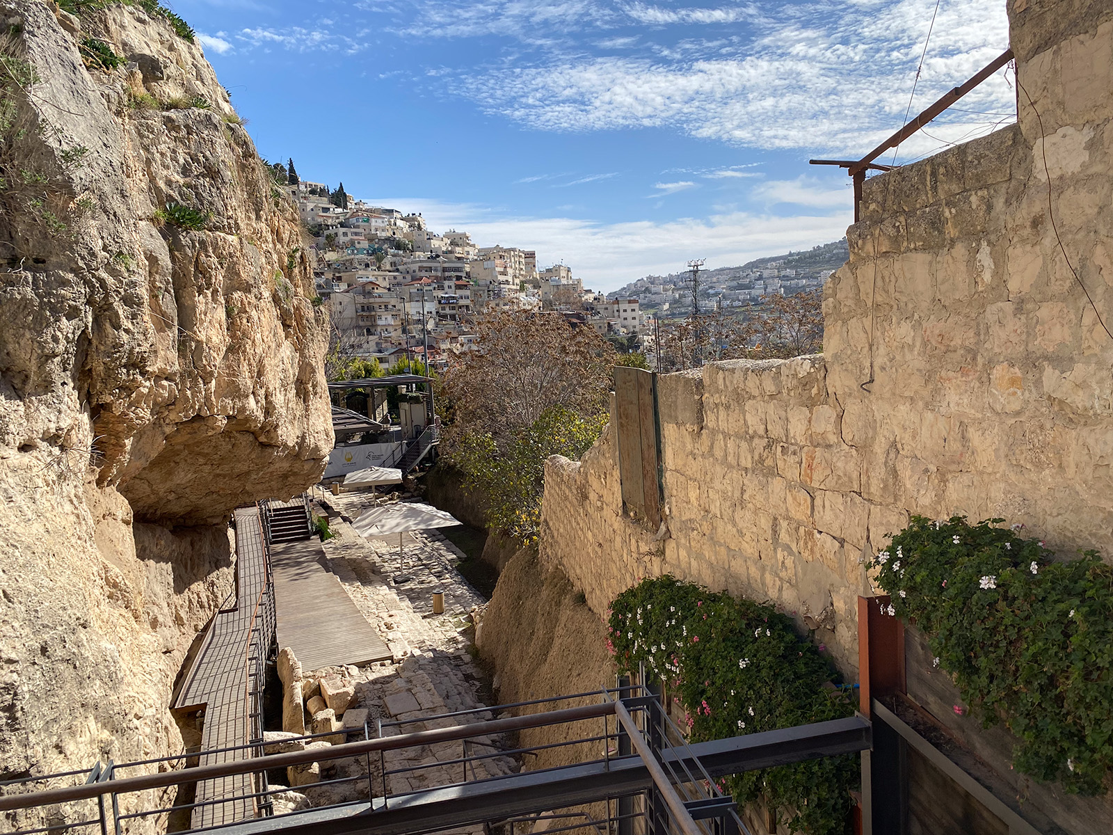
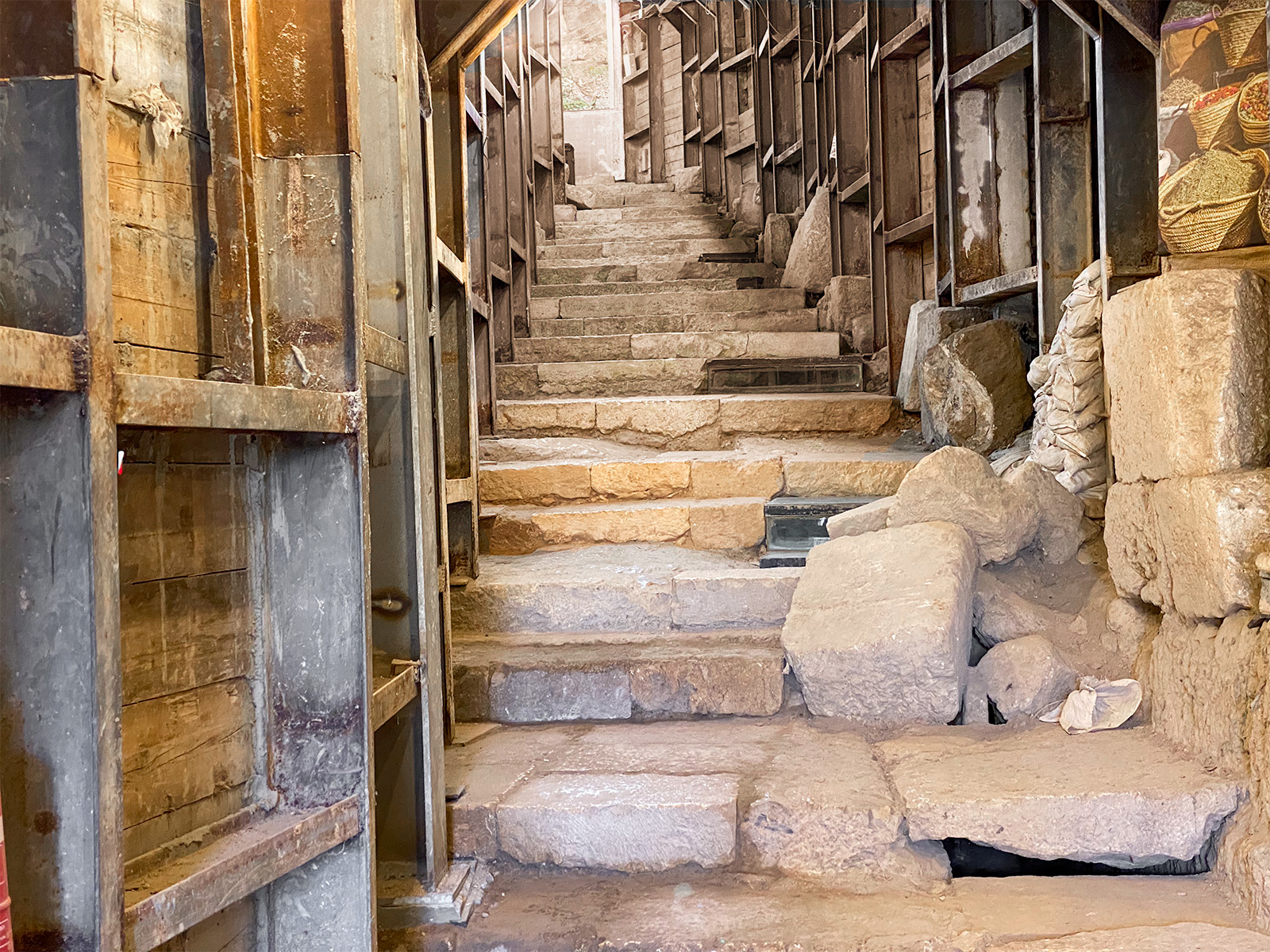
Just beyond the Pool of Siloam, these ancient steps lead to the Pilgrimage Road, the broad stone street that carried Jewish worshippers from the southern entrance of Jerusalem to the Temple Mount. After washing in the Pool of Siloam, pilgrims began the uphill walk through the City of David, joining thousands of others who came to celebrate Passover, Pentecost, and the Feast of Tabernacles. Recent excavations have revealed long sections of this remarkable processional route.

Pool of Siloam

Pilgrimage Road

This reconstruction combines ancient and modern Jerusalem to illustrate the route of the Pilgrimage Road. The Dome of the Rock and the modern neighborhood of Silwan are shown for geographic reference, while the ancient road itself has been restored to reveal how it once climbed from the Pool of Siloam to the southern entrances of the Temple Mount. During the Second Temple period, thousands of Jewish pilgrims followed this route as they ascended to worship during Passover, Pentecost, and the Feast of Tabernacles.

Today, much of the Pilgrimage Road lies buried beneath the modern village of Silwan. Archaeologists have excavated long sections of the original street by tunneling beneath the neighborhood, supporting the buildings above with massive steel beams and reinforced concrete. Visitors now walk through these underground excavations, following the same route that ancient pilgrims once climbed in the open air nearly two thousand years ago.

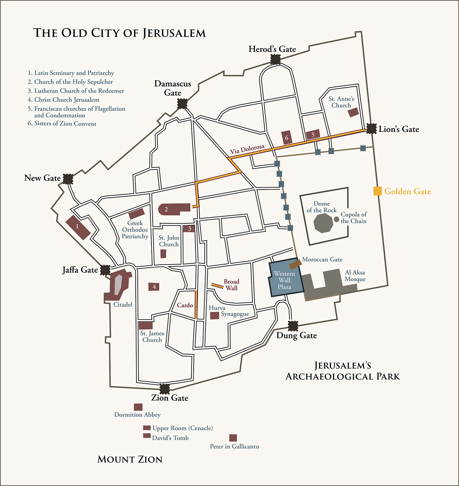
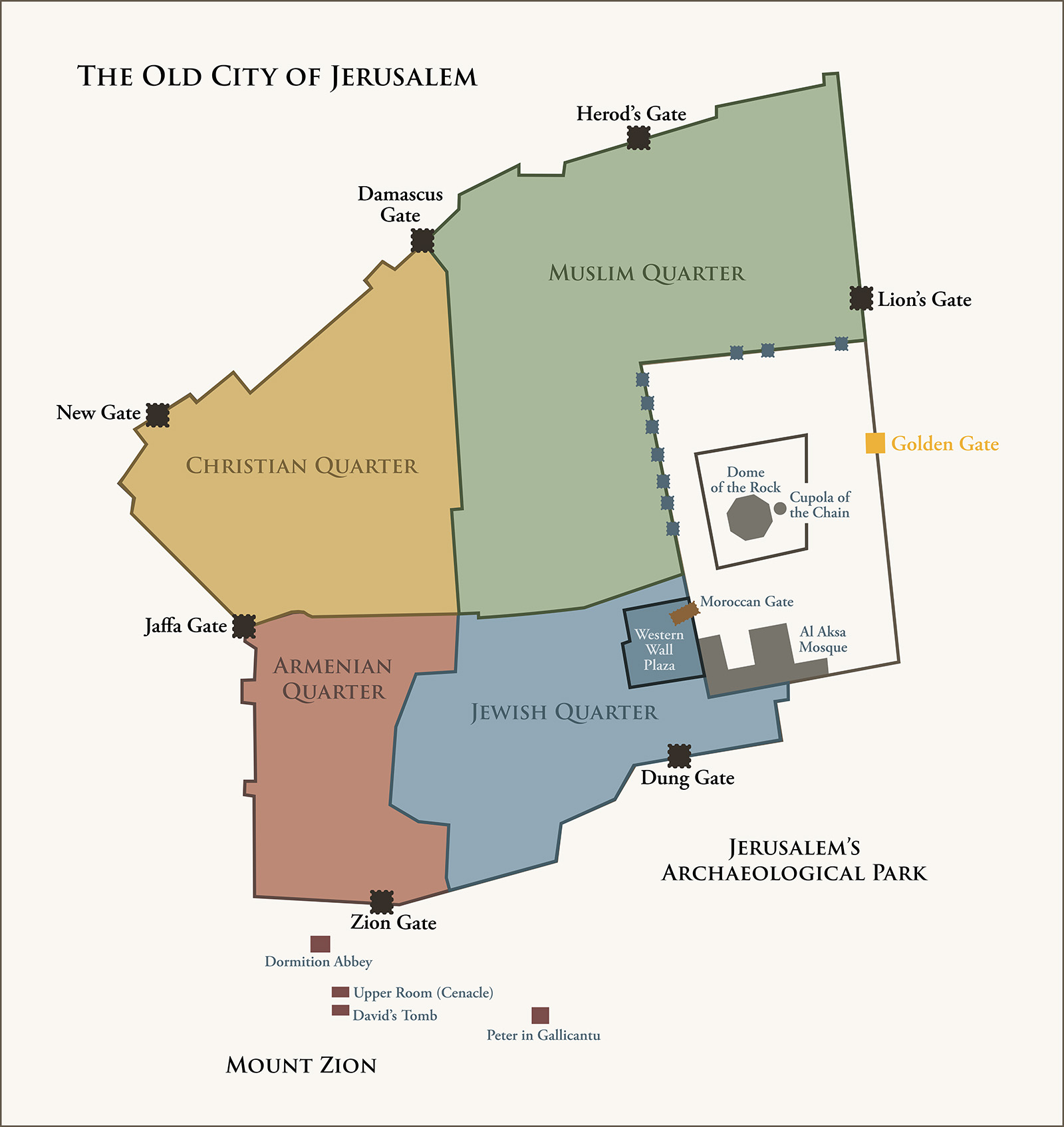
Major Events at Jerusalem

Click the map to show or hide the overlay
Map