Photos and Maps • Photo Usage Policy • Back to Overview
Open chapter PDF to read or share (new tab)
Open chapter PDF (new tab, book format)
View north: Nahal Amud runs from Safed along the eastern edge of Upper and Lower Galilee down to the Sea of Galilee, bordering the three divisions of Galilee. For perspective, see the person on the trail.
You may download photos free of charge for non-commercial, educational purposes: home, church, synagogue, or school. You must, however, give proper attribution on or below each image to BibleLandImages.com.
If you’re using photos as part of a PowerPoint or other electronic presentation, it’s enough to mention the source of the photos at the beginning of your lecture.
The photos may not be used on other internet sites without permission.
You may download favorite chapters and sections or copy their URL links to share via email or in a messenger app. You may also post links on social media or a personal website.
By downloading a photo, chapter, or section you agree to this policy. If you have questions about it or need a commercial photo license, please contact me via email: Daniel@BibleLandImages.com.

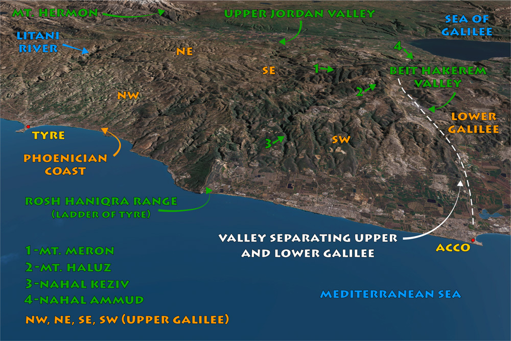
View east: Upper Galilee, Mt. Hermon, the upper jordan Valley, the Golan Heights, and the Sea of Galilee. Lower Galilee begins south of the Beit HaKerem Valley.

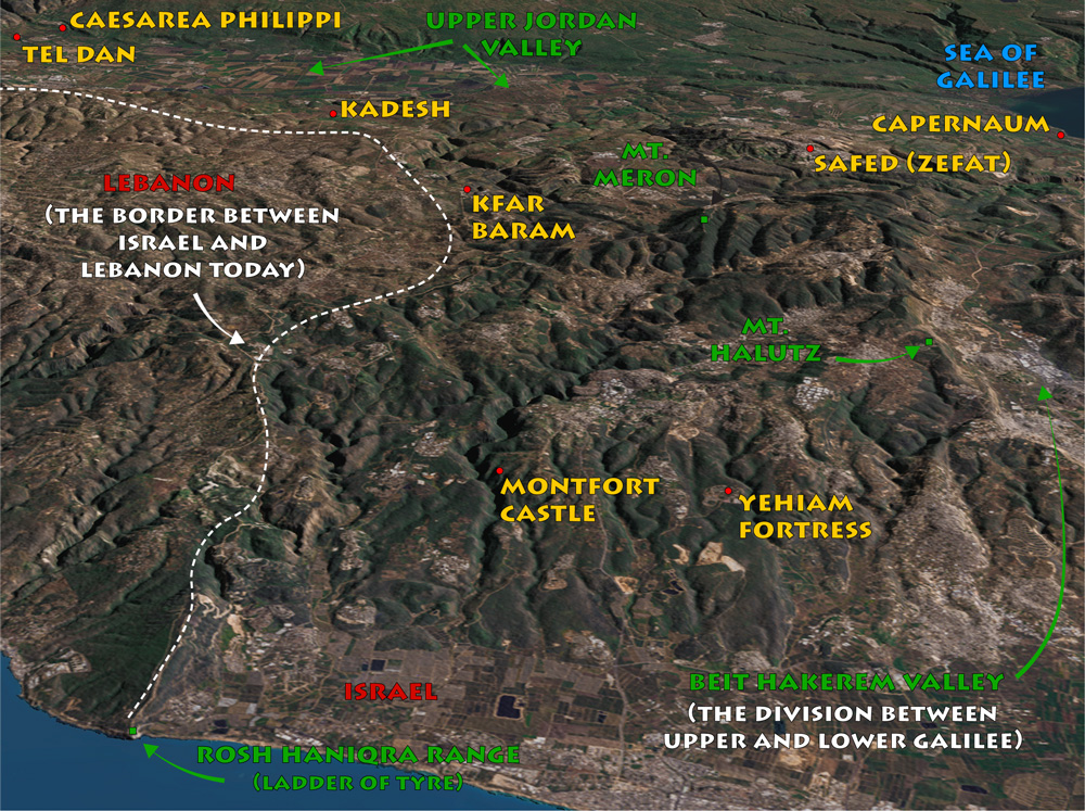
View east: Detail map of Upper Galilee.

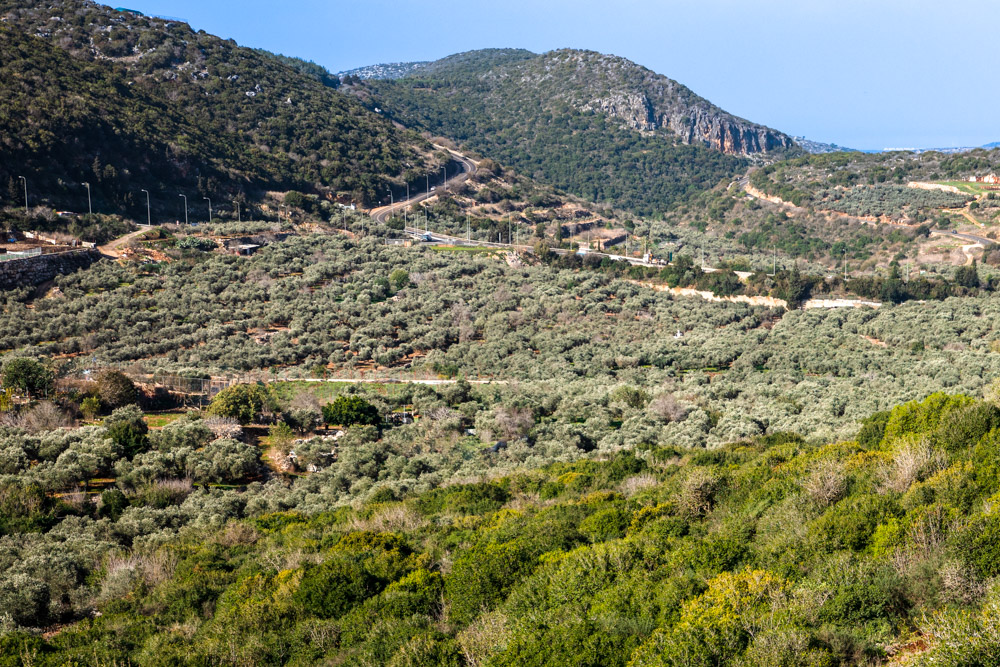
View northeast: The southwest sector of Upper Galilee as described on page 52. Notice the deep ravines alongside a flat cultivatable area.

View west: The mountains and valleys of Upper Galilee directly north of the Beit Hakerem valley, which separates Upper and Lower Galilee.

The Horshat Tal National Park preserves a grove of Mt. Tabor Oak trees, which once covered much of Upper Galilee and the Golan. See “Upper Jordan Valley” in Blessed Pilgrimage, vol. 2.

View north: This photo was taken east of Mt. Halutz in the southeast sector of Upper Galilee. The terrain makes traveling through Upper Galilee nearly impossible except along a few well-established routes.

View north: A stand of smaller oak trees. This photo was taken on the ridge south of Nahal Keziv. These trees are not the Tabor Oaks pictured on page 48 (bottom photo)

View southeast: This photo was taken from Yehiam fortress in the southwest sector of Upper Galilee, east of modern Nahariya on the northern coast of Israel (see “Yehiam Fortress” on page 73).

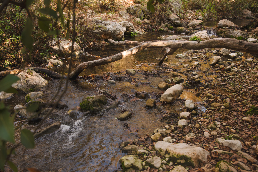
The floor of Nahal Keziv not far from the trail that winds through the reserve.

A spring pouring into Nahal Keziv as you climb up the eastern end.

View east: This photo was taken at the bottom of the Nahal Keziv canyon on the other side of the sloping, v-shaped ridges visible in the top photo on page 53.

View northwest: Nahal Keziv, about 1.3 miles (2 kilometers) east of the Crusader castle of Montfort and 3 miles (4.8 kilometers) west of the Israeli town of Abirim, located on the ridge above the canyon.

View west: This photo was taken from the Montfort Castle overlooking the lower end of Nahal Keziv (see “Montfort Castle” on page 69). The dense vegetation and ravines are typical of Upper Galilee.

View West: Tel Kedesh (center, green mound), and part of the area described by Thomson in the Northeast Sector. For more on Kedesh, see “Kedesh of Naphtali” on page 61.

View east: This photo was taken above Tel Kedesh overlooking the cultivable plain around it on three sides. The Golan Heights are visible (top) with the Upper Jordan below them (not pictured).

View southeast: This photo was taken in the southeast sector of Upper Galilee where it overlooks the upper jordan Valley, south of Ramot Naftali, an Israeli Moshav not far from the Lebanese border.

View northeast: This photo was taken from Mt. Meron. The town of El-Jish (upper right; ancient Gischala or Gush Halav) overlooks the plateau with Mt. Hermon in the background (top right).

View north: Nahal Amud runs from Safed along the eastern edge of Upper and Lower Galilee down to the Sea of Galilee, bordering the three divisions of Galilee. For perspective, see the person on the trail.