Photos and Maps • Photo Usage Policy • Back to Overview
Open chapter PDF to read or share (new tab)
Open chapter PDF (new tab, book format)
View northeast: The Catholic Basilica of the Annunciation in the center of Nazareth.
You may download photos free of charge for non-commercial, educational purposes: home, church, synagogue, or school. You must, however, give proper attribution on or below each image to BibleLandImages.com.
If you’re using photos as part of a PowerPoint or other electronic presentation, it’s enough to mention the source of the photos at the beginning of your lecture.
The photos may not be used on other internet sites without permission.
You may download favorite chapters and sections or copy their URL links to share via email or in a messenger app. You may also post links on social media or a personal website.
By downloading a photo, chapter, or section you agree to this policy. If you have questions about it or need a commercial photo license, please contact me via email: Daniel@BibleLandImages.com.
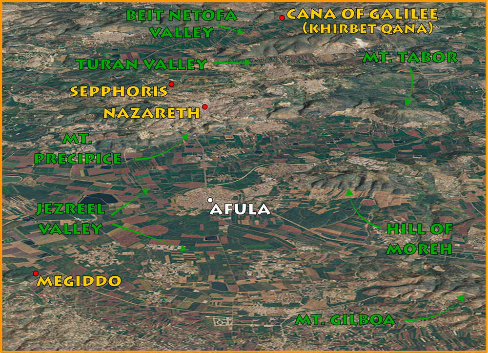
Detail map of area around Nazareth.
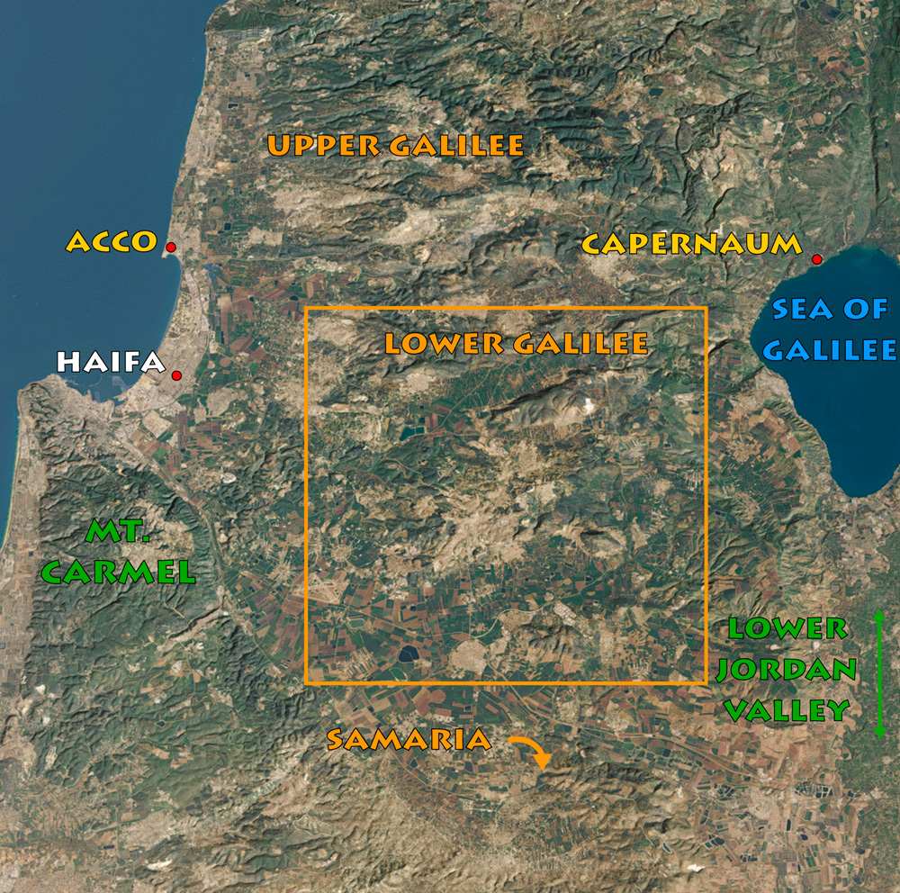
Detail map context.

View northeast: The Catholic Basilica of the Annunciation in the center of Nazareth.

A Jewish Rabbi in the synagogue of Nazareth Village reading from an Isaiah scroll (see page 138).

Grotto of the Annunciation (below), where Catholics believe the angel Gabriel appeared to Mary.

The upper church in the Basilica displays mosaics of Mary from countries worldwide.

Excavations next to the church revealed a first-century AD cave dwelling and cistern.
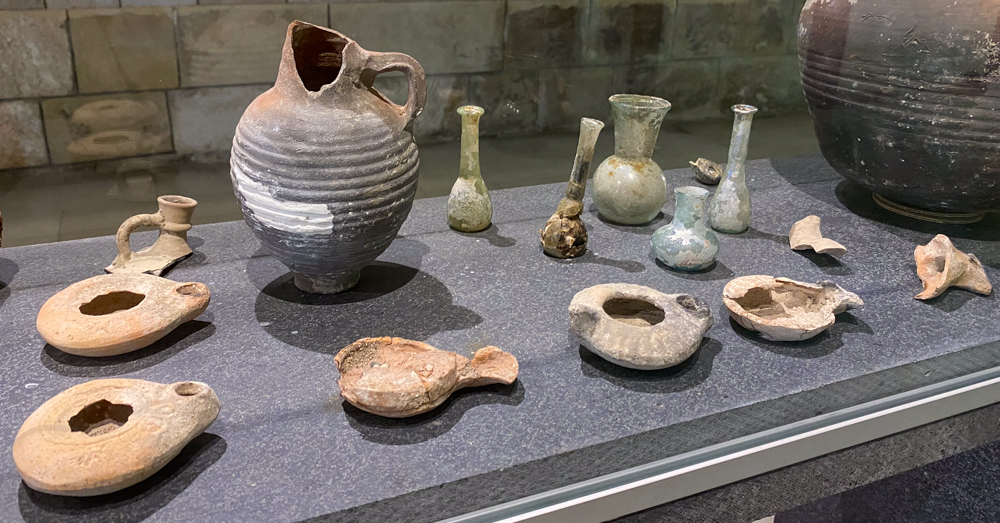
A museum attached to the caves contains artifacts uncovered at the site, including the ones above dating to the Herodian-Roman period (40 BC to 325 AD).

View southwest: Annunciation Basilica (top left); Convent and school; Church of St. Joseph (lower right).
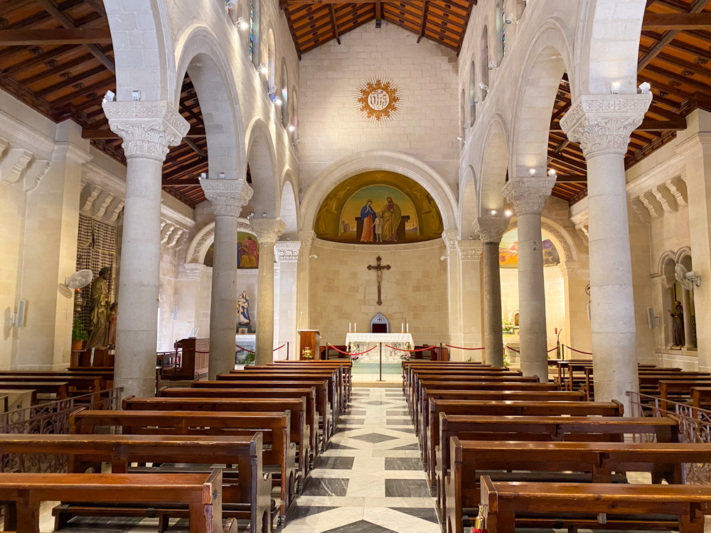
This photo shows the three apses of the Church from the inside. Between the Basilica of the Annunciation and the Church of St. Joseph is the Franciscan convent and the school run by the convent (above).

Early Nazarenes used the caves, granaries, and wells below the chapel (pictured here).

View east: The top of Mt. Precipice (center), where there’s a beautiful view of the Jezreel valley to the east, south, and west. You can just make out the mountains of Jordan at the top of the photo below the clouds, where the tribe of Reuben had its inheritance.
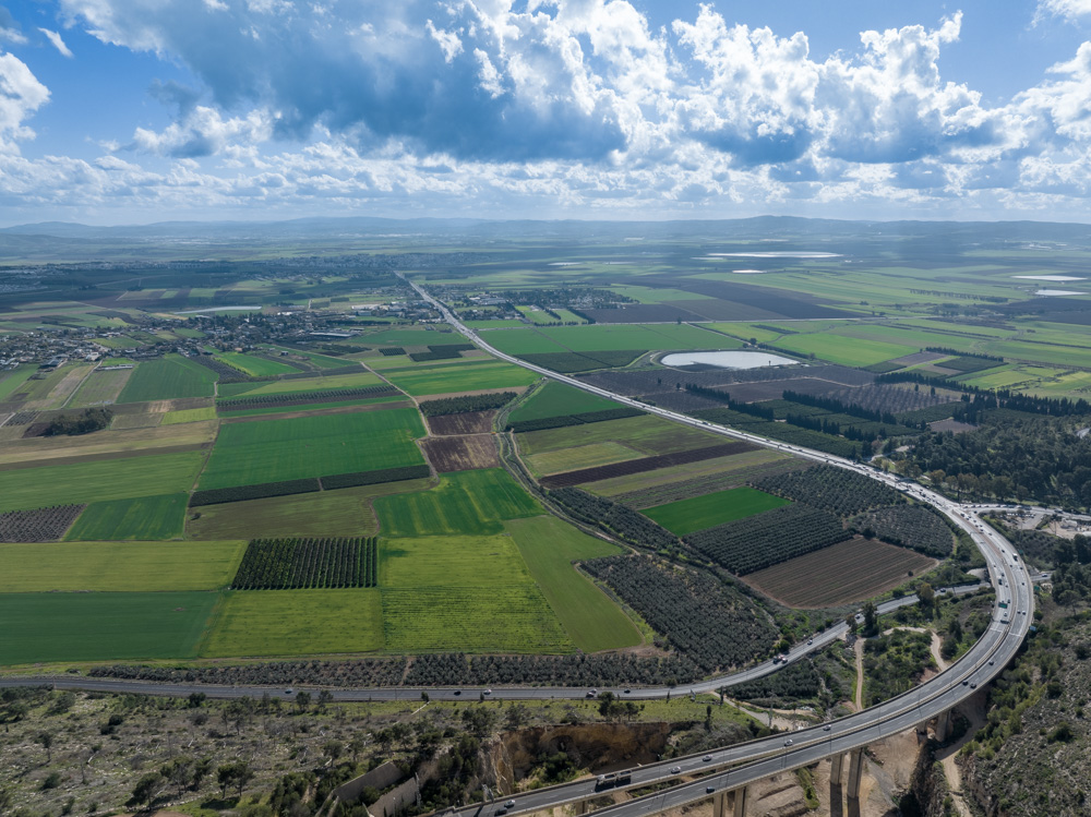
View south: This photo was taken above Mt. Precipice, looking Across the Jezreel valley to Megiddo and other biblical sites. Megiddo’s transliterated Greek name, Armageddon (“Mountain of Megiddo” in Hebrew). refers to the final great conflict before Christ’s Second coming (see Zech. 12:11, Rev. 16:14–21).

View north: This photo of modern Nazareth was taken from above Mt. Precipice, showing that ancient Nazareth rested in a basin surrounded by mountains. The modern city has filled in the basin on every side as it continues to grow.

View southwest: This photo of the Jezreel Valley was taken west of Mt. Precipice (upper right), looking toward the mountains of biblical Samaria (top left) and Mt. Carmel (top right) in the direction of the Mediterranean Sea.

View northwest: Greek Orthodox Church of the Annunciation.

View north: Mary’s Well, Nazareth.
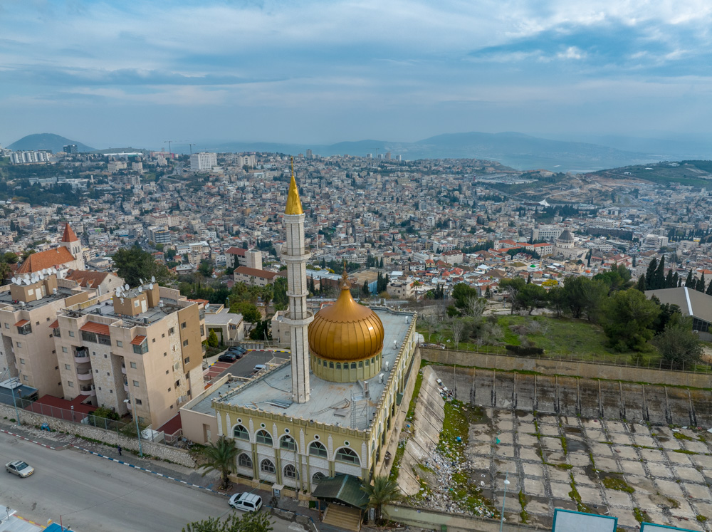
View south: Mt. Tabor (top left); The Hill of Moreh (top right); Nazareth Basin (center, left to right); Maqam al-Nabi Saeen mosque (bottom center).
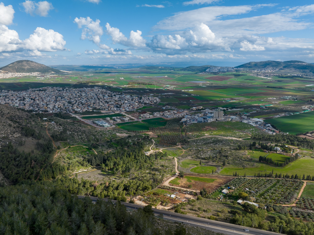
View east: This photo was taken above the southeastern edge of the Nazareth basin overlooking the Jezreel Valley. Mt. Tabor (top left), also called the Mount of Transfiguration (see Matt. 17:1–9), looks down on the Jezreel Valley (top center) and south to the Hill of Moreh and village of Nain (top right) where Jesus brought the Widow’s son back to life (see Luke 7:11–17).

View south: Mt. Precipice is the prominent hill (top center) below the clouds.

View north: This photo was taken from the northern edge of the Nazareth basin looking toward the Beit Netofa Valley and the ancient city of Sepphoris (upper left below the white buildings of Kefar Manda).

Nazareth Village shepherd.

Nazareth Village farmer.

Nazareth Village weaver.

Nazareth Village potter.

Nazareth Village harvest.

Nazareth Village olive press.

Nazareth Village (aerial View northwest): First-century Nazareth Village replica with a synagogue (top center), houses, and village shops. Because of rain, a Galilean synagogue would have been vaulted.

View west: A Nazareth Village watchtower and its farmer watching over his fields.