Photos and Maps • Photo Usage Policy • Back to Overview
Open chapter PDF to read or share (new tab)
Open chapter PDF (new tab, book format)
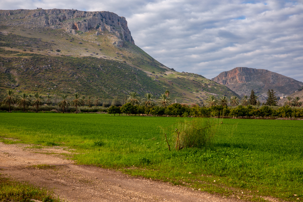
View west: Mt. Arbel (top left) and Mt. Nitai (center right) from the Plain of Gennesaret. Wadi Hamam, or valley of the doves, runs between the mountains.
You may download photos free of charge for non-commercial, educational purposes: home, church, synagogue, or school. You must, however, give proper attribution on or below each image to BibleLandImages.com.
If you’re using photos as part of a PowerPoint or other electronic presentation, it’s enough to mention the source of the photos at the beginning of your lecture.
The photos may not be used on other internet sites without permission.
You may download favorite chapters and sections or copy their URL links to share via email or in a messenger app. You may also post links on social media or a personal website.
By downloading a photo, chapter, or section you agree to this policy. If you have questions about it or need a commercial photo license, please contact me via email: Daniel@BibleLandImages.com.
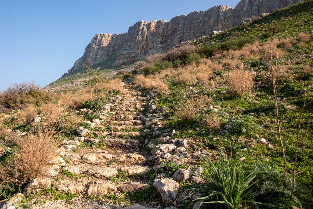
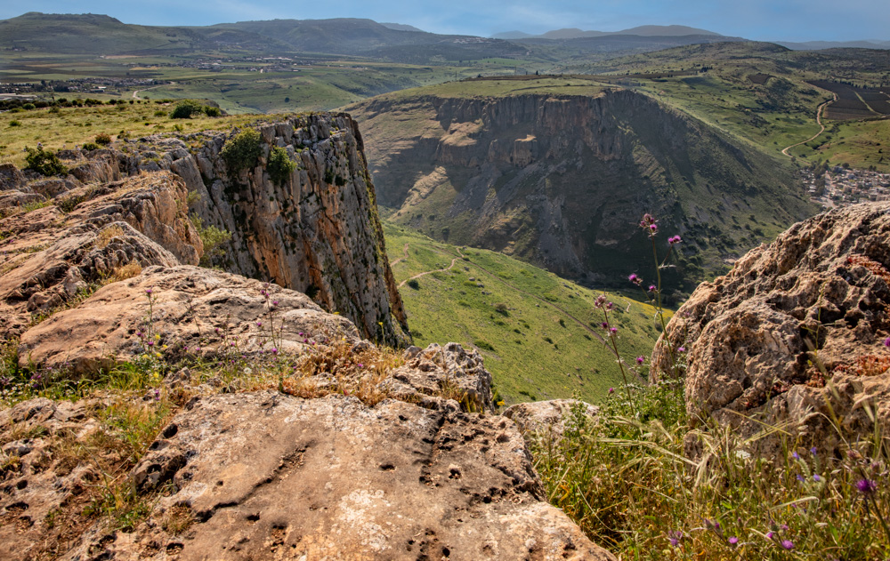
View southeast: The cave cliffs of Mt. Arbel from the trail that ascends to the top. Scaling the cliffs today is possible with the help of rebar ladders embedded in the rock.
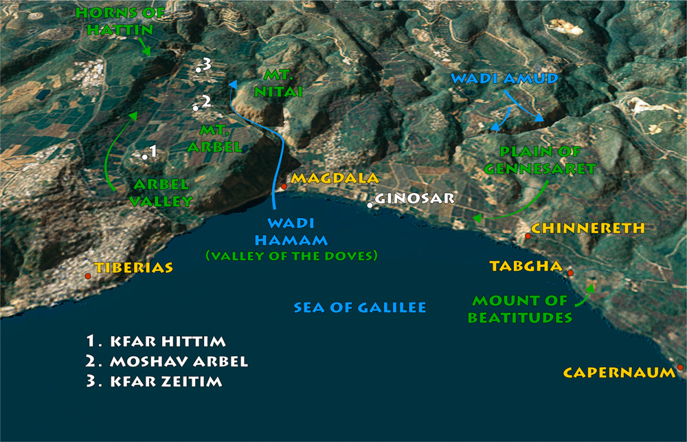
View west: The northwestern shore of the Sea of Galilee. Notice the traditional location of the Mount of Beatitudes between Tabgha and Capernaum. See also “Horns of Hattin” on page 195.
View west: Mt. Arbel (top left) and Mt. Nitai (center right) from the Plain of Gennesaret. Wadi Hamam, or valley of the doves, runs between the mountains.
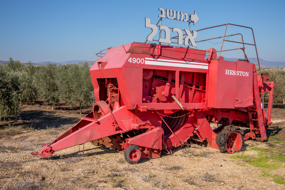
View north: The sign reads “Moshav Arbel” in Hebrew. The retired machine stands in front of an olive tree orchard that belongs to the farmers of the Moshav.
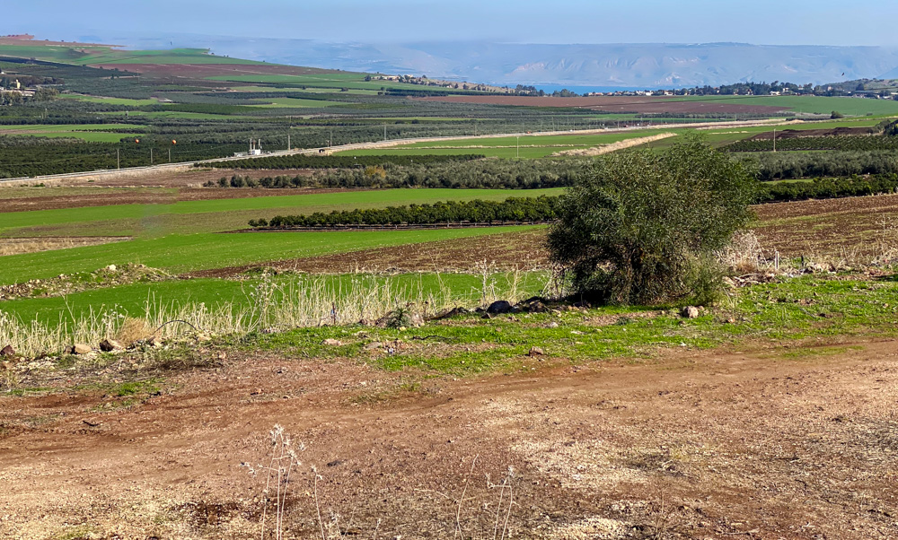
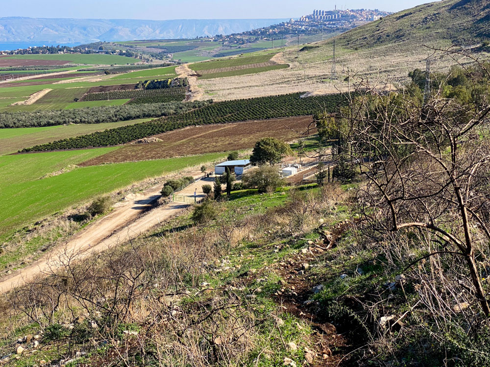
View east: The Arbel Valley, looking toward the Sea of Galilee and Golan heights (top center). The photo was taken from the east side of the Horns of Hattin (see the bottom photo on page 179).
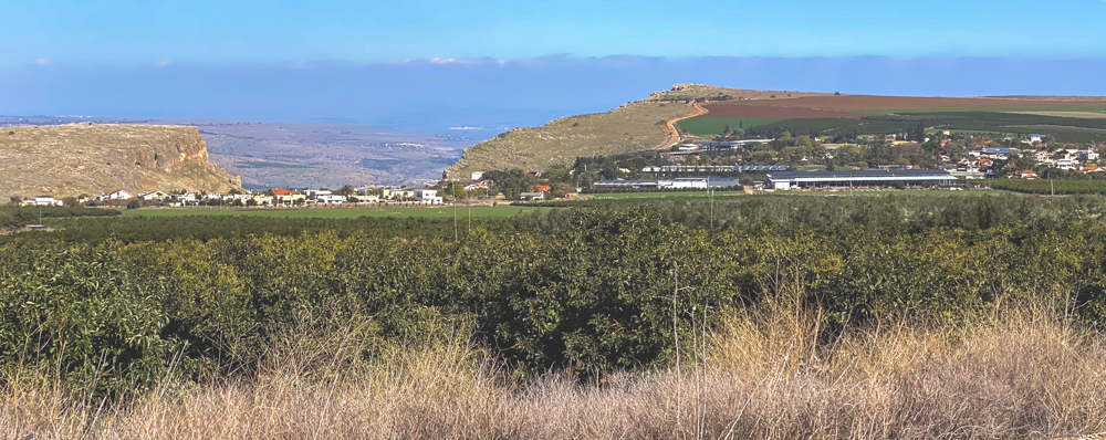
View east: The Arbel Valley with Moshav Arbel at the foot of the mountain (center). On the left is Mt. Nitai. On the right is Mt. Arbel with its cliff peak (top right). Wadi Hamam runs between them.
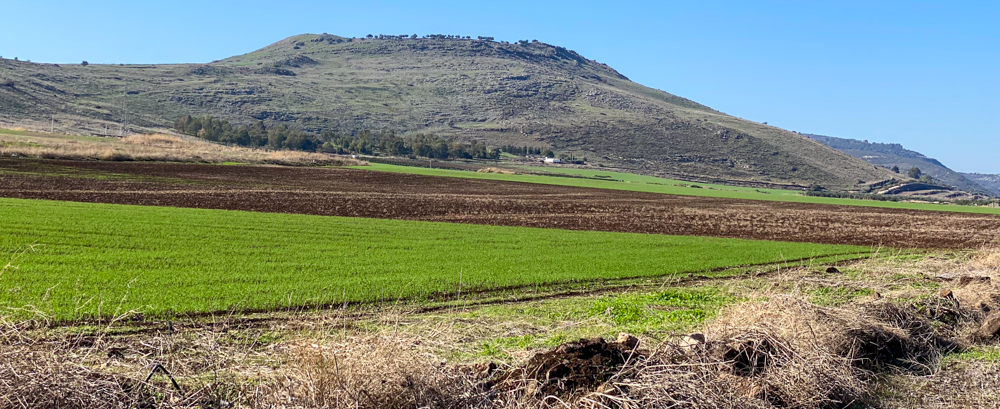
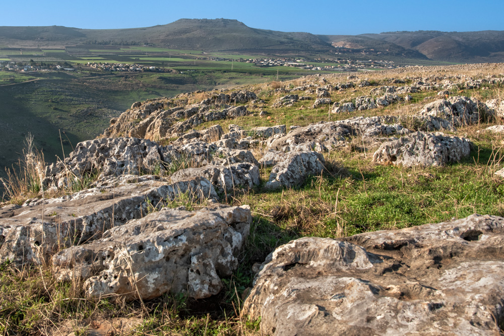
View west: The Arbel Valley below the Horns of Hattin. The climb is steep but possible following animal trails. The view of the valley makes the effort worth it (see bottom photo on page 181).
View northwest: This photo was taken from atop Mt. Arbel, looking across Wadi Hamam to Mt. Nitai (center) and the mountains of Lower Galilee (top).
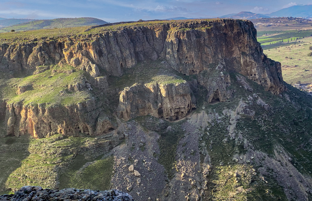
View Northwest: The caves of Mt. Nitai (center) were also fortified and used by the Jews in their battle against Roman rule in the First Jewish-Roman War (66–74 AD).
View west: This photo was taken from the top of Mt. Nitai, looking toward the Horns of Hattin (top center), where Saladin defeated the Crusaders in 1187 AD (See “Horns of Hattin” on page 195).
View East: The east side of the Horns of Hattin with an animal trail (bottom), which leads to the top. Notice the sea of Galilee, The Decapolis city of Sussita, and the Golan Heights (top left).
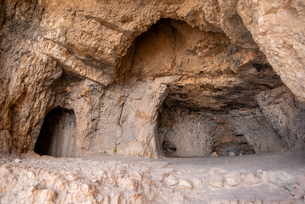
Some of the many caves on the side of Mt. Arbel, used by the Jews in their struggle for independence during the years leading up to the New Testament period.
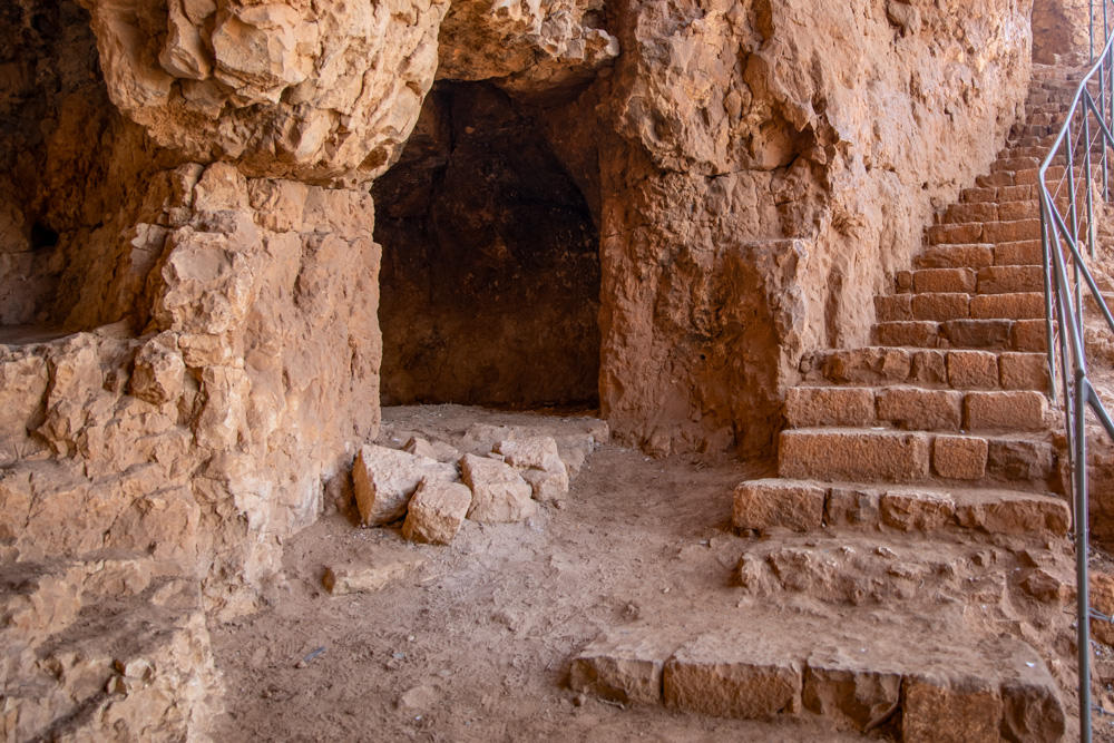
Cave on the side of Mt. Arbel
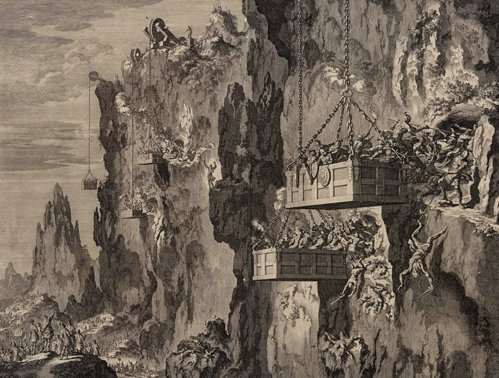
View southeast: Etching by Jan Luiken, 1649–1712. Herod the Great defeated the rebels hiding in the rock cliffs of Mt. Arbel by lowering Roman soldiers in suspended chests.
View northeast: This photo was taken above the Horns of Hattin, looking toward Mt. Nitai (Upper left), Mt. Arbel and Moshav Arbel (upper center), the Sea of Galilee, and the Arbel Valley (center).
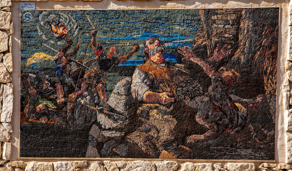
A wall scene displayed in the park depicting the battle of the Jews against Herod the Great. a father slew his seven sons and his wife, then took his own life rather than surrender to Herod.