Photos and Maps • Photo Usage Policy • Back to Overview
Open chapter PDF to read or share (new tab)
Open chapter PDF (new tab, book format)
View east: The Horns of Hattin (center) with Mt. Nitai (top left), Mt. Arbel (top center), and the Sea of Galilee (top right). The battle between Saladin and the Crusaders took place in the field (bottom).
You may download photos free of charge for non-commercial, educational purposes: home, church, synagogue, or school. You must, however, give proper attribution on or below each image to BibleLandImages.com.
If you’re using photos as part of a PowerPoint or other electronic presentation, it’s enough to mention the source of the photos at the beginning of your lecture.
The photos may not be used on other internet sites without permission.
You may download favorite chapters and sections or copy their URL links to share via email or in a messenger app. You may also post links on social media or a personal website.
By downloading a photo, chapter, or section you agree to this policy. If you have questions about it or need a commercial photo license, please contact me via email: Daniel@BibleLandImages.com.
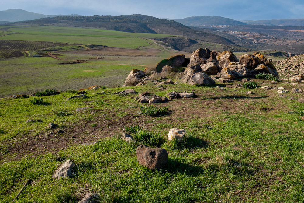
View northwest: The battlefield where Saladin defeated the Crusaders in 1187 AD. This photo was taken from the southwest side of the Horns of Hattin, looking down on the battlefield (See below).
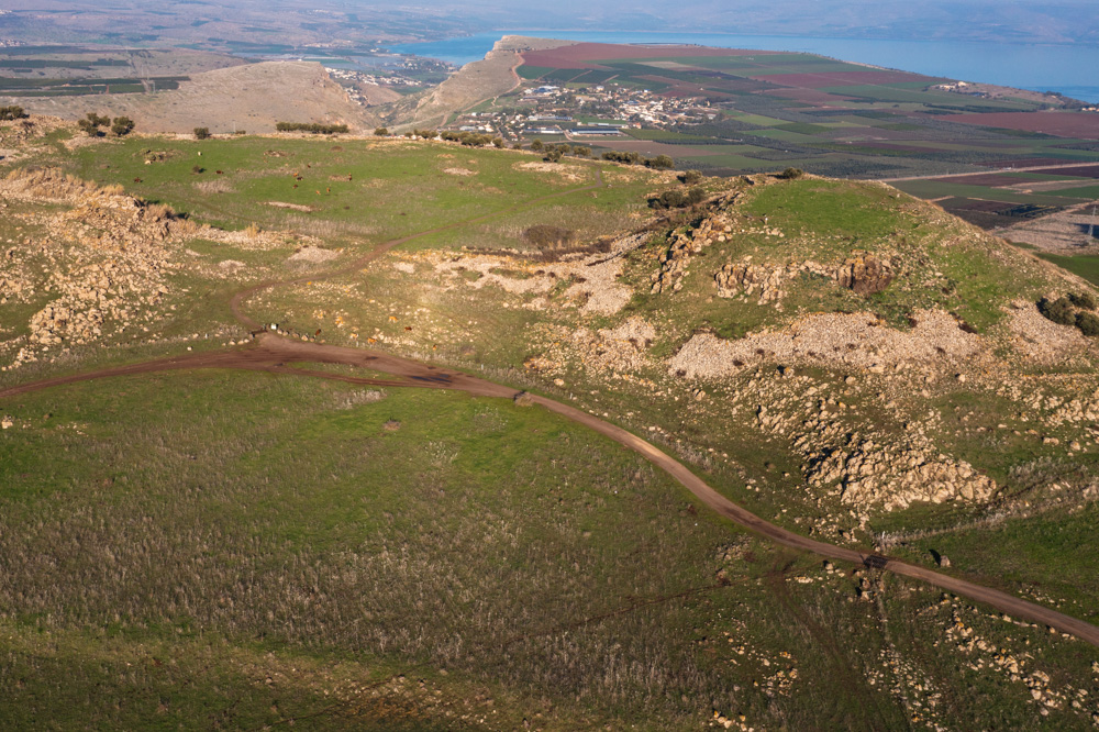
View east: The Horns of Hattin (center) with Mt. Nitai (top left), Mt. Arbel (top center), and the Sea of Galilee (top right). The battle between Saladin and the Crusaders took place in the field (bottom).
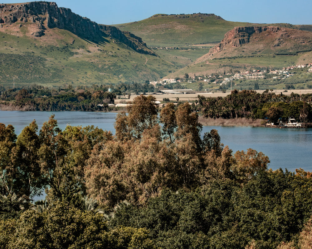
View west: The horns of Hattin (top center) from above Tabgha (see “Tabgha” on page 223). Mt. Arbel (top left), Mt. Nitai (upper right), the Plain of Gennesaret (center), and the Sea of Galilee are also visible.
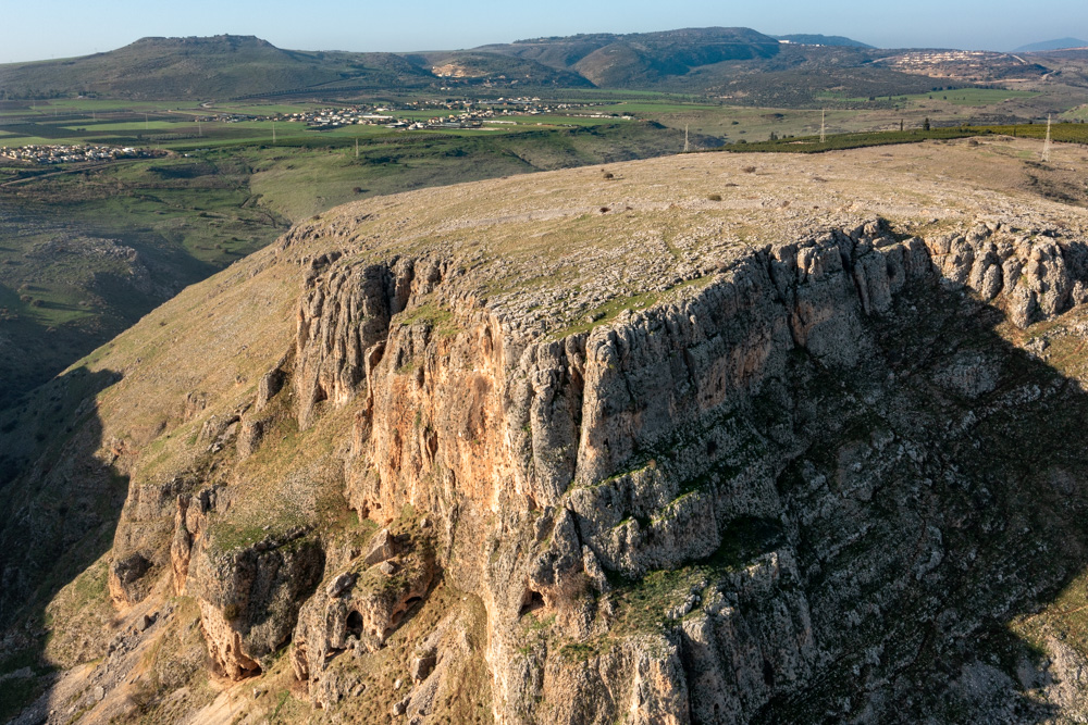
View west: Mt. Nitai looking toward the Horns of Hattin (top left) and the mountains of Lower Galilee. Mt. Nitai slopes south and west toward Wadi Hamam.
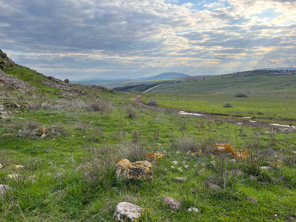
View south: This photo was taken from the field where Saladin defeated the Crusader forces in 1187 AD. you can also see the rounded shape of mt. Tabor (center; see “Mt. Tabor” in Blessed Pilgrimage, vol. 2).
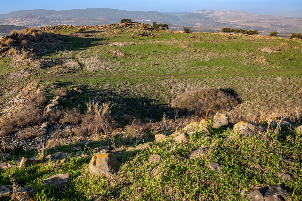
View northeast: The northern peak of Hattin, viewed from the southern peak. For perspective, you can also see Safed (top right; see “safed (zefat)” on page 77).
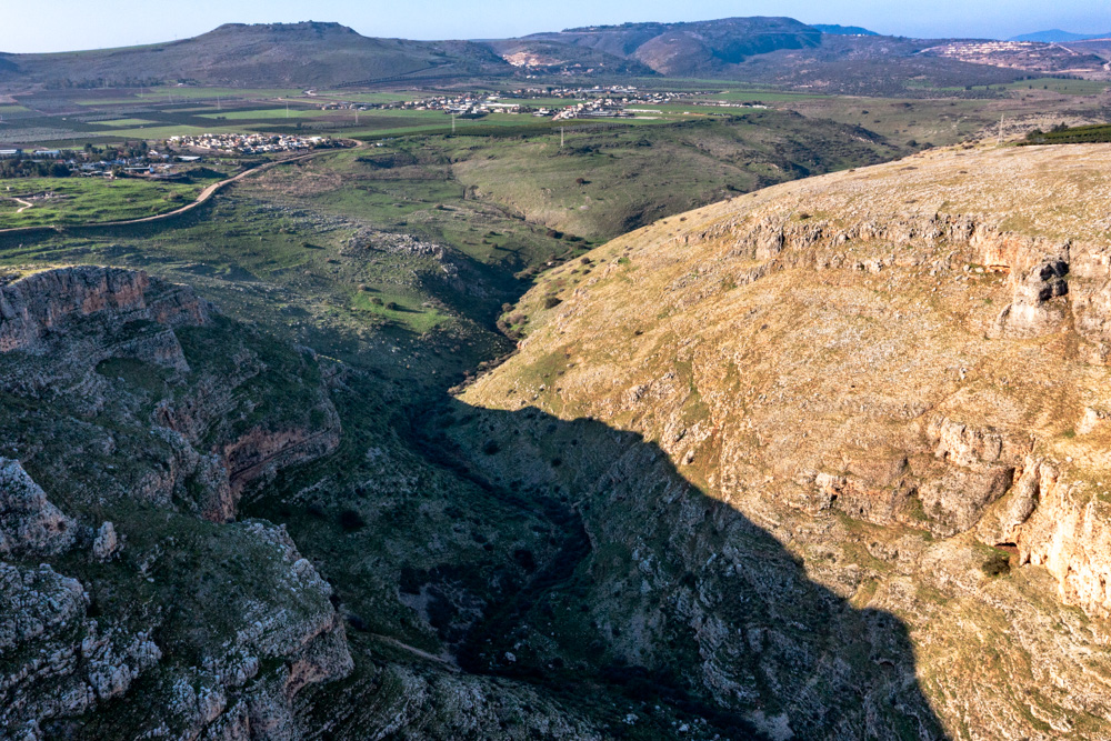
View west: Wadi Hamam below the western ends of Mt. Arbel (bottom left) and Mt. Nitai (bottom right). The horns of Hattin appear in the distance (top left) with the Arbel Valley below them (center).
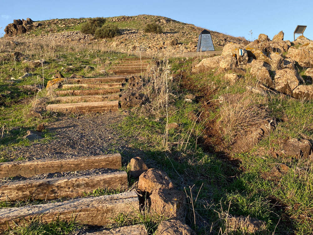
View north: The southern slope of The Horns of Hattin is another place where some Christians believe Jesus gave the Sermon on the Mount (Matt. 5–7; see the photo on page 201).
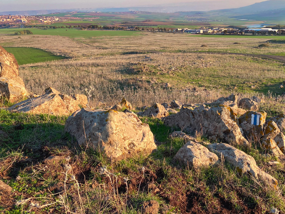
View south: This photo was taken from the top of the wooden stairs (above photo) leading up the hill. It looks down on the field where people may have sat during Christ’s Sermon on the Mount.
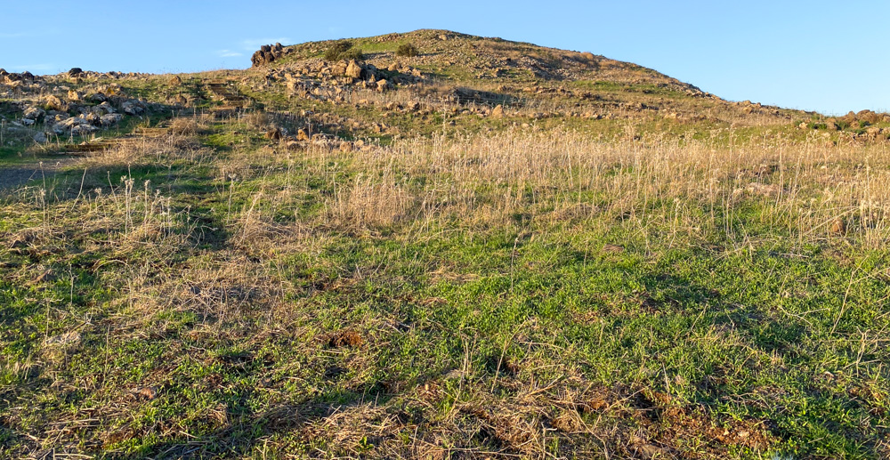
View north: Mount of Beatitudes at The Horns of Hattin. The other traditional Mount of Beatitudes site is above Tabgha on the northern shore of the Sea of Galilee (see “Mount of Beatitudes” on page 229).