The Nabateans were an ancient Arab people. Their capital city was Petra in present-day Jordan. Mamshit is a Nabatean city dating from the fourth century BC, located in the eastern Negev desert of Israel, 3.9 miles (6.25 kilometers) east of Dimona. It was a crucial stop on the Incense Road that linked Southern Arabia through Eilat on the Red Sea to the Mediterranean ports and Jerusalem, facilitating the trade of goods like frankincense and myrrh. The Nabateans didn’t build a permanent settlement at Mampshit until the middle of the Nabatean period (mid-first century AD). Most of the structures you see today represent grand private dwellings built in the late Nabatean period (second century AD) after Rome annexed the Nabatean kingdom in 106 AD.
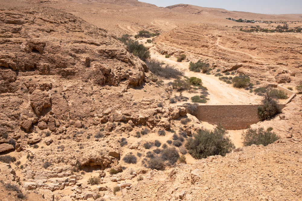
The dams on Wadi Mamshit are a witness to the Nabateans’ exceptional water management skills and their ability to prosper in a harsh desert environment. They harvested the water that ran down the wadi, channeling it into cisterns and reservoirs for use throughout the year (see the fifth photo below).
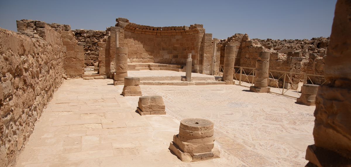
The eastern church of Mampshit is called the “Church of the Martyrs” because it housed the remains of saints and martyrs in reliquary chests (containers used to hold sacred relics, including body parts) in rooms on either side of the apse. Their purpose was to connect contemporary Christians with the heroic, persecuted past of the Christian church.


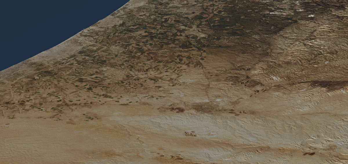
The desert area on the hike between Dimona and Mamshit, visible between the two hills (top right).
Dimona is visible in the distance (top center). This photo of the Negev was taken from the lookout tower of Mampshit.
The gate of the city consists of two towers and a passage. When it was built (late Roman period or third century AD), the city was surrounded by a 3,000 foot-long wall (900 meters). The gate appears on the sixth-century AD Madaba Map mosaic, attesting to the city’s importance.
One of three ancient dams on Wadi Mamshit, built to control the water from flash floods in the Negev.
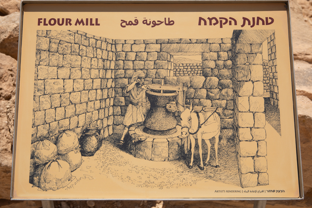
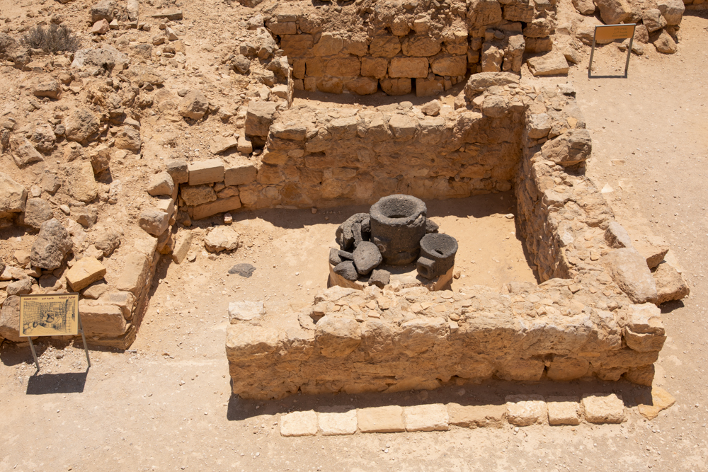
The remains of a flour mill as seen from the lookout tower. There are two complete upper millstones along with millstone fragments (see millstone depiction in previous photo). The millstone bases are missing.
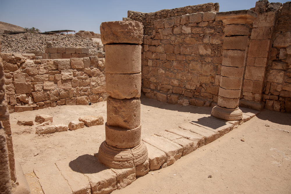
The reception hall of the “Nabatu house” with columns that once supported a second floor. It was the largest house in the city, with an area of 21,500 square feet (2,000 square meters).
This Byzantine bathhouse contained three rooms: a hot room, a tepid room (pictured here), and a dressing and furnace room.
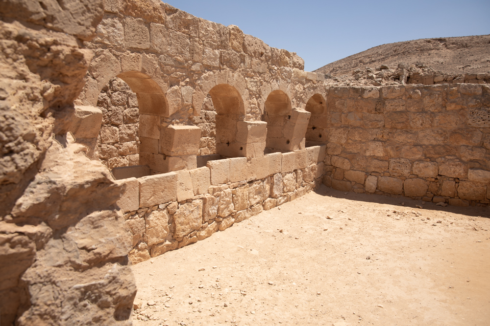
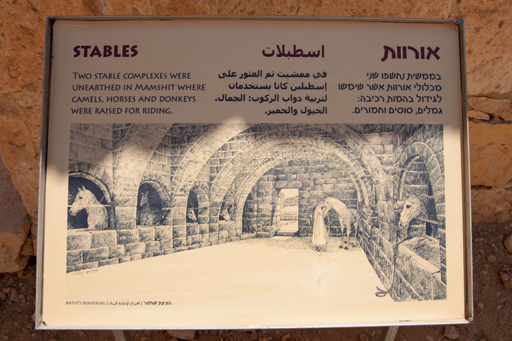
The north side of of the grand stable (see artist’s depiction in the next photo), evidence of the owner’s wealth.
Depiction of the grand stable in the “Nabatu house,” so named because of its many Nabatean features. The remains of the stable are pictured before and after this photo.
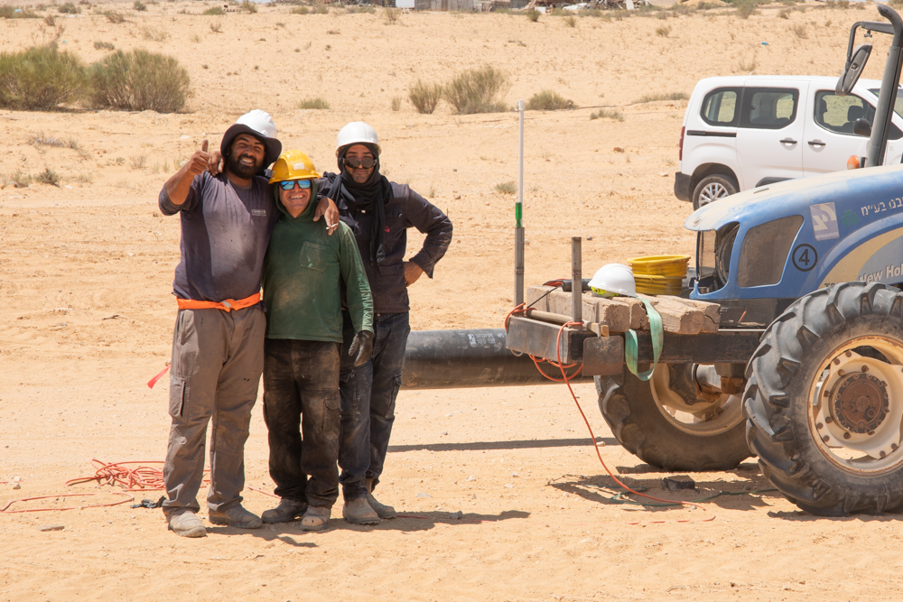
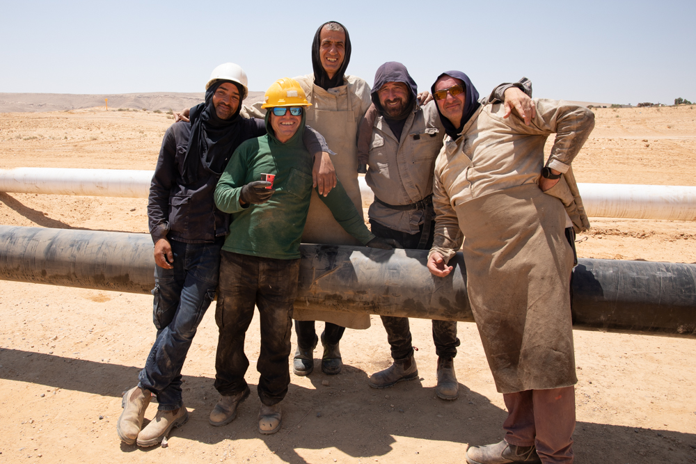
Yesterday I went to the Nabataean site of Mampsis in Israel's Negev desert. Since the bus driver to Eilat wouldn't let me board without paying the full price to Eilat (I was getting off at Dimona), I took the train to Beersheba and then a bus to Dimona. From there, I hiked across the desert to Mampsis (3.9 miles/6.25 kilometers). Last time I posted, I wrote a little bit about why I hike. Today, I hiked to experience the land of Abraham, Isaac, and Jacob. However, something unanticipated occurred, which is not uncommon, and another reason for hiking. It's when I get to interact up close with local folks. I came across a crew of men welding large pipes together.
I don't know what the pipes are for, but I assume they are for water. Walking along, I heard a shout. Three men got together, arms around shoulders, and motioned for me to take their picture. They must have seen me take photos of their operation. Well, I was about thirty yards away, so I ran down the hill to get a closer view. You can see the photos below. After I took a picture of the first group of men, another group, a little ways away, got together and asked for a picture. After the photo op, they all ran up with questions. What stood out then and now is how happy they were. They wanted to know where I was from, what I was doing, and so on. Did I need anything? Cold water? Coffee? We had a good time, and I made some new friends. As I turned to leave, their leader (the smaller man wearing a green sweatshirt) brought me a coffee. I thanked him profusely and pretended to drink it as I walked away.
As I write this, it doesn't seem like very much, but it made my day. If I hadn't been hiking, I would have missed the whole experience. I stopped on my way back from Mampsis and chatted with the foreman. He asked if I was a Jew. I told him I was not, and that I am a Christian. He got the biggest smile on his face, extended a very rough hand, and said, "So am I." It turns out he's from a town close to Nazareth, between Nazareth and Haifa. Mampsis was great. But this experience made the whole effort worth it. I sent copies of the photos (minus the coffee cup) to the tall man who gave me his email address. He said he'd distribute them among the group.


(Click map to toggle overlay)
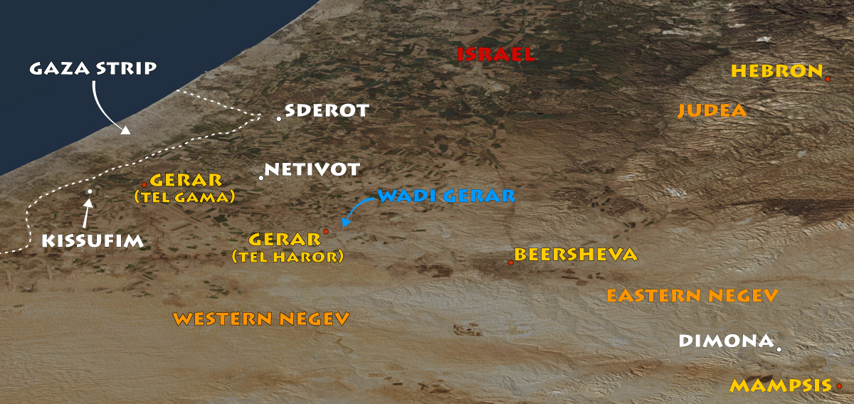
View north: Sderot and Netivot are two of the Israeli cities that Hamas terrorized on Oct. 7, 2023. I included them on the map because I mentioned them in my Facebook post on Gerar, which I visited yesterday (Aug. 7, 2025). I will use this same map with the Gerar web page when I put it up.
 I post updates to this website on my personal