Photos and Maps • Photo Usage Policy • Back to Overview
Open chapter PDF to read or share (new tab)
Open chapter PDF (new tab, book format)
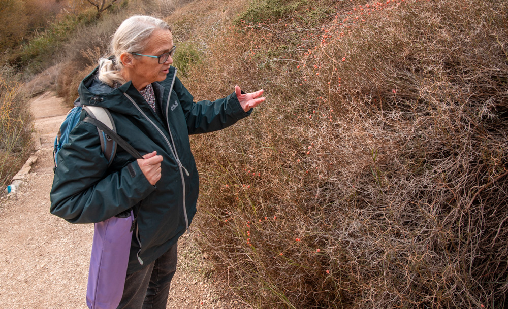
Ann Hansen on the Tanur Waterfall trail in northern Israel, explaining the spiny shrub called Christ’s Thorn, from which it’s traditionally believed The Romans made Jesus’s crown of thorns.
You may download photos free of charge for non-commercial, educational purposes: home, church, synagogue, or school. You must, however, give proper attribution on or below each image to BibleLandImages.com.
If you’re using photos as part of a PowerPoint or other electronic presentation, it’s enough to mention the source of the photos at the beginning of your lecture.
The photos may not be used on other internet sites without permission.
You may download favorite chapters and sections or copy their URL links to share via email or in a messenger app. You may also post links on social media or a personal website.
By downloading a photo, chapter, or section you agree to this policy. If you have questions about it or need a commercial photo license, please contact me via email: Daniel@BibleLandImages.com.
Ann Hansen on the Tanur Waterfall trail in northern Israel, explaining the spiny shrub called Christ’s Thorn, from which it’s traditionally believed The Romans made Jesus’s crown of thorns.
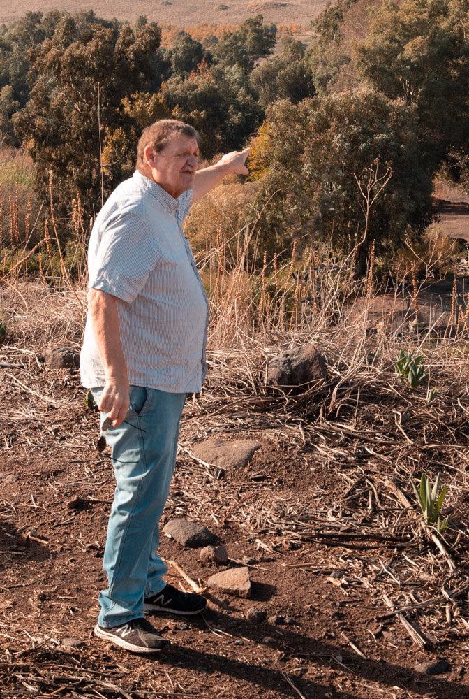
Michael Hansen explaining the background of the Knights Templar fortress of Ateret on the Upper Jordan River.
Mike is also the artist who made the drawings in Blessed Pilgrimage (see Appendix A).
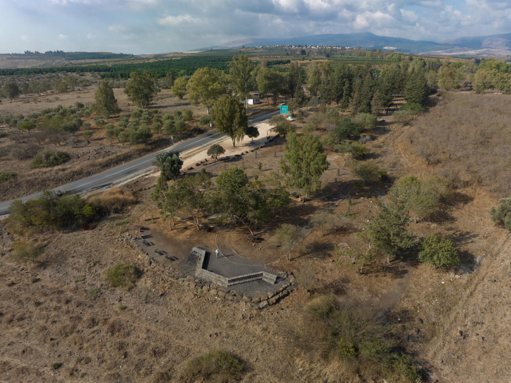
VIEW SOUTHWEST: OLD MISHMAR HAYARDEN WAS DECIMATED AND ABANDONED IN THE WAR OF INDEPENDENCE. THE MEMORIAL IN THE ABOVE PHOTO WAS BUILT ON THE SITE TO COMMEMORATE ITS ROLE IN THE WAR. THE CURRENT MISHMAR HAYARDEN, WHERE THE HANSENS LIVED, IS UPHILL TO THE WEST A COUPLE OF KILOMETERS. IT WAS ESTABLISHED IN THE 1950S AND POPULATED BY NEW IMMIGRANTS FROM MOROCCO AND IRAQ.
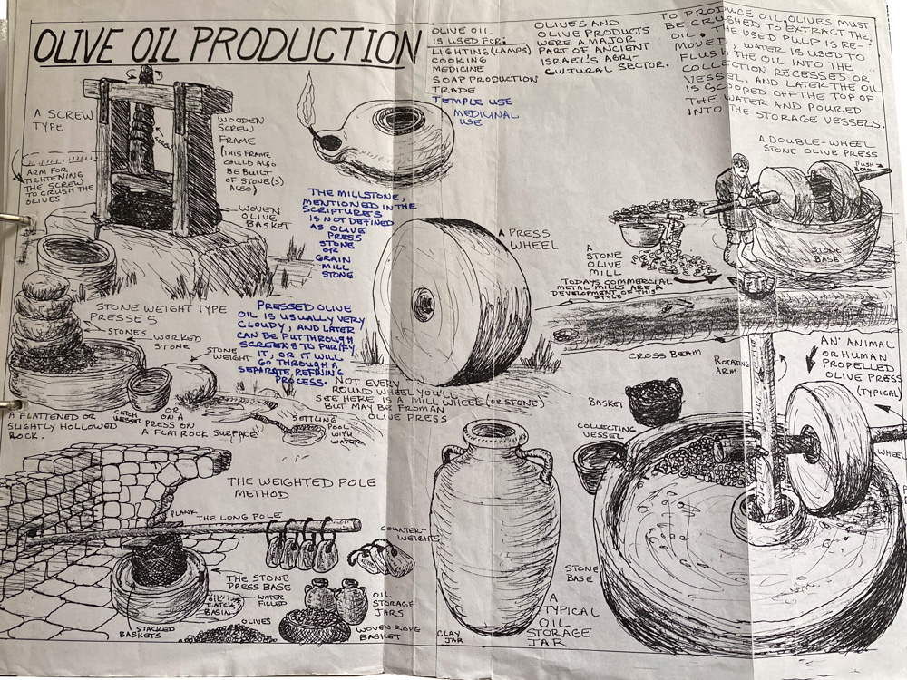
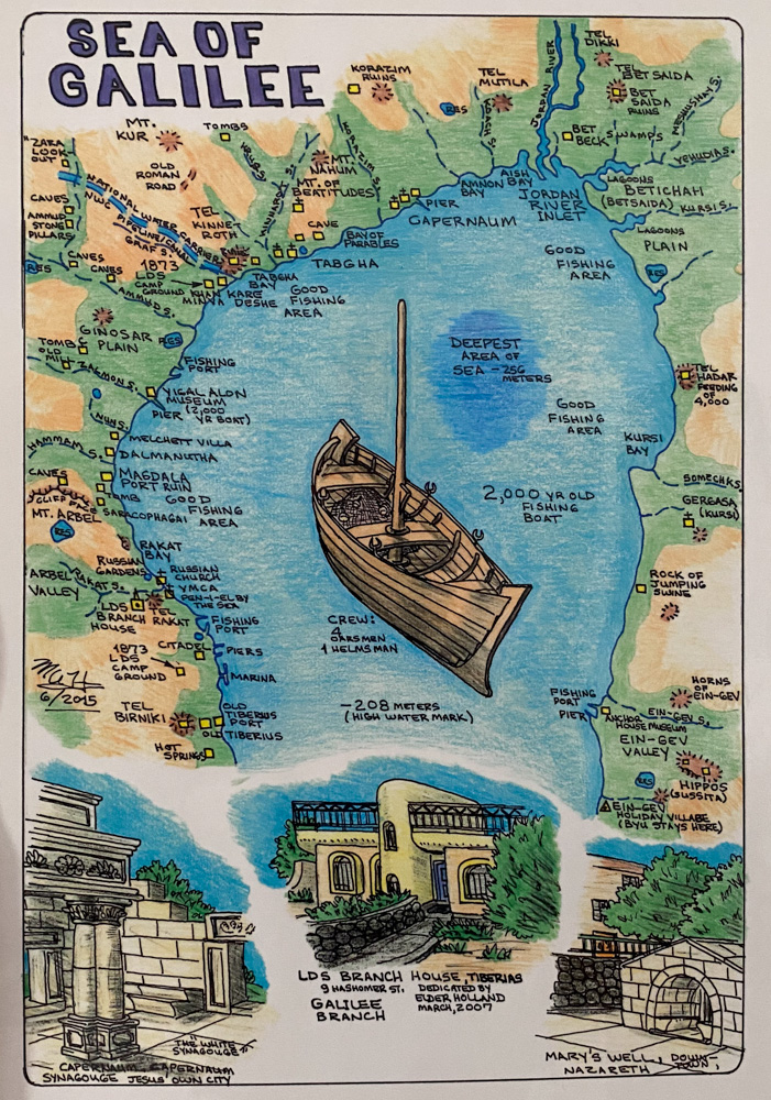
Page from Michael Hansen’s journal on olive oil production. For information on drawings, See “Michael A. Hansen—In Memoriam” on page 295.
VIEW NORTHEAST: TEL DAN (LEFT SIDE OF PHOTO) AT THE NORTHERN END OF THE UPPER JORDAN VALLEY BELOW MT. HERMON. THE TEL COVERS EVERYTHING IN THE PHOTO BELOW THE MOUNTAIN AND LEFT OF THE ORCHARD.
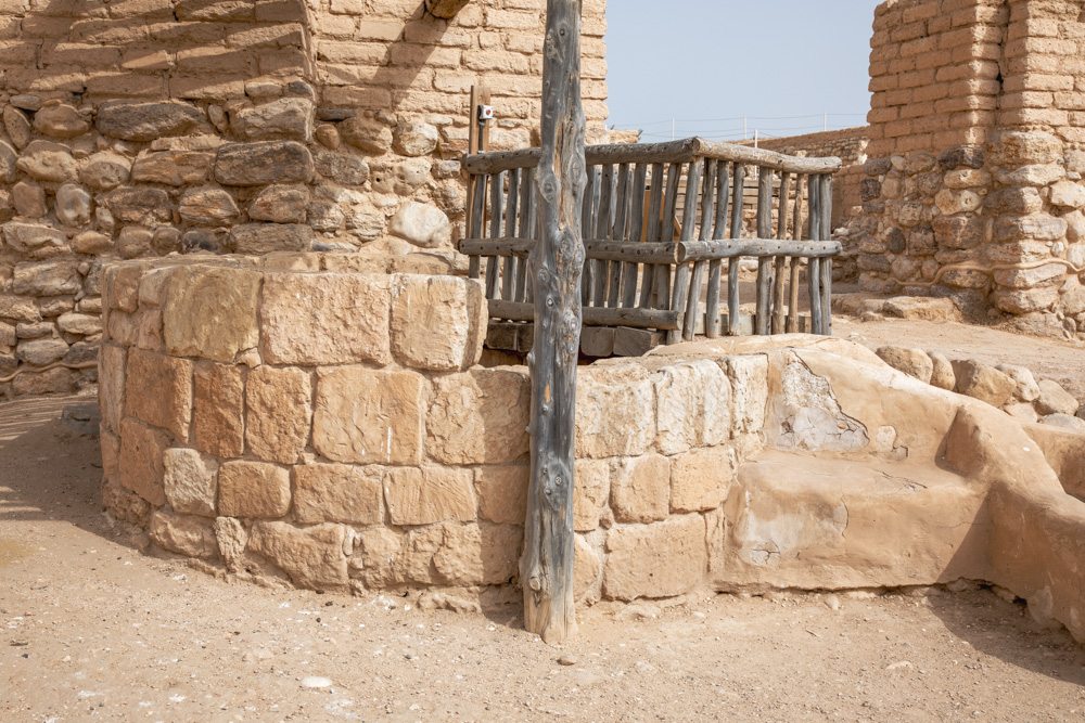
VIEW NORTH: WELL AT TEL BEERSHEBA IN ISRAEL’S NEGEV REGION, 27 MILES (43 KILOMETERS) SOUTH OF HEBRON. ABRAHAM AND HIS SON ISAAC DUG SEVEN WELLS BETWEEN BEERSHEBA AND GERAR TO THE WEST (GEN. 26:18–22).
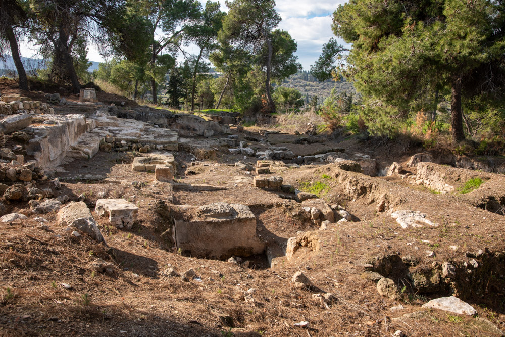
VIEW SOUTH: EXCAVATIONS AT SEPPHORIS. ANN TOOK HER OLDER CHILDREN ON ARCHAEOLOGICAL DIGS AT SEPPHORIS, WHERE THEY LEARNED TO LOVE THE LAND SIFTING THROUGH THE PHYSICAL REMAINS OF ISRAEL’S ANCIENT PEOPLE.
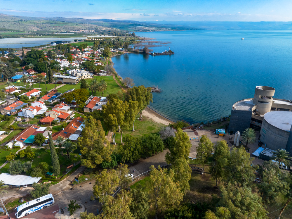
VIEW NORTH: KIBBUTZ GINOSAR ON THE NORTHWEST SHORE OF THE SEA OF GALILEE, WITH THE YIGAL ALLON CENTER (RIGHT). THE FIRST-CENTURY AD GALILEE BOAT WAS DISCOVERED HERE.
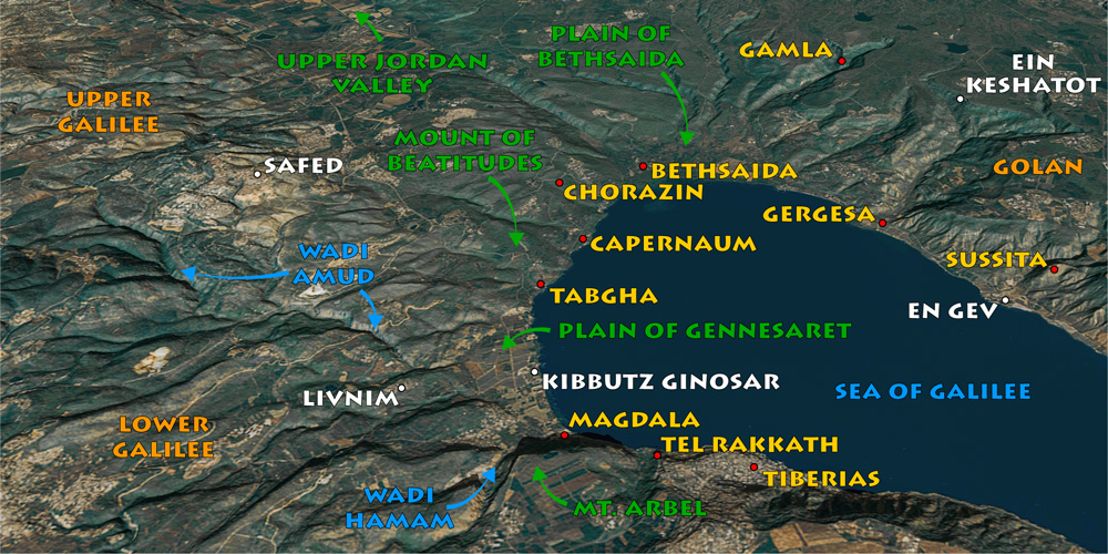
View northeast: Michael and Ann raised their family in Livnim, where they lived for twenty years. From there they took their weekend hikes and excursions all over Galilee and the rest of the Holy land.
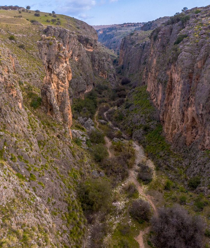
VIEW NORTH: TRAIL THROUGH WADI AMUD CANYON. THIS PHOTO WAS TAKEN HALF A MILE (ALMOST A KILOMETER) NORTHEAST OF LIVNIM, WHERE THE HANSENS LIVED OVERLOOKING THE SEA OF GALILEE.