Photos and Maps • Photo Usage Policy • Back to Overview
Open chapter PDF to read or share (new tab)
Open chapter PDF (new tab, book format)
View west: the northern wall and breach below the synagogue (bottom left; see detail photo on page 280). Also visible is the Sea of Galilee (upper right).
You may download photos free of charge for non-commercial, educational purposes: home, church, synagogue, or school. You must, however, give proper attribution on or below each image to BibleLandImages.com.
If you’re using photos as part of a PowerPoint or other electronic presentation, it’s enough to mention the source of the photos at the beginning of your lecture.
The photos may not be used on other internet sites without permission.
You may download favorite chapters and sections or copy their URL links to share via email or in a messenger app. You may also post links on social media or a personal website.
By downloading a photo, chapter, or section you agree to this policy. If you have questions about it or need a commercial photo license, please contact me via email: Daniel@BibleLandImages.com.
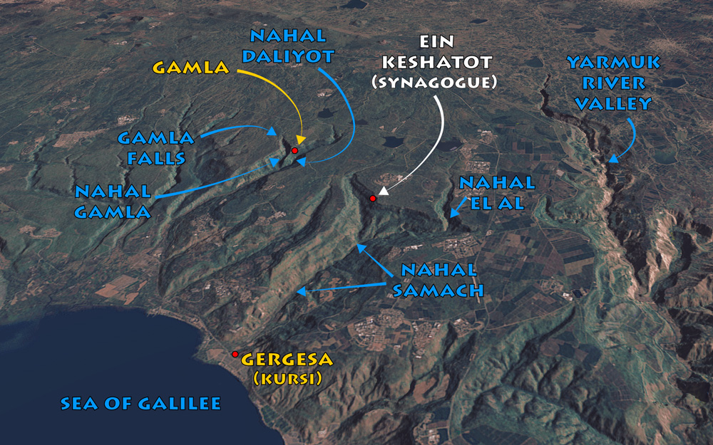
View northeast: Gamla context map. See “Nahal Samach” on page 271 and the synagogue of Ein Keshatot in chapter 4, “Ancient Synagogues,” on page 33.
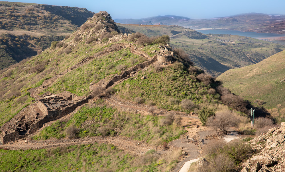
View west: the northern wall and breach below the synagogue (bottom left; see detail photo on page 280). Also visible is the Sea of Galilee (upper right).
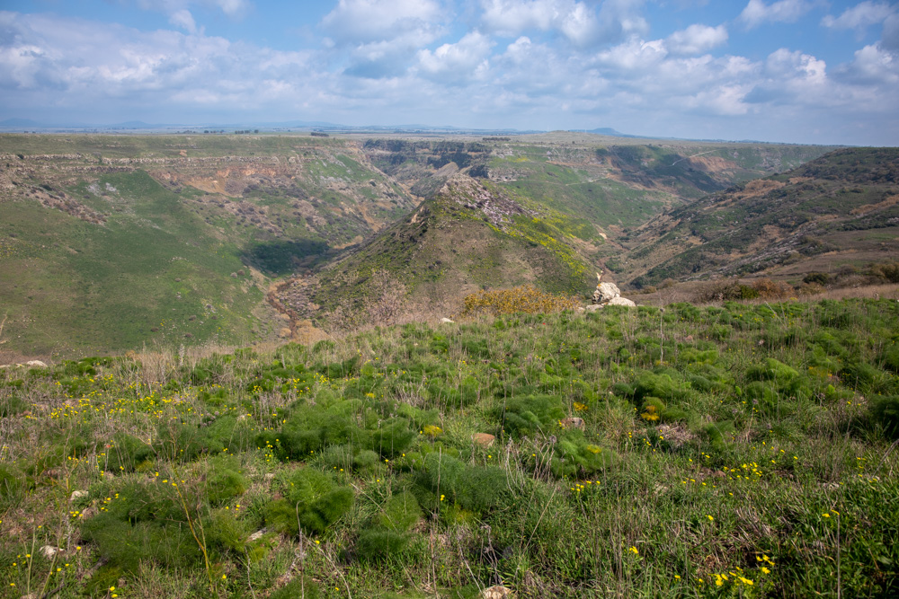
View east: The acropolis of the camel-shaped fortress of Gamla, showing the steep ravines on the north, south, and west sides. Compare with the map on page 274.
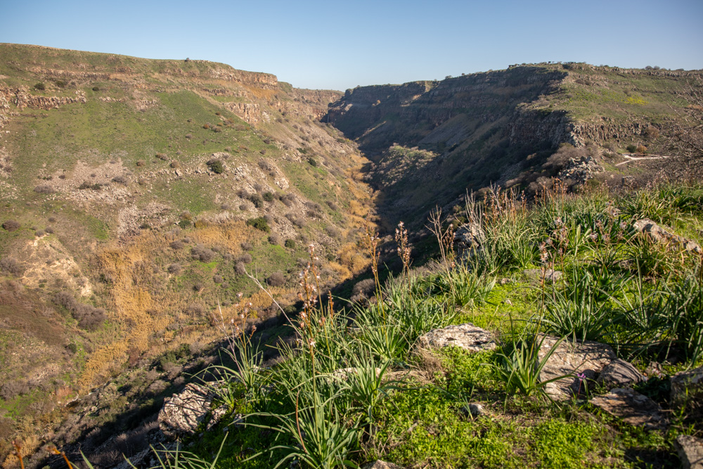
View east: Nahal Gamla forms the canyon below Gamla falls (see the map on page 274). This photo was taken standing on the north side of Gamla, overlooking the canyon.
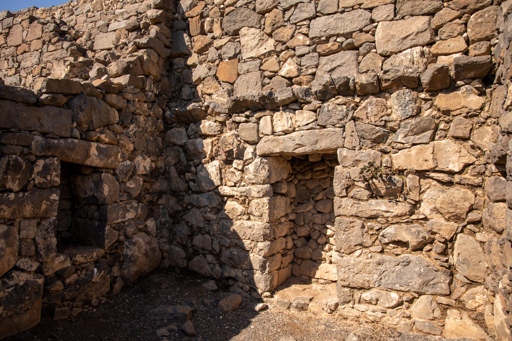
The stone corbel (horizontal beam) upheld the roof. The ceiling of this room was the floor of the building above it. The second-story buildings collapsed under the weight of the Roman soldiers.
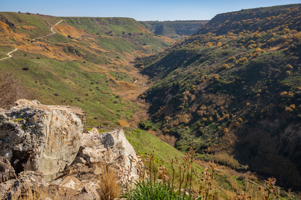
View east: Nahal Daliyot forms the canyon on the south side of Gamla. This photo was taken standing on the south side. At The head of the canyon is the popular Daliyot recreational camp.
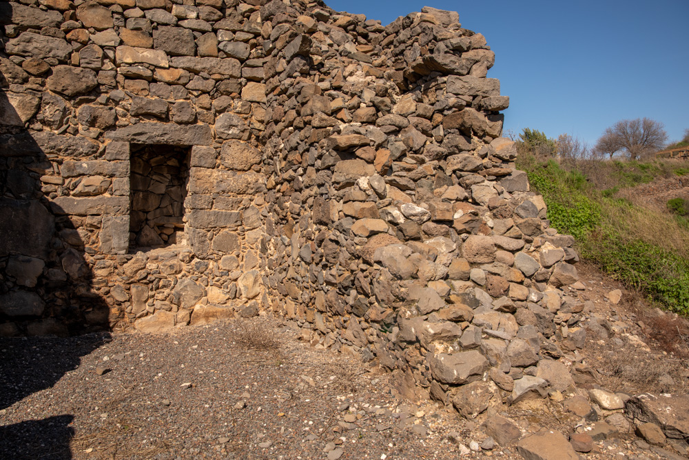
View Northeast: The Jews didn’t build walls around the city because of the steep ravines that protected it on three sides. They built the eastern wall (center right) by filling in gaps between houses (center left).
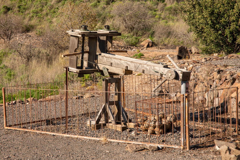
Ballista artillery engine used to hurl stone missiles. It had a maximum range of about 400 meters and fired missiles weighing from 1.8 pounds (800 grams) to many kilograms (1 KG = 2.2 lb).

View west: Detail of the breach in the defense wall of Gamla. The Romans breached the wall, then fought the Jewish defenders up the hill in hand-to-hand combat.
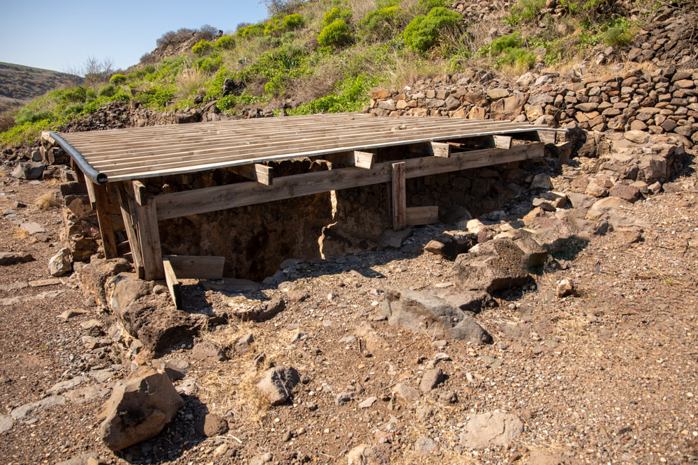
View west: Detail of covered Miqveh (Jewish ritual bath) located on the west side of the synagogue. See photo below.
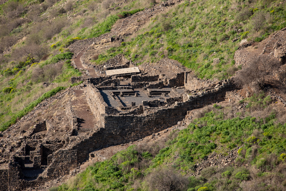
View west: The Gamla synagogue (center) with the eastern wall in front. Also pictured is one of three breaches in the wall (lower left) and a Miqveh (covered building, center—see above photo).
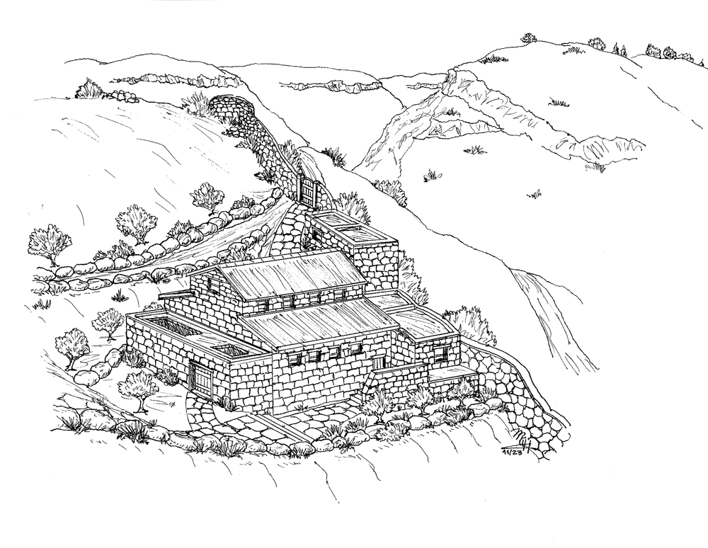
View Northeast: Michael Hansen’s conception of the Gamla Synagogue from above Nahal Daliyot (see photo on page 277), looking toward Nahal Gamla (top center; see top photo on page 276).

View Northeast: The interior of the first century AD Synagogue with three columns and side benches. The northwest corner contained an alcove for Torah scrolls.
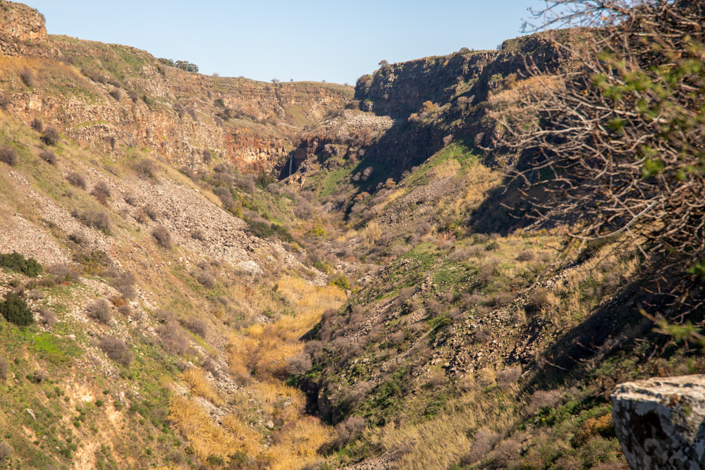
View East: Nahal Gamla with Gamla Falls at the head of the canyon (upper center in the shadows). The Gamla Falls are the highest in Israel (see below).
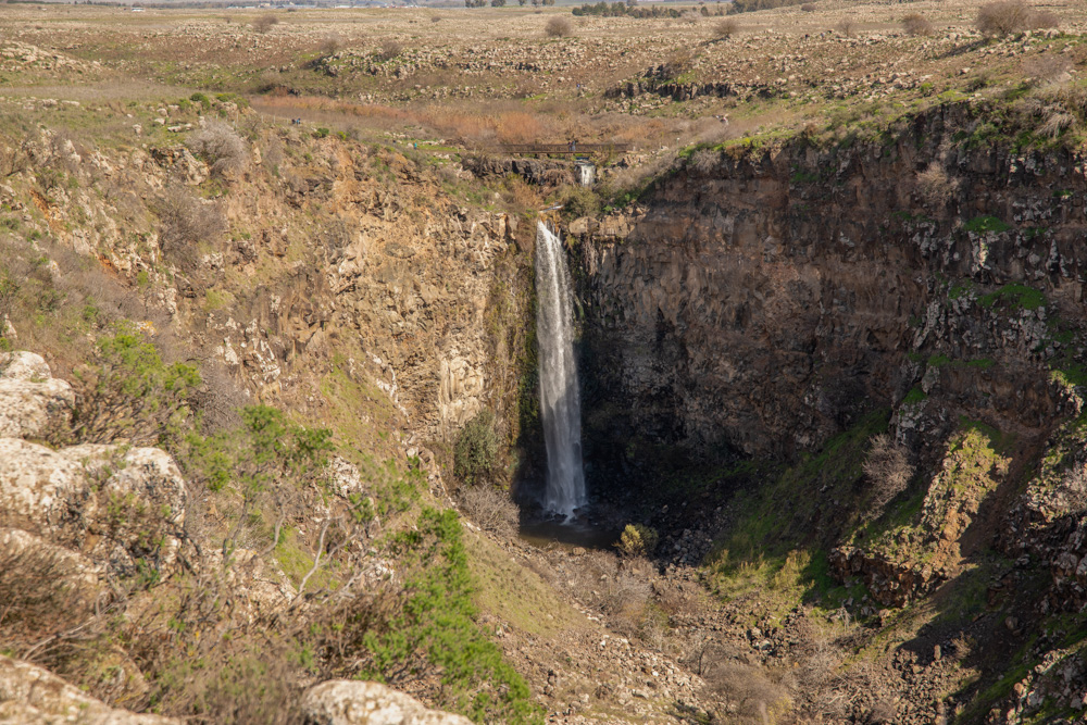
View east: Detail of Gamla Falls (see the map on page 274). You can hike to the Falls from the gamla Nature Reserve parking lot. This photo was taken on February 2, 2022.
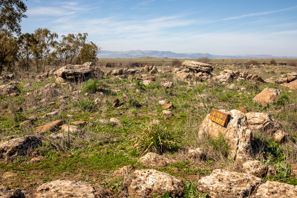
View west: The trail to Gamla falls takes you through this field of Dolmens, which were stone tables used for burial. You can also see the canyon edge of Nahal Gamla (upper center).