Photos and Maps • Photo Usage Policy • Back to Overview
Open chapter PDF to read or share (new tab)
Open chapter PDF (new tab, book format)
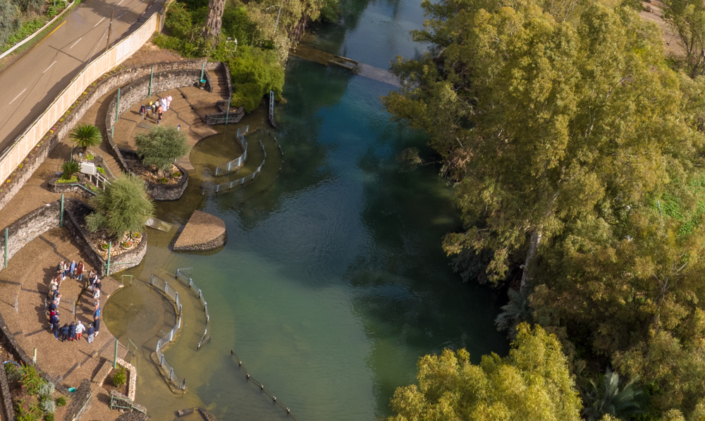
View east: Aerial photo of Yardenit with the Jordan River baptismal sites. I baptized my eight-year-old son here when we lived in Israel as a family forty years ago.
You may download photos free of charge for non-commercial, educational purposes: home, church, synagogue, or school. You must, however, give proper attribution on or below each image to BibleLandImages.com.
If you’re using photos as part of a PowerPoint or other electronic presentation, it’s enough to mention the source of the photos at the beginning of your lecture.
The photos may not be used on other internet sites without permission.
You may download favorite chapters and sections or copy their URL links to share via email or in a messenger app. You may also post links on social media or a personal website.
By downloading a photo, chapter, or section you agree to this policy. If you have questions about it or need a commercial photo license, please contact me via email: Daniel@BibleLandImages.com.

View north: This photo was taken from approximately the same place as the photo on page 21, with my handheld camera instead of my drone. Safed (Zefat) is also visible on top of the hill (top center).

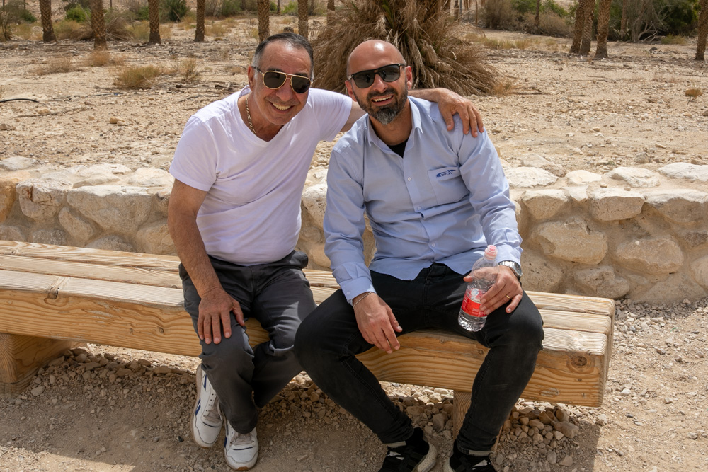
I met these happy bus drivers near the entrance to Nahal Arugot (Dead Sea region) after hiking over from Ein Gedi (see Blessed Pilgrimage, vol. 2). On tour, Take time to meet and talk with local people.

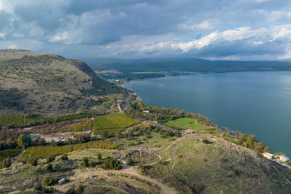
View north: This photo looks across Tel Rakkat and the Rakkat Valley toward the northern shore of the Sea of Galilee. halfway around the shore was the city of ancient Capernaum.

View east: The Jordan River near Yardenit (see “Yardenit Baptismal Site” on page 293 for an expanded view of the area).

View southeast: Tiberias and the Sea of Galilee. the central bus station is on the right side behind the dark building. the shortcut was through the field (bottom right).

View east: The southeastern shore of the Sea of Galilee. The start of the Yarmuk Canyon is also visible above the southern plain (top right).

View east: Aerial photo of Yardenit with the Jordan River baptismal sites. I baptized my eight-year-old son here when we lived in Israel as a family forty years ago.

View east: The Upper Jordan Valley from Upper Galilee during a break in the rain.

View southeast: The Upper Jordan valley with the Hula Nature Reserve (top right).

View east: Upper Galilee from the western cliffs overlooking the Upper Jordan Valley (covered by clouds). The photo was taken during the winter on January 31, 2023.

View south: This photo was taken a short distance from the one above. The orange, blue, and white trail marker identifies Israel’s National Trail between the southern and northern borders.

View west: This photo was taken the same day as the ones on page 26. I left the Upper Jordan Valley rim and walked to Alma, where I caught a bus to Safed and another to Haifa. this is the road I walked, moving toward the high mountains of Upper Galilee (see “Upper Galilee” on page 47).

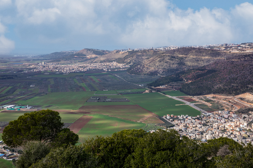
View west: The Jezreel Valley from Mt. Tabor looking toward Nazareth (top center) and Mt. Precipice with the trees on the north slope (top left).

View west: cabbage harvesting in a muddy Jezreel Valley. I took this picture walking from Mt. Tabor to Nain on the northern slope of the Hill of Moreh, a distance of about 6 miles (9.6 kilometers).

View east: The northern shore of the Sea of Galilee, looking toward Gamla and the Golan Heights. This photo was taken in the afternoon on a wet, rainy day.