Download Photos and Maps • Photo Usage Policy • Back to Overview
Open chapter PDF to read or share (new tab)
Open chapter PDF (new tab, book format)
View east: Cana of Galilee (Khirbet Qana) is at the end of the road (top center) that leads from Jotapata (see “Jotapata” on page 99). For the Cana of Galilee contour map, see page 111.

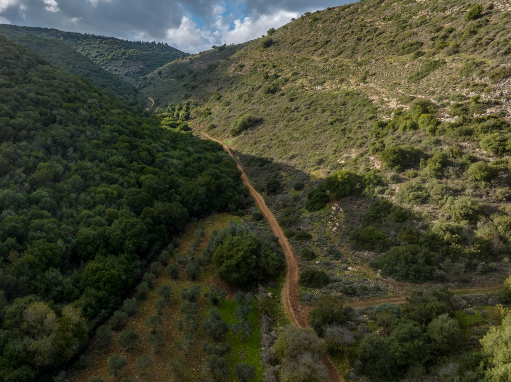
View west: The Road leading from Cana of Galilee to Jotapata (see photo below). The distance between the two cities is about 2 miles (3.2 kilometers).

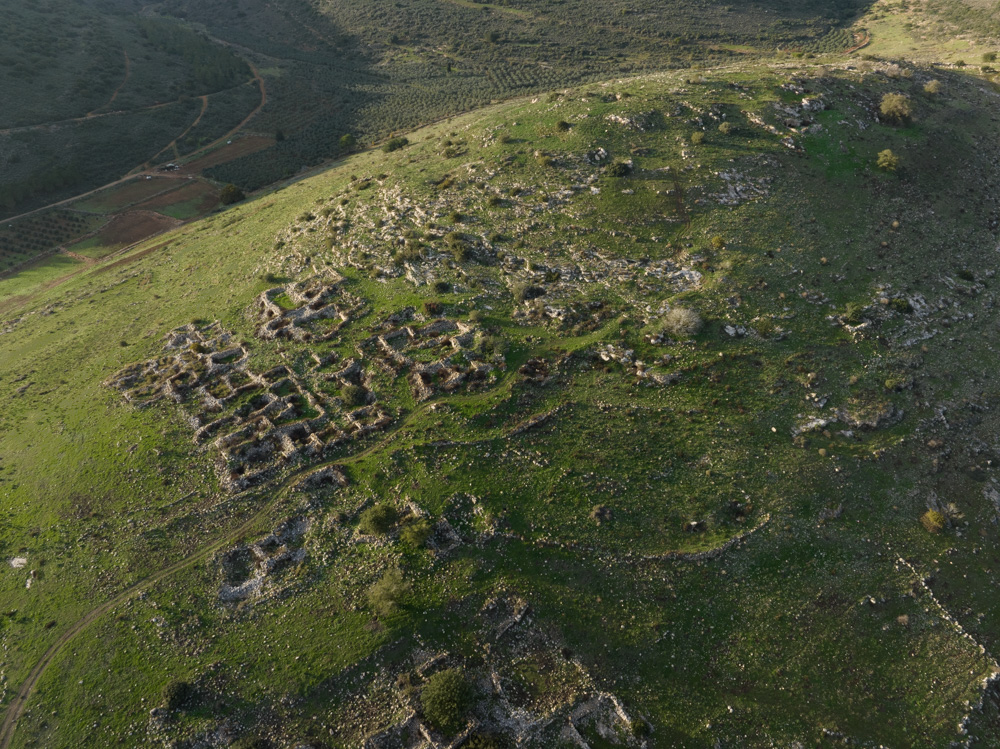
View northwest: The end of the road to Jotapata from Cana. The ancient site was on the hill below the ridge (top center). It’s in the sunlight.

View east: Cana of Galilee (Khirbet Qana) is at the end of the road (top center) that leads from Jotapata (see “Jotapata” on page 99). For the Cana of Galilee contour map, see page 111.

View north: Cana of Galilee (center). This photo goes with the one at the top of page 107, with excavations of the ancient city. you see how Cana was situated on the hill.

View southeast: This photo was taken across the excavations visible in the photo above, across the Beit Netofa Valley. Notice the villages on the other side of the valley (slopes of Mt. Turan).

View northwest: This photo is a detail of the excavations of ancient Cana, which y0u see from a distance in the photo at the top of page 106.

View south: This photo is a continuation of the one on the bottom of page 106, lookiing across the Cana excavations. Upper Nazareth is visible (top right) above the Turan valley.

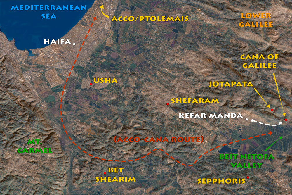
View northeast: The road to Cana (top center), coming from the coastal city of Acco/Ptolemais in the west.

View north: This map shows the proximity of Cana to the coast, as well as ancient Jotapata and Sepphoris (see “Jotapata” on page 99 and “Sepphoris” on page 119).

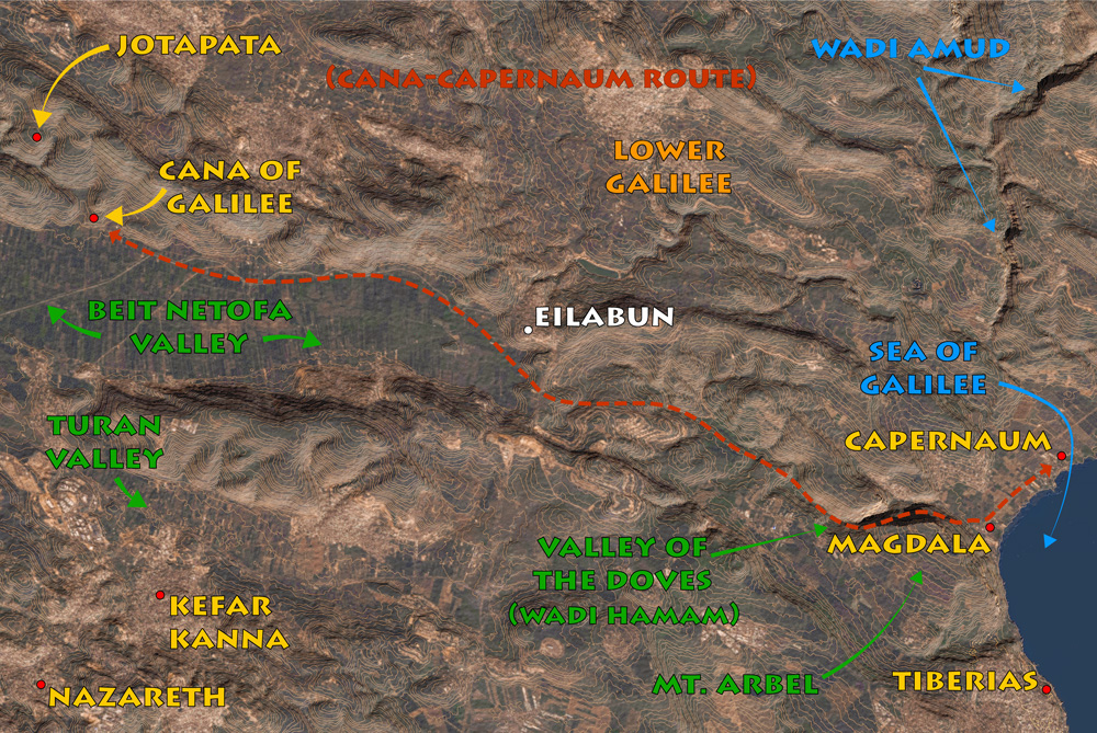
View north: Cana of Galilee contour map, showing the route from Cana to Capernaum. The distance is about 20 miles (33 kilometers).

View east: This photo was taken from above Cana looking toward the eastern end of the Beit Netofa Valley. The road runs as it did anciently from Cana to the Sea of Galilee and Capernaum. Also visible is Israel’s National Water carrier (top center) running through the valley toward the coast.
You may download photos free of charge for non-commercial, educational purposes: home, church, synagogue, or school. You must, however, give proper attribution on or below each image to BibleLandImages.com.
If you’re using photos as part of a PowerPoint or other electronic presentation, it’s enough to mention the source of the photos at the beginning of your lecture.
The photos may not be used on other internet sites without permission.
You may download favorite chapters and sections or copy their URL links to share via email or in a messenger app. You may also post links on social media or a personal website.
By downloading a photo, chapter, or section you agree to this policy. If you have questions about it or need a commercial photo license, please contact me via email: Daniel@BibleLandImages.com.