Photos and Maps • Photo Usage Policy • Back to Overview
Open chapter to read or share as PDF (new tab)
Open chapter as PDF (new tab, book format, share link)
View south: The Torah Shrine located at the southern end of the synagogue to the right of the main entrance, which faces Jerusalem.
You may download photos free of charge for non-commercial, educational purposes: home, church, synagogue, or school. You must, however, give proper attribution on or below each image to BibleLandImages.com.
If you’re using photos as part of a PowerPoint or other electronic presentation, it’s enough to mention the source of the photos at the beginning of your lecture.
The photos may not be used on other internet sites without permission.
You may download favorite chapters and sections or copy their URL links to share via email or in a messenger app. You may also post links on social media or a personal website.
By downloading a photo, chapter, or section you agree to this policy. If you have questions about it or need a commercial photo license, please contact me via email: Daniel@BibleLandImages.com.

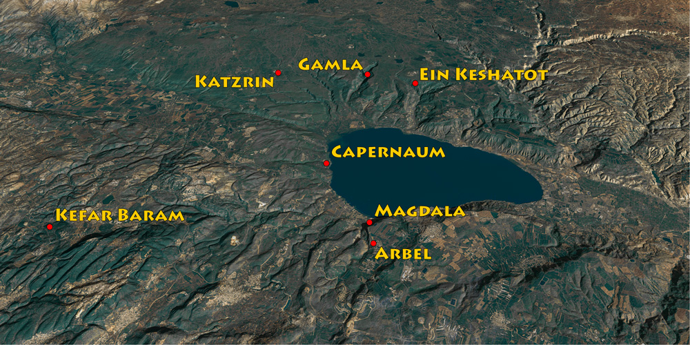
View northeast: map showing the locations of the synagogues reviewed in this chapter. See also “Magdala” on page 211 and “Capernaum” on page 235.

View northeast: Detail of the white fourth-century synagogue of Capernaum. This is the main hall with seating on either side. See “Capernaum” on page 235.

View northwest: the grounds of western Capernaum. In the foreground are the ruins of the Roman-period town. Above the ruins are three structures: (1) Capernaum’s fourth-century synagogue (center right), (2) the modern memorial building built over the house of St. Peter (center left), and (3) the Franciscan Monastery (top left). For more on the synagogue, See “Capernaum” on page 235.

The Theodotus Inscription is on display in the Israel Museum (Jerusalem).

View southwest: The “Spring of the Arches” at Ein Keshatot.

View north: The main entrance of the sixth-century AD Ein Keshatot Synagogue. It faces south, toward Jerusalem.

View south: The Torah Shrine located at the southern end of the synagogue to the right of the main entrance, which faces Jerusalem.

View northeast: In relation to the surrounding area, the synagogue is located on the other side of the trees below the sunlit area (upper right).

View west: The Torah Shrine of Ein Keshatot (left) with the western entrance to the synagogue (center). The columns supported a second story in antiquity.

Grapevine growing out of an amphora. Grapes are associated with abundance (see Num. 13:23).

Menorah, Shofar (ram’s horn), and incense shovel.

Incense shovel, Menorah, Lulav (ritual palm branch), and Etrog (citrus fruit).

The vulture is a well-known Jewish art motif in the Galilee and Golan regions. Although the Bible forbids eating vultures (Lev. 11:13, Deut. 14:12), they are associated symbolically with purification.

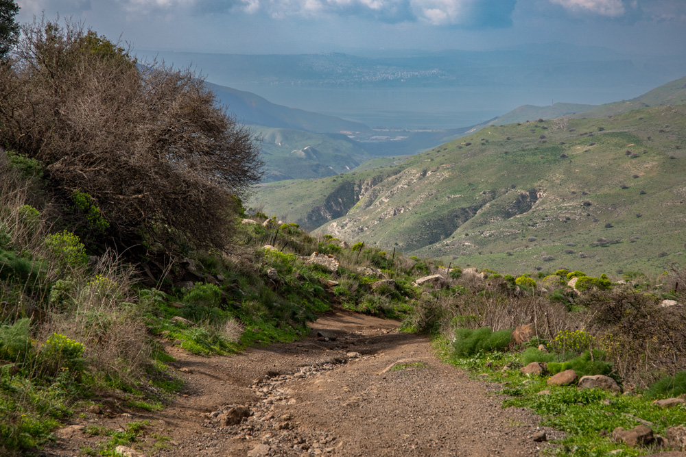
View west: The trail leading down to Nahal Samach and the Sea of Galilee (top center) from Ein Keshatot and the Golan Heights. Also visible is Gergesa (Kursi) on the shore of the lake (top center).

View northeast: Nahal Samach north of Ein Keshatot and the plateau. The road (center) leads down Nahal Samach to Gergesa (Kursi). See the map on page 30 and photo above.

View northwest: The three-portal entrance to the third-century Kefar Baram Synagogue. It was likely damaged in the Galilee Earthquake of 1837. See “Kefar Baram” on page 65.

View northeast: The lintel and wreath carving above the synagogue’s center portal (see the photo on page 38). On the top of the lintel are grapevines and clusters with two winged figures on the sides.

View east: The first-century AD synagogue of Gamla. See “Gamla” on page 275 for photos of the surrounding area and more of the synagogue on page 280.

View north: inside the synagogue of katzrin with two rows of columns that supported the balcony on the second floor.

View south: The entrance to the Talmudic synagogue of Katzrin. For more photos of the synagogue and the Talmudic village of Katzrin, see “Katzrin Park” in Blessed Pilgrimage, vol. 2).

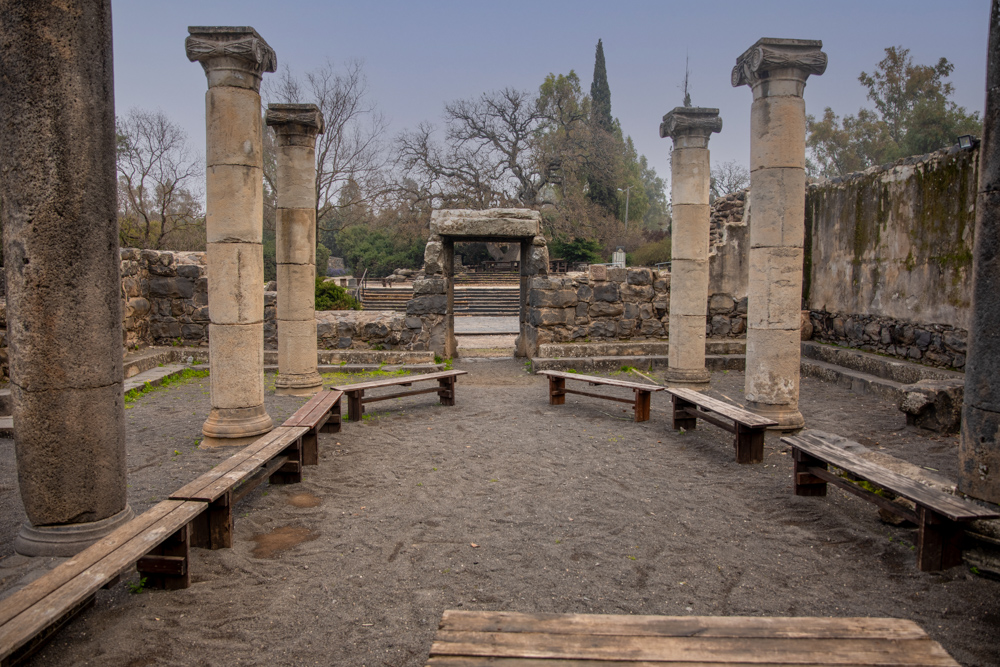
View northwest: The study hall of the synagogue. Three columns supported the synagogue’s roof. Benches ran along its walls.

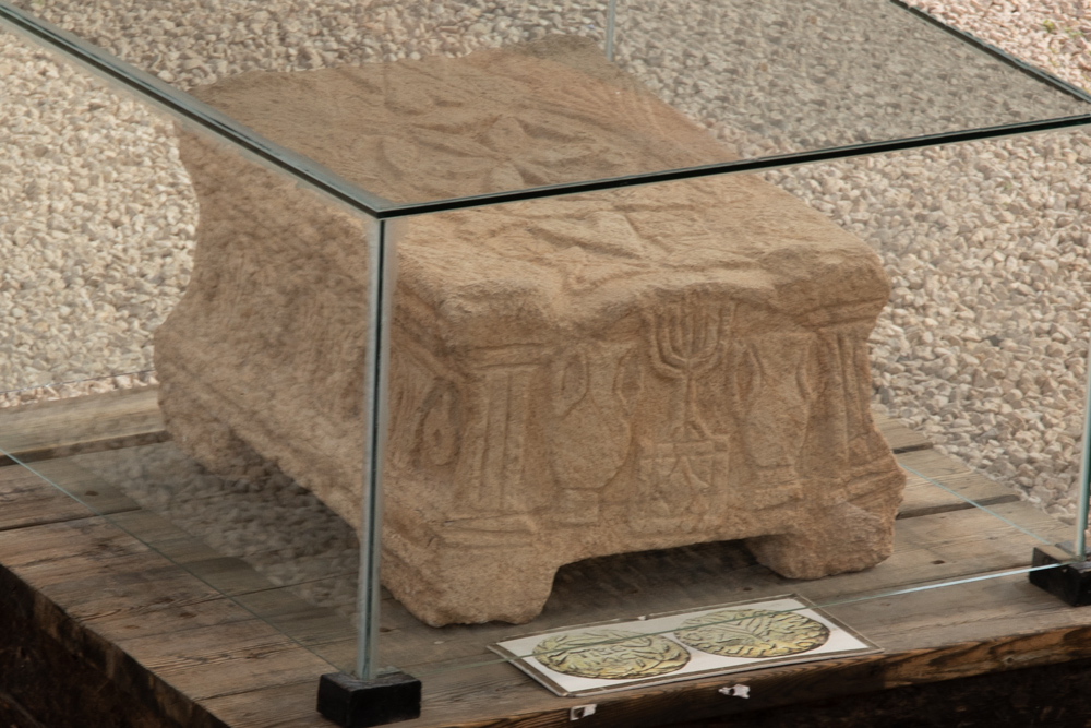
The Magdala Stone. Carvings on the stone depict the Second Temple before the Romans destroyed it in 70 AD. The Stone’s temple Menorah (center) is the earliest one found in a synagogue.

View north: The excavations (bottom center) where a second first-century AD synagogue was uncovered at Magdala. The plain of Gennesaret (right) and sunlit Safed (top right) are also visible.

View northwest: The remains of the Arbel synagogue’s entrance (top right) with the hills of lower Galilee visible in the distance.

View northeast: This is the view below the arbel synagogue looking toward Mt. Nitai (top left) and Mt. Arbel (top right), with the Sea of Galilee (upper center) below Mt. Arbel.